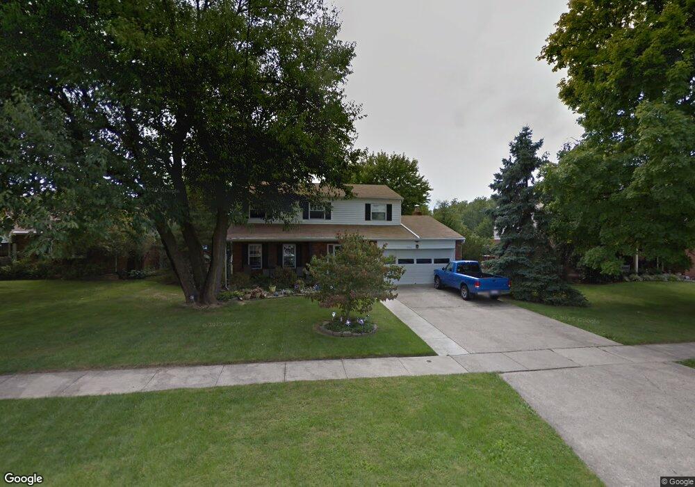
1054 Fuhrman Rd Cincinnati, OH 45215
Estimated Value: $317,561 - $340,000
4
Beds
3
Baths
1,874
Sq Ft
$177/Sq Ft
Est. Value
About This Home
This home is located at 1054 Fuhrman Rd, Cincinnati, OH 45215 and is currently estimated at $331,890, approximately $177 per square foot. 1054 Fuhrman Rd is a home located in Hamilton County with nearby schools including Reading Community High School, Saints Peter and Paul Academy, and Mount Notre Dame High School.
Ownership History
Date
Name
Owned For
Owner Type
Purchase Details
Closed on
May 18, 2006
Sold by
Kohler George N
Bought by
Schierloh Arnold N and Schierloh Catherine A
Current Estimated Value
Home Financials for this Owner
Home Financials are based on the most recent Mortgage that was taken out on this home.
Original Mortgage
$134,000
Outstanding Balance
$78,227
Interest Rate
6.54%
Mortgage Type
Fannie Mae Freddie Mac
Estimated Equity
$253,663
Purchase Details
Closed on
Sep 27, 1994
Sold by
Kohler George Norman
Bought by
Kohler George N
Create a Home Valuation Report for This Property
The Home Valuation Report is an in-depth analysis detailing your home's value as well as a comparison with similar homes in the area
Home Values in the Area
Average Home Value in this Area
Purchase History
| Date | Buyer | Sale Price | Title Company |
|---|---|---|---|
| Schierloh Arnold N | -- | Title Resolutions | |
| Kohler George N | -- | -- |
Source: Public Records
Mortgage History
| Date | Status | Borrower | Loan Amount |
|---|---|---|---|
| Open | Schierloh Arnold N | $134,000 |
Source: Public Records
Tax History Compared to Growth
Tax History
| Year | Tax Paid | Tax Assessment Tax Assessment Total Assessment is a certain percentage of the fair market value that is determined by local assessors to be the total taxable value of land and additions on the property. | Land | Improvement |
|---|---|---|---|---|
| 2024 | $4,258 | $82,254 | $14,788 | $67,466 |
| 2023 | $4,322 | $82,254 | $14,788 | $67,466 |
| 2022 | $3,991 | $58,867 | $12,835 | $46,032 |
| 2021 | $3,331 | $58,867 | $12,835 | $46,032 |
| 2020 | $3,367 | $58,867 | $12,835 | $46,032 |
| 2019 | $3,264 | $52,095 | $11,358 | $40,737 |
| 2018 | $3,267 | $52,095 | $11,358 | $40,737 |
| 2017 | $3,079 | $52,095 | $11,358 | $40,737 |
| 2016 | $3,193 | $54,194 | $11,130 | $43,064 |
| 2015 | $3,222 | $54,194 | $11,130 | $43,064 |
| 2014 | $2,818 | $54,194 | $11,130 | $43,064 |
| 2013 | $2,857 | $55,301 | $11,358 | $43,943 |
Source: Public Records
Map
Nearby Homes
- 1119 Oldwick Dr
- 1128 Oldwick Dr
- 1194 Fuhrman Rd
- 1223 Alwil Dr
- 1246 Thurnridge Dr
- 2920 E Galbraith Rd
- 8389 Arborcrest Dr
- 2259 Pompano Ave
- 0 Hill St Unit 1616370
- 404 Flora St
- 1626 Krylon Dr
- 234 Mcguire Ln
- 2451 Hunt Rd
- 310 E Vine St
- 3275 Legacy Trace
- 8990 Sedgewick Dr
- 797 4th St
- 162 E Crest Dr
- 2590 Hunt Rd
- 109 Calico Ct
- 1058 Fuhrman Rd
- 1050 Fuhrman Rd
- 1046 Fuhrman Rd
- 1062 Fuhrman Rd
- 1061 Fuhrman Rd
- 1057 Fuhrman Rd
- 1053 Fuhrman Rd
- 1042 Fuhrman Rd
- 1049 Fuhrman Rd
- 1077 Fuhrman Rd
- 1045 Fuhrman Rd
- 1100 Fuhrman Rd
- 1066 Fuhrman Rd
- 1041 Fuhrman Rd
- 3170 Patrisal Ct
- 3180 Patrisal Ct
- 1038 Fuhrman Rd
- 1081 Fuhrman Rd
- 1037 Fuhrman Rd
- 3190 Patrisal Ct