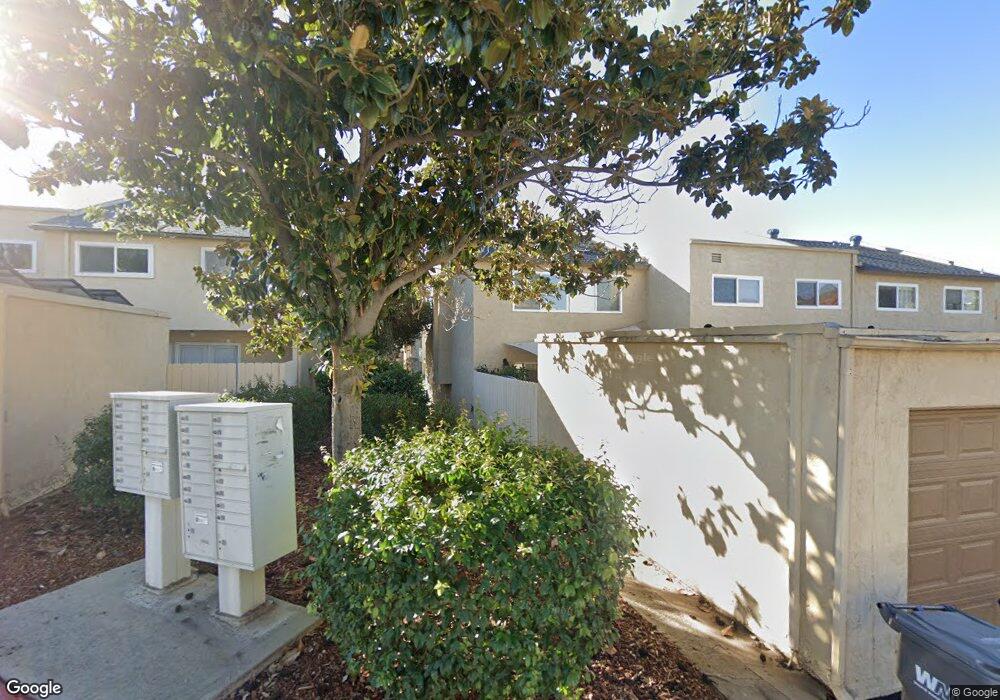
10546 Kerrigan Ct Santee, CA 92071
Estimated Value: $588,740 - $611,000
3
Beds
2
Baths
1,323
Sq Ft
$454/Sq Ft
Est. Value
About This Home
This home is located at 10546 Kerrigan Ct, Santee, CA 92071 and is currently estimated at $600,435, approximately $453 per square foot. 10546 Kerrigan Ct is a home located in San Diego County with nearby schools including Cajon Park Elementary School and Santana High School.
Ownership History
Date
Name
Owned For
Owner Type
Purchase Details
Closed on
Nov 19, 2018
Sold by
Mcgirk Michael P
Bought by
Mcgirk Michael P
Current Estimated Value
Purchase Details
Closed on
Jan 21, 2014
Sold by
Daniels Andrew Martin and Daniels Barbara Dyar
Bought by
Mcgirk Michael P
Home Financials for this Owner
Home Financials are based on the most recent Mortgage that was taken out on this home.
Original Mortgage
$265,567
Outstanding Balance
$192,365
Interest Rate
3.37%
Mortgage Type
FHA
Estimated Equity
$408,070
Purchase Details
Closed on
Jul 21, 2005
Sold by
Daniels Andrew Martin and Daniels Barbara Dyar
Bought by
Daniels Andrew Martin and Daniels Barbara Dyar
Home Financials for this Owner
Home Financials are based on the most recent Mortgage that was taken out on this home.
Original Mortgage
$252,000
Interest Rate
5.56%
Mortgage Type
Stand Alone Refi Refinance Of Original Loan
Create a Home Valuation Report for This Property
The Home Valuation Report is an in-depth analysis detailing your home's value as well as a comparison with similar homes in the area
Purchase History
| Date | Buyer | Sale Price | Title Company |
|---|---|---|---|
| Mcgirk Michael P | -- | None Available | |
| Mcgirk Michael P | $290,000 | Lawyers Title Company | |
| Daniels Andrew Martin | -- | Fidelity National Title |
Source: Public Records
Mortgage History
| Date | Status | Borrower | Loan Amount |
|---|---|---|---|
| Open | Mcgirk Michael P | $265,567 | |
| Previous Owner | Daniels Andrew Martin | $252,000 |
Source: Public Records
Tax History
| Year | Tax Paid | Tax Assessment Tax Assessment Total Assessment is a certain percentage of the fair market value that is determined by local assessors to be the total taxable value of land and additions on the property. | Land | Improvement |
|---|---|---|---|---|
| 2025 | $4,195 | $355,490 | $96,604 | $258,886 |
| 2024 | $4,195 | $348,520 | $94,710 | $253,810 |
| 2023 | $4,066 | $341,687 | $92,853 | $248,834 |
| 2022 | $4,034 | $334,988 | $91,033 | $243,955 |
| 2021 | $3,976 | $328,421 | $89,249 | $239,172 |
| 2020 | $3,927 | $325,054 | $88,334 | $236,720 |
| 2019 | $3,788 | $318,681 | $86,602 | $232,079 |
| 2018 | $3,710 | $312,433 | $84,904 | $227,529 |
| 2017 | $3,660 | $306,308 | $83,240 | $223,068 |
| 2016 | $3,549 | $300,303 | $81,608 | $218,695 |
| 2015 | $3,501 | $295,793 | $80,383 | $215,410 |
| 2014 | $1,577 | $123,921 | $33,676 | $90,245 |
Source: Public Records
Map
Nearby Homes
- 10219 Kerrigan St
- 10606 N Magnolia Ave
- 10214 Michala Place
- 10209 Princess Sarit Way
- 10382 Alphonse St Unit F4
- 10621 Keith St
- 10760 N Magnolia Ave Unit B6
- 10746 N Magnolia Ave Unit C3
- 10726 Ironwood Ave
- 10254 Princess Joann Rd
- 10634 Sanfred Ct
- 10836 Stoney Creek Ct
- 10143 Maple Tree Rd
- 10520 El Nopal
- 11009 Summit Ave
- 11009 Summit Ave Unit n/a
- 0 Summit Ave Unit PTP2601675
- 11025 Summit Ave
- 11025 Summit Ave Unit n/a
- 10811 Susie Place
- 10548 Kerrigan Ct
- 10544 Kerrigan Ct
- 10542 Kerrigan Ct
- 10540 Kerrigan Ct
- 10550 Kerrigan Ct
- 10538 Kerrigan Ct
- 10552 Kerrigan Ct
- 10536 Kerrigan Ct
- 10562 Kerrigan Ct
- 10554 Kerrigan Ct
- 10564 Kerrigan Ct
- 10556 Kerrigan Ct
- 10584 Kerrigan Ct
- 10534 Kerrigan Ct
- 10582 Kerrigan Ct
- 10566 Kerrigan Ct
- 10558 Kerrigan Ct
- 10580 Kerrigan Ct
- 10532 Kerrigan Ct
- 10244 Kerrigan St
Your Personal Tour Guide
Ask me questions while you tour the home.