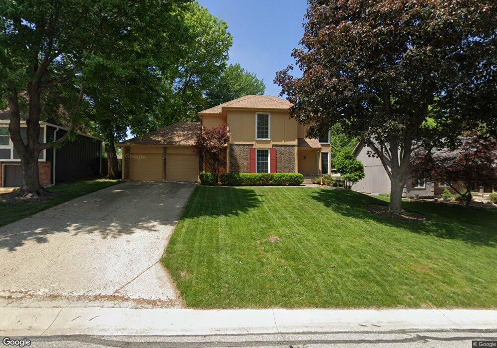
10570 Noland Rd Lenexa, KS 66215
Oak Park NeighborhoodEstimated Value: $416,330 - $420,000
4
Beds
3
Baths
2,323
Sq Ft
$180/Sq Ft
Est. Value
About This Home
This home is located at 10570 Noland Rd, Lenexa, KS 66215 and is currently estimated at $418,083, approximately $179 per square foot. 10570 Noland Rd is a home located in Johnson County with nearby schools including Rosehill Elementary School, Indian Woods Middle School, and Shawnee Mission South High School.
Ownership History
Date
Name
Owned For
Owner Type
Purchase Details
Closed on
Sep 25, 2003
Sold by
Donley James A and Donley Sarah M
Bought by
Brown Jon A and Brown Patricia K
Current Estimated Value
Home Financials for this Owner
Home Financials are based on the most recent Mortgage that was taken out on this home.
Original Mortgage
$140,800
Outstanding Balance
$65,751
Interest Rate
6.22%
Mortgage Type
Purchase Money Mortgage
Estimated Equity
$352,332
Create a Home Valuation Report for This Property
The Home Valuation Report is an in-depth analysis detailing your home's value as well as a comparison with similar homes in the area
Home Values in the Area
Average Home Value in this Area
Purchase History
| Date | Buyer | Sale Price | Title Company |
|---|---|---|---|
| Brown Jon A | -- | Chicago Title Insurance Comp |
Source: Public Records
Mortgage History
| Date | Status | Borrower | Loan Amount |
|---|---|---|---|
| Open | Brown Jon A | $140,800 |
Source: Public Records
Tax History Compared to Growth
Tax History
| Year | Tax Paid | Tax Assessment Tax Assessment Total Assessment is a certain percentage of the fair market value that is determined by local assessors to be the total taxable value of land and additions on the property. | Land | Improvement |
|---|---|---|---|---|
| 2024 | $3,772 | $39,180 | $8,557 | $30,623 |
| 2023 | $3,621 | $37,030 | $8,557 | $28,473 |
| 2022 | $3,403 | $35,052 | $8,557 | $26,495 |
| 2021 | $3,118 | $30,544 | $7,128 | $23,416 |
| 2020 | $2,986 | $29,279 | $5,484 | $23,795 |
| 2019 | $2,656 | $26,082 | $4,245 | $21,837 |
| 2018 | $2,555 | $24,990 | $4,245 | $20,745 |
| 2017 | $2,389 | $23,000 | $4,245 | $18,755 |
| 2016 | $2,334 | $22,103 | $4,245 | $17,858 |
| 2015 | $2,243 | $21,678 | $4,245 | $17,433 |
| 2013 | -- | $21,298 | $4,245 | $17,053 |
Source: Public Records
Map
Nearby Homes
- 13401 W 105th Terrace
- 10590 Bradshaw St
- 12808 W 108th St
- 10474 Caenen Lake Rd
- 10580 Long St
- 12707 W 108th Terrace
- 10566 Century Ln
- 12696 W 108th Terrace
- 10331 Westgate St
- 10226 Gillette St
- 10901 Gillette St
- 10909 Gillette St
- 12400 W 105th Terrace
- 10308 Westgate St
- 10220 Gillette St
- 10997 Rosehill Rd
- 10981 Rosehill Rd
- 10211 Hauser St
- 12946 W 110th St
- 13300 W 102nd St
- 10574 Noland Rd
- 10566 Noland Rd
- 10571 Hauser St
- 10580 Noland Rd
- 10573 Hauser St
- 10560 Noland Rd
- 10559 Hauser St
- 10575 Noland Rd
- 10571 Noland Rd
- 10581 Hauser St
- 10567 Noland Rd
- 10581 Noland Rd
- 10584 Noland Rd
- 10556 Noland Rd
- 10553 Hauser St
- 10585 Hauser St
- 10561 Noland Rd
- 10585 Noland Rd
- 10588 Noland Rd
- 10557 Noland Rd