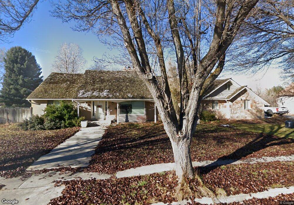
10585 N 5370 W Highland, UT 84003
Estimated Value: $928,646 - $1,075,000
3
Beds
4
Baths
3,486
Sq Ft
$293/Sq Ft
Est. Value
About This Home
This home is located at 10585 N 5370 W, Highland, UT 84003 and is currently estimated at $1,019,662, approximately $292 per square foot. 10585 N 5370 W is a home located in Utah County with nearby schools including Highland Elementary School, Mountain Ridge Junior High School, and Lone Peak High School.
Ownership History
Date
Name
Owned For
Owner Type
Purchase Details
Closed on
Jun 7, 2021
Sold by
Wells Clay R
Bought by
Wells Clay R and Wells Amy Jo
Current Estimated Value
Home Financials for this Owner
Home Financials are based on the most recent Mortgage that was taken out on this home.
Original Mortgage
$343,700
Outstanding Balance
$311,178
Interest Rate
2.9%
Mortgage Type
New Conventional
Estimated Equity
$708,484
Purchase Details
Closed on
Jul 17, 2013
Sold by
Godwin Craig and Godwin Ladawn
Bought by
Wells Clay R
Home Financials for this Owner
Home Financials are based on the most recent Mortgage that was taken out on this home.
Original Mortgage
$375,750
Interest Rate
3.88%
Mortgage Type
New Conventional
Purchase Details
Closed on
Sep 11, 2006
Sold by
Godwin Craig Edward Andrew and Godwin Ladawn H
Bought by
Godwin Craig Edward Andrew and Godwin Ladawn H
Create a Home Valuation Report for This Property
The Home Valuation Report is an in-depth analysis detailing your home's value as well as a comparison with similar homes in the area
Home Values in the Area
Average Home Value in this Area
Purchase History
| Date | Buyer | Sale Price | Title Company |
|---|---|---|---|
| Wells Clay R | -- | Artisan Title | |
| Wells Clay R | -- | None Available | |
| Godwin Craig Edward Andrew | -- | None Available |
Source: Public Records
Mortgage History
| Date | Status | Borrower | Loan Amount |
|---|---|---|---|
| Open | Wells Clay R | $343,700 | |
| Closed | Wells Clay R | $375,750 |
Source: Public Records
Tax History Compared to Growth
Tax History
| Year | Tax Paid | Tax Assessment Tax Assessment Total Assessment is a certain percentage of the fair market value that is determined by local assessors to be the total taxable value of land and additions on the property. | Land | Improvement |
|---|---|---|---|---|
| 2025 | $3,685 | $477,620 | $320,400 | $548,000 |
| 2024 | $3,685 | $455,180 | $0 | $0 |
| 2023 | $3,515 | $468,325 | $0 | $0 |
| 2022 | $3,224 | $416,515 | $0 | $0 |
| 2021 | $2,838 | $546,200 | $181,700 | $364,500 |
| 2020 | $2,694 | $508,500 | $158,000 | $350,500 |
| 2019 | $2,528 | $499,100 | $158,000 | $341,100 |
| 2018 | $2,362 | $443,100 | $146,500 | $296,600 |
| 2017 | $2,306 | $230,945 | $0 | $0 |
| 2016 | $2,503 | $234,300 | $0 | $0 |
| 2015 | $2,569 | $227,920 | $0 | $0 |
| 2014 | $1,817 | $159,720 | $0 | $0 |
Source: Public Records
Map
Nearby Homes
- 10531 N Alpine Hwy
- 10507 N 5470 W
- Villa A Plan at TEN700
- Villa D Plan at TEN700
- Cottonwood Villa Plan at TEN700
- Villa C Plan at TEN700
- Douglas Villa Plan at TEN700
- Villa B Plan at TEN700
- 10763 N Dosh Ln
- 10685 N Jerling Dr
- 5509 W Sicily Ln
- 10905 N Vercelli Dr
- 10261 N 5230 W
- 5538 W Naples Dr Unit 125
- 10925 N Marsala Dr
- 5538 W Turin Ln
- 5378 W 10130 N
- 5433 W 10130 N
- 5159 W 11000 N
- 5586 W 10130 N
- 10602 N 5400 W
- 10602 N 5400 W Unit 12
- 10607 N 5370 W
- 10584 N 5370 W
- 10606 N 5400 W
- 10606 N 5400 W Unit 13
- 10565 N 5370 W
- 5391 W 10600 N
- 5391 W 10600 N Unit 11
- 10564 N 5370 W
- 10608 N 5370 W
- 10608 N 5400 W
- 10608 N 5400 W Unit 14
- 10581 N Alpine Hwy
- 5429 W 10600 N
- 5429 W 10600 N Unit 10
- 10567 N Alpine Hwy
- 10603 N 5400 W
- 10603 N 5400 W Unit 24
- 5271 W 10610 N