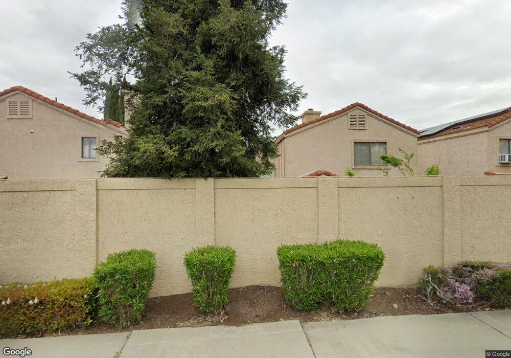
1059 Burnham Dr Pittsburg, CA 94565
River Run NeighborhoodEstimated Value: $508,028 - $606,000
3
Beds
2
Baths
1,252
Sq Ft
$435/Sq Ft
Est. Value
About This Home
This home is located at 1059 Burnham Dr, Pittsburg, CA 94565 and is currently estimated at $544,257, approximately $434 per square foot. 1059 Burnham Dr is a home located in Contra Costa County with nearby schools including Parkside Elementary School, Martin Luther King Jr. Junior High School, and Pittsburg Senior High School.
Ownership History
Date
Name
Owned For
Owner Type
Purchase Details
Closed on
Aug 8, 2019
Sold by
Taylor Tanaya L
Bought by
Chen Zhan L and Guan Mendy M
Current Estimated Value
Home Financials for this Owner
Home Financials are based on the most recent Mortgage that was taken out on this home.
Original Mortgage
$329,600
Outstanding Balance
$288,669
Interest Rate
3.7%
Mortgage Type
New Conventional
Estimated Equity
$255,588
Purchase Details
Closed on
Oct 6, 2016
Sold by
Perez Julio C and Perez Saida E
Bought by
Taylor Tanaya L
Home Financials for this Owner
Home Financials are based on the most recent Mortgage that was taken out on this home.
Original Mortgage
$319,113
Interest Rate
3.43%
Mortgage Type
FHA
Create a Home Valuation Report for This Property
The Home Valuation Report is an in-depth analysis detailing your home's value as well as a comparison with similar homes in the area
Home Values in the Area
Average Home Value in this Area
Purchase History
| Date | Buyer | Sale Price | Title Company |
|---|---|---|---|
| Chen Zhan L | $412,000 | Chicago Title Company | |
| Taylor Tanaya L | $325,000 | Old Republic Title Company |
Source: Public Records
Mortgage History
| Date | Status | Borrower | Loan Amount |
|---|---|---|---|
| Open | Chen Zhan L | $329,600 | |
| Previous Owner | Taylor Tanaya L | $319,113 |
Source: Public Records
Tax History Compared to Growth
Tax History
| Year | Tax Paid | Tax Assessment Tax Assessment Total Assessment is a certain percentage of the fair market value that is determined by local assessors to be the total taxable value of land and additions on the property. | Land | Improvement |
|---|---|---|---|---|
| 2025 | $5,553 | $450,578 | $191,386 | $259,192 |
| 2024 | $5,573 | $441,744 | $187,634 | $254,110 |
| 2023 | $5,573 | $433,083 | $183,955 | $249,128 |
| 2022 | $5,658 | $424,593 | $180,349 | $244,244 |
| 2021 | $5,667 | $416,268 | $176,813 | $239,455 |
| 2019 | $4,634 | $338,129 | $108,201 | $229,928 |
| 2018 | $4,460 | $331,500 | $106,080 | $225,420 |
| 2017 | $4,435 | $325,000 | $104,000 | $221,000 |
| 2016 | $2,462 | $171,809 | $38,030 | $133,779 |
| 2015 | $2,586 | $169,229 | $37,459 | $131,770 |
| 2014 | $2,503 | $165,915 | $36,726 | $129,189 |
Source: Public Records
Map
Nearby Homes
- 1031 Burnham Dr
- 105 Salinas Ct
- 181 Maidenhair St
- 285 Auburn
- 343 Bernauer
- 221 Bruno Ave
- 2106 Goff Ave
- 742 Wedgewood Dr
- 2154 Burton Ave
- 4 Crowley Ct
- 93 La Habra
- 171 Clipper Dr
- 406 Cape May Ct
- 102 Dimaggio Ave
- 207 Thomas Way
- 183 W Leland Rd
- 225 Royce Way
- 22 Orinda Cir
- 148 Spinnaker Way
- 333 Atherton Ave
- 1061 Burnham Dr
- 1057 Burnham Dr
- 1063 Burnham Dr
- 1055 Burnham Dr
- 1060 Monfredo Dr
- 1058 Monfredo Dr
- 1062 Monfredo Dr
- 1056 Monfredo Dr
- 1053 Burnham Dr
- 1065 Burnham Dr
- 1064 Monfredo Dr
- 1060 Burnham Dr
- 1058 Burnham Dr
- 1054 Monfredo Dr
- 1062 Burnham Dr
- 1056 Burnham Dr
- 1051 Burnham Dr
- 1067 Burnham Dr
- 1066 Monfredo Dr
- 1064 Burnham Dr
