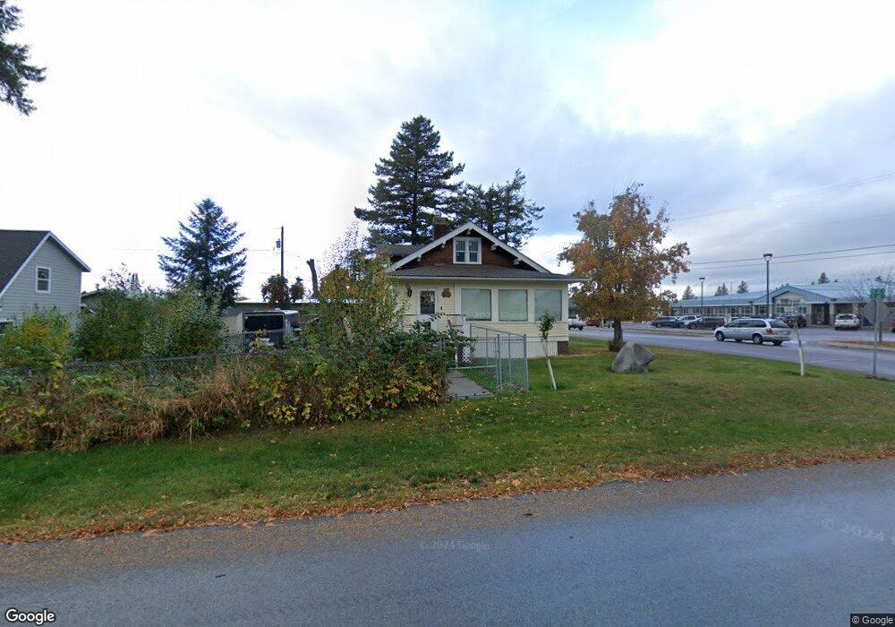
106 1st Ave E Columbia Falls, MT 59912
Estimated Value: $389,000 - $443,000
1
Bed
1
Bath
1,478
Sq Ft
$285/Sq Ft
Est. Value
About This Home
This home is located at 106 1st Ave E, Columbia Falls, MT 59912 and is currently estimated at $420,859, approximately $284 per square foot. 106 1st Ave E is a home located in Flathead County with nearby schools including Glacier Gateway Elementary School, Columbia Falls Junior High School (7-8), and Columbia Falls High School.
Ownership History
Date
Name
Owned For
Owner Type
Purchase Details
Closed on
Sep 24, 2025
Sold by
Whitman Kelly J
Bought by
Whitman Family Trust and Whitman
Current Estimated Value
Purchase Details
Closed on
Nov 19, 2021
Sold by
Marilyn Lane Family Trust and Marilyn Lane
Bought by
Whitman Kelly J
Purchase Details
Closed on
Jul 27, 2009
Sold by
Whitman Marilyn and Lane Marilyn
Bought by
Lane Marilyn
Home Financials for this Owner
Home Financials are based on the most recent Mortgage that was taken out on this home.
Original Mortgage
$135,000
Interest Rate
5.31%
Mortgage Type
New Conventional
Create a Home Valuation Report for This Property
The Home Valuation Report is an in-depth analysis detailing your home's value as well as a comparison with similar homes in the area
Home Values in the Area
Average Home Value in this Area
Purchase History
| Date | Buyer | Sale Price | Title Company |
|---|---|---|---|
| Whitman Family Trust | -- | None Listed On Document | |
| Whitman Kelly J | -- | None Listed On Document | |
| Lane Marilyn | -- | Insured Titles |
Source: Public Records
Mortgage History
| Date | Status | Borrower | Loan Amount |
|---|---|---|---|
| Previous Owner | Lane Marilyn | $135,000 |
Source: Public Records
Tax History
| Year | Tax Paid | Tax Assessment Tax Assessment Total Assessment is a certain percentage of the fair market value that is determined by local assessors to be the total taxable value of land and additions on the property. | Land | Improvement |
|---|---|---|---|---|
| 2025 | $1,785 | $407,200 | $0 | $0 |
| 2024 | $2,289 | $325,000 | $0 | $0 |
| 2023 | $2,457 | $325,000 | $0 | $0 |
| 2022 | $2,511 | $232,900 | $0 | $0 |
| 2021 | $2,573 | $232,900 | $0 | $0 |
| 2020 | $2,194 | $179,200 | $0 | $0 |
| 2019 | $2,090 | $179,200 | $0 | $0 |
| 2018 | $1,883 | $153,200 | $0 | $0 |
| 2017 | $1,826 | $153,200 | $0 | $0 |
| 2016 | $1,704 | $139,400 | $0 | $0 |
| 2015 | $1,691 | $139,400 | $0 | $0 |
| 2014 | $1,727 | $85,860 | $0 | $0 |
Source: Public Records
Map
Nearby Homes
- 540 Nucleus Ave Unit 304
- 1327 1st Ave E
- 556 7th Avenue East N
- 1020 3rd Ave E
- 46 Council Bluffs Dr
- 986 3rd Street West N
- 809 9th St W Unit 1
- 809 9th St W Unit 14
- 809 9th St W Unit 17
- 36 13th St E
- 1069 3rd Street West N
- 1154 3rd Street West N
- 1154 3rd Ave W
- 929 9th St W
- 1005 10th St W
- 290 Larch Ridge
- 1130 10th Ave W
- 943 Frontage Rd
- Lots 30, 31, 32 Highway 2 E
- 1629 4th Ave W Unit 103
Your Personal Tour Guide
Ask me questions while you tour the home.