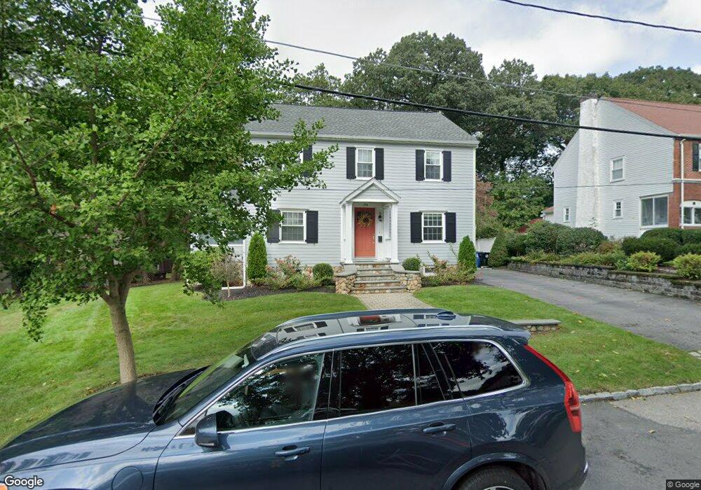
106 Lorimer Rd Belmont, MA 02478
Belmont Hill NeighborhoodEstimated Value: $850,000 - $1,587,242
3
Beds
2
Baths
1,664
Sq Ft
$750/Sq Ft
Est. Value
About This Home
This home is located at 106 Lorimer Rd, Belmont, MA 02478 and is currently estimated at $1,248,561, approximately $750 per square foot. 106 Lorimer Rd is a home located in Middlesex County with nearby schools including Roger Wellington Elementary School, Winthrop L Chenery Middle School, and Belmont High School.
Ownership History
Date
Name
Owned For
Owner Type
Purchase Details
Closed on
Feb 1, 2022
Sold by
Todaro Scott B and Todaro Maureen K
Bought by
Scott B Todaro Lt
Current Estimated Value
Purchase Details
Closed on
Dec 17, 2004
Sold by
Carter Ruth D and Rosenthal Ruth D
Bought by
Todaro Maureen T
Home Financials for this Owner
Home Financials are based on the most recent Mortgage that was taken out on this home.
Original Mortgage
$440,800
Interest Rate
5.68%
Mortgage Type
Purchase Money Mortgage
Create a Home Valuation Report for This Property
The Home Valuation Report is an in-depth analysis detailing your home's value as well as a comparison with similar homes in the area
Home Values in the Area
Average Home Value in this Area
Purchase History
| Date | Buyer | Sale Price | Title Company |
|---|---|---|---|
| Scott B Todaro Lt | -- | None Available | |
| Todaro Maureen T | $551,500 | -- |
Source: Public Records
Mortgage History
| Date | Status | Borrower | Loan Amount |
|---|---|---|---|
| Previous Owner | Todaro Maureen T | $440,800 |
Source: Public Records
Tax History Compared to Growth
Tax History
| Year | Tax Paid | Tax Assessment Tax Assessment Total Assessment is a certain percentage of the fair market value that is determined by local assessors to be the total taxable value of land and additions on the property. | Land | Improvement |
|---|---|---|---|---|
| 2025 | $16,265 | $1,428,000 | $735,000 | $693,000 |
| 2024 | $14,277 | $1,352,000 | $789,000 | $563,000 |
| 2023 | $14,129 | $1,257,000 | $744,000 | $513,000 |
| 2022 | $12,717 | $1,158,000 | $681,000 | $477,000 |
| 2021 | $12,744 | $1,102,000 | $652,000 | $450,000 |
| 2020 | $12,045 | $1,095,000 | $690,000 | $405,000 |
| 2019 | $11,016 | $944,000 | $535,000 | $409,000 |
| 2018 | $17,577 | $834,000 | $435,000 | $399,000 |
| 2017 | $5,316 | $675,000 | $352,000 | $323,000 |
| 2016 | $8,064 | $642,000 | $352,000 | $290,000 |
| 2015 | $7,688 | $596,000 | $293,000 | $303,000 |
Source: Public Records
Map
Nearby Homes
- 14 Mallard Way
- 9 Stanley Rd
- 38 Van Vechten St
- 51 S Cottage Rd Unit 112
- 5 Meadows Ln Unit 105
- 100 Shirley Rd
- 26 Brookfield Rd
- 34 Woodbine Rd
- 135 Marsh St
- 25 Moraine St Unit 25
- 53 Crestview Rd
- 77 Wellesley Rd
- 600 Trapelo Rd Unit 1
- 560 Concord Ave
- 23 Centre Ave
- 26 Centre Ave
- 220 Sycamore St
- 39 Birch Hill Rd
- 155 Marguerite Ave
- 85 Rosewood Dr
- 100 Lorimer Rd
- 126 Brookside Ave
- 94 Lorimer Rd
- 112 Brookside Ave
- 139 Brookside Ave
- 145 Brookside Ave
- 87 Lorimer Rd
- 133 Brookside Ave
- 81 Lorimer Rd
- 82 Lorimer Rd
- 157 Brookside Ave
- 100 Brookside Ave
- 75 Lorimer Rd
- 127 Brookside Ave
- 76 Lorimer Rd
- 121 Brookside Ave
- 67 Lorimer Rd
- 92 Brookside Ave
- 115 Brookside Ave
- 70 Lorimer Rd