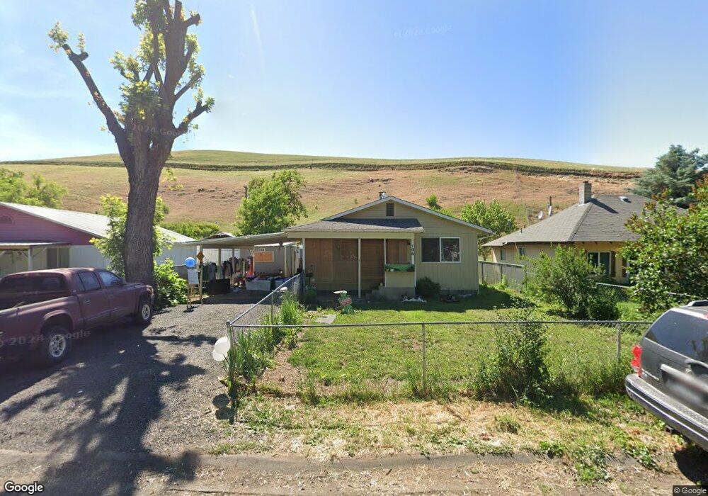
106 N 3rd St W Lapwai, ID 83540
Estimated Value: $262,000 - $528,000
3
Beds
1
Bath
1,092
Sq Ft
$362/Sq Ft
Est. Value
About This Home
This home is located at 106 N 3rd St W, Lapwai, ID 83540 and is currently estimated at $395,000, approximately $361 per square foot. 106 N 3rd St W is a home located in Nez Perce County with nearby schools including Lapwai Elementary School and Lapwai Middle/High School.
Ownership History
Date
Name
Owned For
Owner Type
Purchase Details
Closed on
Nov 5, 2010
Sold by
Timentwa Carla and Kauffman Carla
Bought by
Timentwa William Gail and Timentwa Carla Jean
Current Estimated Value
Purchase Details
Closed on
Apr 22, 2009
Sold by
Gonzales John F
Bought by
Kauffman Carl
Purchase Details
Closed on
May 3, 2007
Sold by
Chimburas Carlo J and Chimburas Iria A
Bought by
Gonzales Carla and Gonzales John
Home Financials for this Owner
Home Financials are based on the most recent Mortgage that was taken out on this home.
Original Mortgage
$104,500
Interest Rate
6.15%
Mortgage Type
New Conventional
Create a Home Valuation Report for This Property
The Home Valuation Report is an in-depth analysis detailing your home's value as well as a comparison with similar homes in the area
Home Values in the Area
Average Home Value in this Area
Purchase History
| Date | Buyer | Sale Price | Title Company |
|---|---|---|---|
| Timentwa William Gail | -- | -- | |
| Kauffman Carl | -- | -- | |
| Gonzales Carla | -- | -- |
Source: Public Records
Mortgage History
| Date | Status | Borrower | Loan Amount |
|---|---|---|---|
| Previous Owner | Gonzales Carla | $104,500 |
Source: Public Records
Tax History Compared to Growth
Tax History
| Year | Tax Paid | Tax Assessment Tax Assessment Total Assessment is a certain percentage of the fair market value that is determined by local assessors to be the total taxable value of land and additions on the property. | Land | Improvement |
|---|---|---|---|---|
| 2025 | -- | $0 | $0 | $0 |
| 2024 | -- | $0 | $0 | $0 |
| 2023 | -- | $0 | $0 | $0 |
| 2022 | $0 | $0 | $0 | $0 |
| 2021 | $0 | $0 | $0 | $0 |
| 2020 | $0 | $0 | $0 | $0 |
| 2019 | $2,082 | $0 | $0 | $0 |
| 2018 | $0 | $0 | $0 | $0 |
| 2017 | $2,082 | $0 | $0 | $0 |
| 2016 | $2,082 | $0 | $0 | $0 |
| 2015 | -- | $0 | $0 | $0 |
| 2014 | -- | $0 | $0 | $0 |
Source: Public Records
Map
Nearby Homes
- 188 Coyote Dr
- TBD Highway 12
- 2111 Vinifera Blvd
- 2108 Vinifera Blvd
- 7774 Paddock Ln
- 2244 Park Ave
- 2243 Powers Dr
- 2235 Powers Dr
- 2219 Powers Dr
- 2213 Powers Dr
- 2211 Powers Dr
- TBD Cougar Ridge Rd
- 3714 Skyview Dr
- 3728 Skyview Dr
- 1248 Bighorn Dr
- 2206 Ripon Ave
- 2113 Powers Ave Unit B
- 22236 Gunsmoke Canyon
- 2115 Powers Ave Unit A
- 2102 Alder Ave Unit A
- 106 W 3rd St
- 110 S 3rd St W
- 104 N 3rd St W
- 109 3rd St W
- 202 S 3rd St W
- 153 Joseph St W
- 151 Joseph St W
- 214 S 3rd St W
- 201 Birch Ave W
- 156 Joseph St W
- 215 W Alder St
- 111 S 2nd St W
- 313 W Locust Ave
- 154 Joseph St W
- 313 W Locust Ave
- 145 Joseph St W
- 205 W 2nd St
- 152 Joseph Ct
- 207 W Birch Ave
- 301 3rd St W