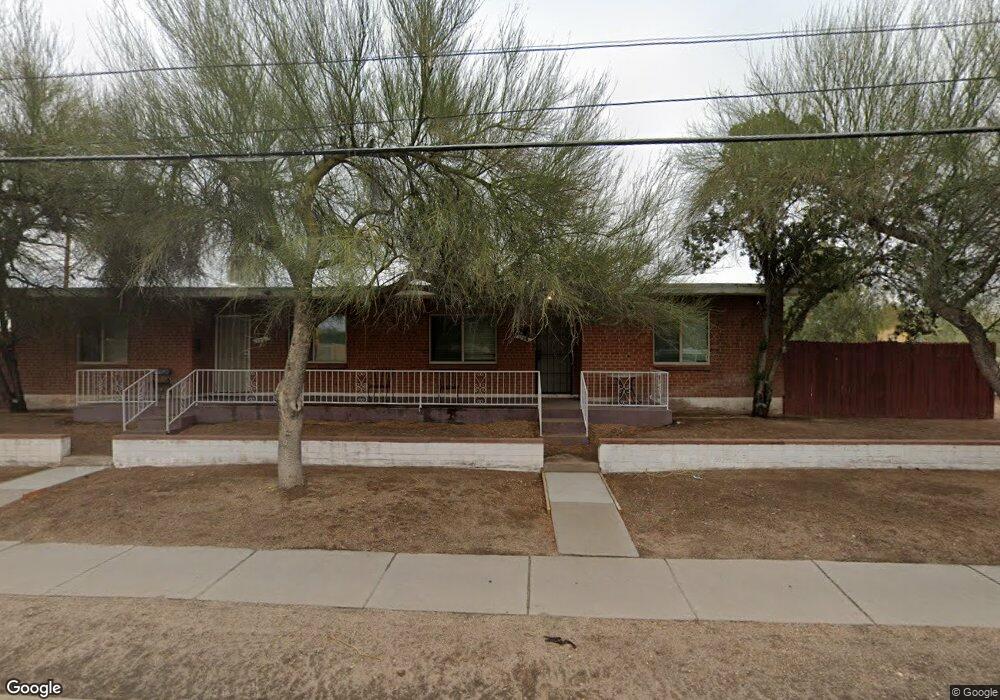
106 N Campbell Ave Tucson, AZ 85719
Sam Hughes NeighborhoodEstimated Value: $358,181 - $450,000
--
Bed
--
Bath
1,648
Sq Ft
$250/Sq Ft
Est. Value
About This Home
This home is located at 106 N Campbell Ave, Tucson, AZ 85719 and is currently estimated at $412,045, approximately $250 per square foot. 106 N Campbell Ave is a home with nearby schools including Sam Hughes Elementary, Mansfeld Middle School, and Tucson High Magnet School.
Ownership History
Date
Name
Owned For
Owner Type
Purchase Details
Closed on
Aug 26, 2025
Sold by
Brown Kendall Leigh
Bought by
Brown Living Trust and Brown
Current Estimated Value
Purchase Details
Closed on
Dec 17, 2019
Sold by
Brown Chad Frederick and Brown Kendall Leigh
Bought by
Brown Kendall Ligh and Brown Chad Frederick
Purchase Details
Closed on
Jun 25, 2019
Sold by
Lee Jerry W
Bought by
Li Shu Ti Hung and Lee Jerry W
Purchase Details
Closed on
Feb 19, 2014
Sold by
Gee Lillian Lee and Gee Lillian Lee
Bought by
Lee Jerry W
Purchase Details
Closed on
Dec 9, 2003
Sold by
Lee Jerry W
Bought by
Gee Lillian Lee
Create a Home Valuation Report for This Property
The Home Valuation Report is an in-depth analysis detailing your home's value as well as a comparison with similar homes in the area
Home Values in the Area
Average Home Value in this Area
Purchase History
| Date | Buyer | Sale Price | Title Company |
|---|---|---|---|
| Brown Living Trust | -- | None Listed On Document | |
| Brown Kendall Ligh | -- | None Available | |
| Li Shu Ti Hung | -- | None Available | |
| Li Shu Ti Hung | -- | None Available | |
| Lee Jerry W | -- | Title Security Agency Of Az | |
| Gee Lillian Lee | -- | -- |
Source: Public Records
Tax History Compared to Growth
Tax History
| Year | Tax Paid | Tax Assessment Tax Assessment Total Assessment is a certain percentage of the fair market value that is determined by local assessors to be the total taxable value of land and additions on the property. | Land | Improvement |
|---|---|---|---|---|
| 2025 | $2,002 | $15,133 | -- | -- |
| 2024 | $1,810 | $14,412 | -- | -- |
| 2023 | $1,810 | $13,726 | -- | -- |
| 2022 | $1,821 | $13,072 | $0 | $0 |
| 2021 | $1,810 | $11,857 | $0 | $0 |
| 2020 | $1,755 | $16,978 | $0 | $0 |
| 2019 | $1,732 | $16,348 | $0 | $0 |
| 2018 | $1,694 | $10,242 | $0 | $0 |
| 2017 | $1,684 | $10,242 | $0 | $0 |
| 2016 | $1,644 | $9,755 | $0 | $0 |
| 2015 | $1,576 | $9,290 | $0 | $0 |
Source: Public Records
Map
Nearby Homes
- 0 No Address Unit 22515641
- 0 No Address Unit 22521060
- 0 No Address Unit 22515640
- 1650 E 10th St
- 323 N Norris Ave
- 2001 E 8th St
- 55 N Cherry Ave Unit 205
- 55 N Cherry Ave Unit 105
- 55 N Cherry Ave Unit 211
- 1827 E 13th St
- 1438 E 9th St
- 1515 E 12th St
- 1649 E 13th St
- 1333 E Broadway Blvd
- 2003 E 5th St
- 1537 E Manlove St
- 1330 E Broadway Blvd
- 1330 E 12th St
- 530 N Wilson Ave
- 629 N Wilson Ave
- 1909 E 10th St
- 1915 E 10th St
- 118 N Campbell Ave
- 120 N Campbell Ave
- 1921 E 10th St
- 1902 E 10th St
- 128 N Campbell Ave
- 1910 E 10th St
- 1927 E 10th St
- 1916 E 10th St
- 1920 E 10th St
- 1823 E 10th St
- 1933 E 10th St
- 121 N Norris Ave
- 1932 E 10th St
- 1902 E 9th St
- 1910 E 9th St
- 1817 E 10th St
- 1916 E 9th St
- 127 N Norris Ave