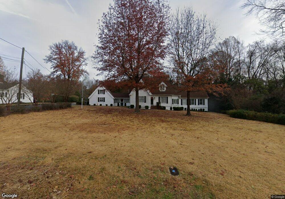
106 W Riverside Dr Smithfield, NC 27577
Estimated Value: $386,000 - $466,000
4
Beds
3
Baths
3,162
Sq Ft
$135/Sq Ft
Est. Value
About This Home
This home is located at 106 W Riverside Dr, Smithfield, NC 27577 and is currently estimated at $427,080, approximately $135 per square foot. 106 W Riverside Dr is a home located in Johnston County with nearby schools including South Smithfield Elementary School, Smithfield Middle School, and Smithfield-Selma High School.
Ownership History
Date
Name
Owned For
Owner Type
Purchase Details
Closed on
Apr 22, 2016
Sold by
Mcartan Northie and Mcartan Lisa D
Bought by
Cataliotti Joseph C and Cataliotti Carson S
Current Estimated Value
Home Financials for this Owner
Home Financials are based on the most recent Mortgage that was taken out on this home.
Original Mortgage
$237,601
Outstanding Balance
$189,069
Interest Rate
3.73%
Mortgage Type
New Conventional
Estimated Equity
$238,011
Purchase Details
Closed on
Dec 27, 2013
Sold by
Malphrus James S and Malphrus Robin W
Bought by
Mcartan Northie and Mcartan Lisa D
Home Financials for this Owner
Home Financials are based on the most recent Mortgage that was taken out on this home.
Original Mortgage
$12,000
Interest Rate
4.25%
Mortgage Type
New Conventional
Create a Home Valuation Report for This Property
The Home Valuation Report is an in-depth analysis detailing your home's value as well as a comparison with similar homes in the area
Home Values in the Area
Average Home Value in this Area
Purchase History
| Date | Buyer | Sale Price | Title Company |
|---|---|---|---|
| Cataliotti Joseph C | $160,000 | None Available | |
| Mcartan Northie | $120,000 | None Available |
Source: Public Records
Mortgage History
| Date | Status | Borrower | Loan Amount |
|---|---|---|---|
| Open | Cataliotti Joseph C | $237,601 | |
| Previous Owner | Mcartan Northie | $12,000 |
Source: Public Records
Tax History
| Year | Tax Paid | Tax Assessment Tax Assessment Total Assessment is a certain percentage of the fair market value that is determined by local assessors to be the total taxable value of land and additions on the property. | Land | Improvement |
|---|---|---|---|---|
| 2025 | $3,789 | $390,660 | $70,000 | $320,660 |
| 2024 | $2,928 | $236,140 | $45,000 | $191,140 |
| 2023 | $2,975 | $236,140 | $45,000 | $191,140 |
| 2022 | $3,070 | $236,140 | $45,000 | $191,140 |
| 2021 | $3,070 | $236,140 | $45,000 | $191,140 |
| 2020 | $3,141 | $236,140 | $45,000 | $191,140 |
| 2019 | $3,141 | $236,140 | $45,000 | $191,140 |
| 2018 | $3,714 | $275,090 | $81,900 | $193,190 |
| 2017 | $3,723 | $275,090 | $81,900 | $193,190 |
| 2016 | $3,385 | $250,760 | $81,900 | $168,860 |
| 2015 | $3,385 | $250,760 | $81,900 | $168,860 |
| 2014 | $3,385 | $250,760 | $81,900 | $168,860 |
Source: Public Records
Map
Nearby Homes
- 109 W Riverside Dr
- 113 W Riverside Dr
- 0 W Rose St
- 510 S 4th St
- 212 Lily Patch Ln
- 216 Lily Patch Ln
- 240 Lily Patch Ln
- 228 Lily Patch Ln
- 162 Caitlyn Pkwy
- 212 Caitlyn Pkwy
- 220 Lily Patch Ln
- 224 Lily Patch Ln
- 313 S 4th St
- 407 E Woodall St
- 103 E Meadowbrook Dr
- 161 Holton St
- 169 Holton St
- 173 Holton St
- 177 Holton St
- 181 Holton St
- 112 W Riverside Dr
- 101 E Riverside Dr
- 103 W Riverside Dr
- 103 W Riverside Dr
- 103 E Riverside Dr
- 104 E Riverside Dr
- 116 W Riverside Dr
- 410 S 1st St
- 407 S Vermont St
- 117 W Riverside Dr
- 106 E Riverside Dr
- 409 S Vermont St
- 411 S 1st St
- 108 W Davis St
- 110 E Riverside Dr
- 122 W Riverside Dr
- 102 W Davis St
- 112 W Davis St
- 115 E Riverside Dr
- 414 S 1st St
Your Personal Tour Guide
Ask me questions while you tour the home.