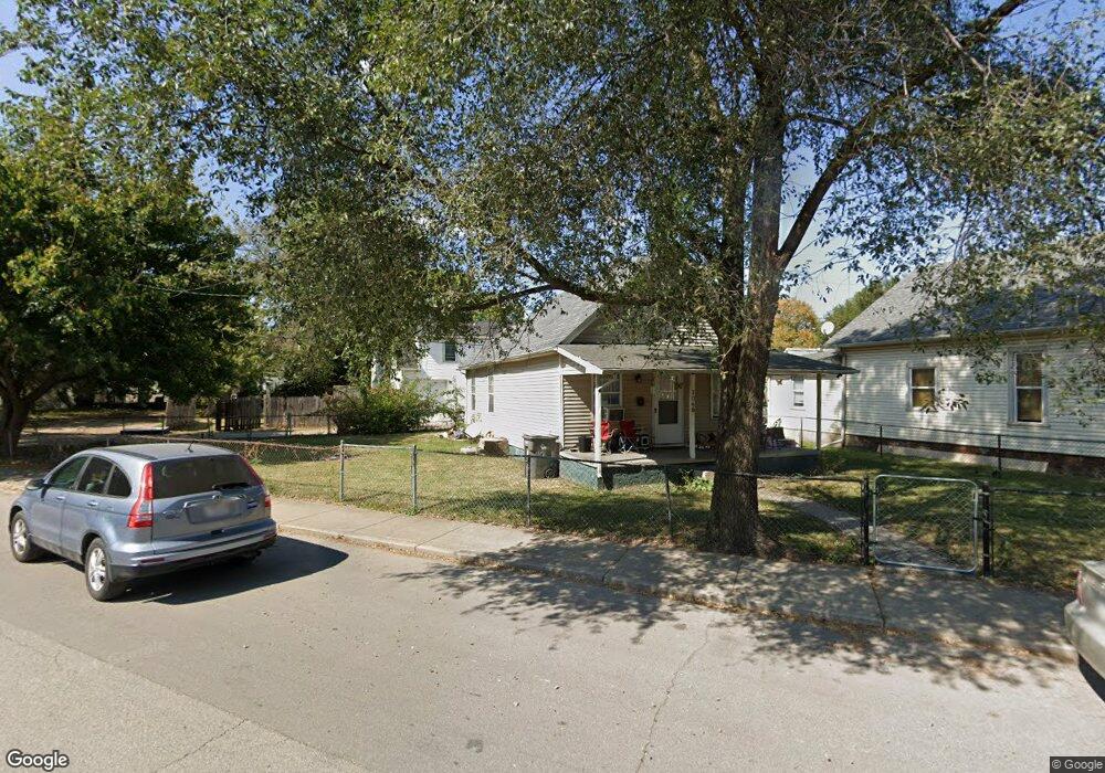
1060 W Mccarty St Indianapolis, IN 46221
West Indianapolis NeighborhoodEstimated Value: $87,000 - $155,000
2
Beds
1
Bath
867
Sq Ft
$131/Sq Ft
Est. Value
About This Home
This home is located at 1060 W Mccarty St, Indianapolis, IN 46221 and is currently estimated at $113,343, approximately $130 per square foot. 1060 W Mccarty St is a home located in Marion County with nearby schools including William Penn School 49, Eleanor Skillen School No. 34, and Ralph Waldo Emerson School 58.
Ownership History
Date
Name
Owned For
Owner Type
Purchase Details
Closed on
Jan 23, 2007
Sold by
Foto Ghebrihiwet K
Bought by
Foto Ghebrihiwet K and Berhane Almaz
Current Estimated Value
Purchase Details
Closed on
Jan 8, 2007
Sold by
Jpmorgan Chase Bank
Bought by
Foto Ghebrihiwet K
Purchase Details
Closed on
Oct 3, 2006
Sold by
Citzgerald John C and Lasalle Bank Na
Bought by
Jp Morgan Chase Bank
Create a Home Valuation Report for This Property
The Home Valuation Report is an in-depth analysis detailing your home's value as well as a comparison with similar homes in the area
Home Values in the Area
Average Home Value in this Area
Purchase History
| Date | Buyer | Sale Price | Title Company |
|---|---|---|---|
| Foto Ghebrihiwet K | -- | None Available | |
| Foto Ghebrihiwet K | -- | None Available | |
| Jp Morgan Chase Bank | $25,575 | None Available |
Source: Public Records
Tax History Compared to Growth
Tax History
| Year | Tax Paid | Tax Assessment Tax Assessment Total Assessment is a certain percentage of the fair market value that is determined by local assessors to be the total taxable value of land and additions on the property. | Land | Improvement |
|---|---|---|---|---|
| 2024 | $1,020 | $41,600 | $2,300 | $39,300 |
| 2023 | $1,020 | $40,100 | $2,300 | $37,800 |
| 2022 | $1,043 | $41,300 | $2,300 | $39,000 |
| 2021 | $754 | $29,800 | $2,300 | $27,500 |
| 2020 | $635 | $27,400 | $2,300 | $25,100 |
| 2019 | $538 | $22,800 | $2,300 | $20,500 |
| 2018 | $587 | $22,000 | $2,300 | $19,700 |
| 2017 | $272 | $9,900 | $2,300 | $7,600 |
| 2016 | $211 | $9,900 | $2,300 | $7,600 |
| 2014 | $208 | $9,600 | $2,300 | $7,300 |
| 2013 | $487 | $19,900 | $2,300 | $17,600 |
Source: Public Records
Map
Nearby Homes
- 653 Birch Ave
- 639 Warren Ave
- 623 Arbor Ave
- 625 Arbor Ave
- 312 W Morris St
- 1133 S Richland St
- 1738 W Morris St
- 262 W Ray St
- 1130 S Senate Ave
- 55 S Harding St Unit 301
- 825 Kappes St
- 1212 S Senate Ave
- 248 W Morris St
- 1837 W Wilkins St
- 1845 W Wilkins St
- 1809 W Morris St
- 1842 Westview Dr
- 1922 Westview Dr
- 121 Neal Ave
- 1846 W Lambert St
- 1054 W Mccarty St
- 670 River Ave
- 810 River Ave
- 649 Birch Ave
- 645 Birch Ave
- 666 River Ave
- 820 River Ave
- 635 Birch Ave
- 661 Birch Ave
- 662 River Ave
- 655 Birch Ave
- 637 Birch Ave
- 1071 W Mccarty St
- 663 Birch Ave Unit 665
- 824 River Ave
- 633 Birch Ave
- 651 Birch Ave Unit Main House
- 828 River Ave
- 1079 W Mccarty St
- 667 Birch Ave