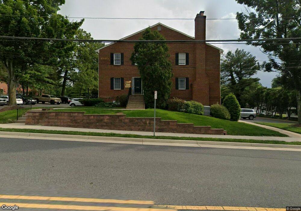
10605 Judicial Dr Unit A2 Fairfax, VA 22030
Estimated Value: $691,909
--
Bed
--
Bath
2,218
Sq Ft
$312/Sq Ft
Est. Value
About This Home
This home is located at 10605 Judicial Dr Unit A2, Fairfax, VA 22030 and is currently estimated at $691,909, approximately $311 per square foot. 10605 Judicial Dr Unit A2 is a home located in Fairfax City with nearby schools including Daniels Run Elementary School, Johnson Middle School, and Fairfax High.
Ownership History
Date
Name
Owned For
Owner Type
Purchase Details
Closed on
Sep 3, 1997
Sold by
Crosson Kenneth L and Crosson Susan K
Bought by
10605 Judicial Lc
Current Estimated Value
Home Financials for this Owner
Home Financials are based on the most recent Mortgage that was taken out on this home.
Original Mortgage
$148,000
Outstanding Balance
$22,714
Interest Rate
7.36%
Mortgage Type
Commercial
Estimated Equity
$669,195
Purchase Details
Closed on
Jan 4, 1996
Sold by
State St Bank & Trust Co
Bought by
Crosson Kenneth L
Home Financials for this Owner
Home Financials are based on the most recent Mortgage that was taken out on this home.
Original Mortgage
$150,000
Interest Rate
7.34%
Mortgage Type
Commercial
Purchase Details
Closed on
Jul 18, 1995
Sold by
Cronin George F
Bought by
State St Bank & Trust Co
Create a Home Valuation Report for This Property
The Home Valuation Report is an in-depth analysis detailing your home's value as well as a comparison with similar homes in the area
Home Values in the Area
Average Home Value in this Area
Purchase History
| Date | Buyer | Sale Price | Title Company |
|---|---|---|---|
| 10605 Judicial Lc | $198,000 | -- | |
| Crosson Kenneth L | $152,250 | -- | |
| State St Bank & Trust Co | $183,083 | -- |
Source: Public Records
Mortgage History
| Date | Status | Borrower | Loan Amount |
|---|---|---|---|
| Open | State St Bank & Trust Co | $148,000 | |
| Previous Owner | State St Bank & Trust Co | $150,000 |
Source: Public Records
Tax History Compared to Growth
Tax History
| Year | Tax Paid | Tax Assessment Tax Assessment Total Assessment is a certain percentage of the fair market value that is determined by local assessors to be the total taxable value of land and additions on the property. | Land | Improvement |
|---|---|---|---|---|
| 2025 | $5,653 | $479,100 | $111,200 | $367,900 |
| 2024 | $5,534 | $479,100 | $111,200 | $367,900 |
| 2023 | $5,510 | $479,100 | $111,200 | $367,900 |
| 2022 | $5,438 | $479,100 | $111,200 | $367,900 |
| 2021 | $6,049 | $504,100 | $111,200 | $392,900 |
| 2020 | $6,049 | $504,100 | $111,200 | $392,900 |
| 2019 | $6,300 | $536,200 | $111,200 | $425,000 |
| 2018 | $6,300 | $536,200 | $111,200 | $425,000 |
| 2017 | $3,123 | $536,200 | $111,200 | $425,000 |
| 2016 | $3,102 | $536,200 | $111,200 | $425,000 |
| 2015 | $6,361 | $564,400 | $111,200 | $453,200 |
| 2014 | $6,505 | $594,100 | $111,200 | $482,900 |
Source: Public Records
Map
Nearby Homes
- 4200 Allison Cir
- 10634 Pocket Place
- 10632 Pocket Place
- 10723 West Dr Unit 103
- 10723 West Dr Unit 303
- 10725 West Dr Unit 301
- 10720 West Dr Unit 101
- 10665 Yorktown Ct
- 10570 Main St Unit 220
- 10816 Verde Vista Dr
- 4222 Lamarre Dr
- 4316 Chain Bridge Rd
- 10626 Regent Park Ct
- 10913 Byrd Dr
- 3989 Norton Place Unit 105
- 10419 Courthouse Dr
- 10603 Legacy Ln
- 10351 Sager Ave
- 10353 Main St
- 10719 Viognier Terrace
- 10605 Judicial Dr
- 10605 Judicial Dr Unit A4
- 10605 Judicial Dr Unit B4
- 10605 Judicial Dr Unit A1
- 10605 Judicial Dr Unit A3
- 10605 Judicial Dr Unit B1
- 4118 Leonard Dr
- 4122 Leonard Dr
- 4116 Leonard Dr
- 10603 Judicial Dr
- 4120 Leonard Dr
- 4124 Leonard Dr
- 4126 Leonard Dr
- 16017 Maple St
- 10634 Maple St
- 10632 Maple St
- 10636 Maple St
- 10630 Maple St
- 4130 Leonard Dr
- 10628 Maple St