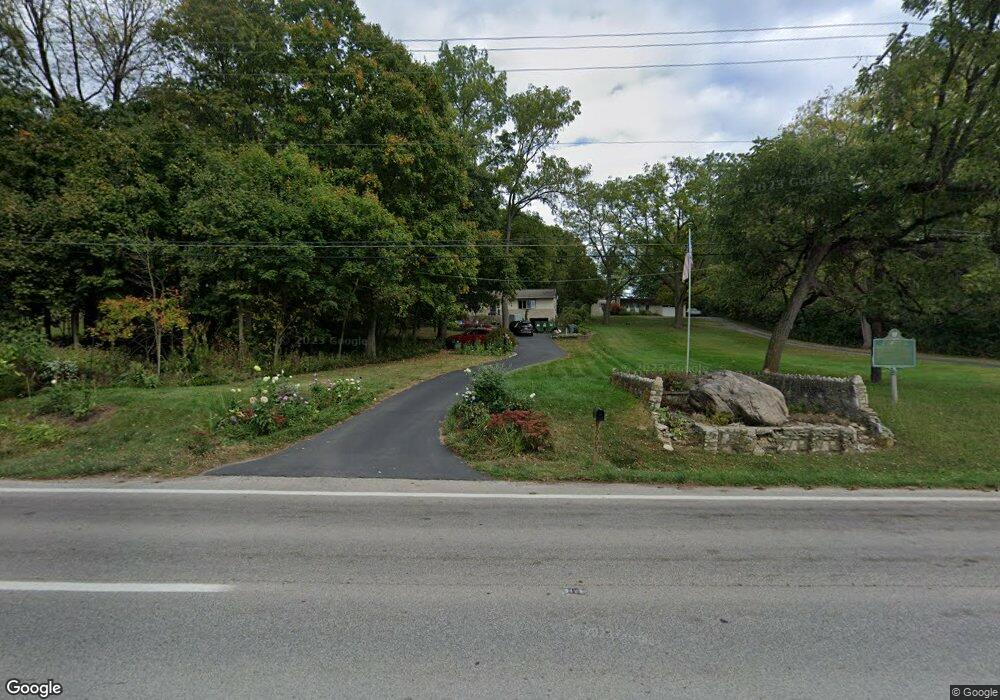
10607 Riverside Dr Powell, OH 43065
Liberty Township NeighborhoodEstimated Value: $452,363 - $710,000
5
Beds
2
Baths
2,100
Sq Ft
$282/Sq Ft
Est. Value
About This Home
This home is located at 10607 Riverside Dr, Powell, OH 43065 and is currently estimated at $591,341, approximately $281 per square foot. 10607 Riverside Dr is a home located in Delaware County with nearby schools including Scioto Ridge Elementary School, Olentangy Liberty Middle School, and Olentangy Liberty High School.
Ownership History
Date
Name
Owned For
Owner Type
Purchase Details
Closed on
Aug 13, 1998
Sold by
Wilson Maria A
Bought by
Grandstaff Timothy M Bridgham Nancy
Current Estimated Value
Home Financials for this Owner
Home Financials are based on the most recent Mortgage that was taken out on this home.
Original Mortgage
$192,000
Interest Rate
7.07%
Mortgage Type
New Conventional
Create a Home Valuation Report for This Property
The Home Valuation Report is an in-depth analysis detailing your home's value as well as a comparison with similar homes in the area
Home Values in the Area
Average Home Value in this Area
Purchase History
| Date | Buyer | Sale Price | Title Company |
|---|---|---|---|
| Grandstaff Timothy M Bridgham Nancy | $240,000 | -- |
Source: Public Records
Mortgage History
| Date | Status | Borrower | Loan Amount |
|---|---|---|---|
| Previous Owner | Grandstaff Timothy M Bridgham Nancy | $192,000 |
Source: Public Records
Tax History Compared to Growth
Tax History
| Year | Tax Paid | Tax Assessment Tax Assessment Total Assessment is a certain percentage of the fair market value that is determined by local assessors to be the total taxable value of land and additions on the property. | Land | Improvement |
|---|---|---|---|---|
| 2024 | $6,439 | $122,890 | $24,470 | $98,420 |
| 2023 | $6,464 | $122,890 | $24,470 | $98,420 |
| 2022 | $5,232 | $78,860 | $15,090 | $63,770 |
| 2021 | $5,264 | $78,860 | $15,090 | $63,770 |
| 2020 | $5,289 | $78,860 | $15,090 | $63,770 |
| 2019 | $5,074 | $78,860 | $15,090 | $63,770 |
| 2018 | $5,097 | $78,860 | $15,090 | $63,770 |
| 2017 | $5,044 | $74,060 | $13,930 | $60,130 |
| 2016 | $5,095 | $74,060 | $13,930 | $60,130 |
| 2015 | $4,608 | $74,060 | $13,930 | $60,130 |
| 2014 | $4,672 | $74,060 | $13,930 | $60,130 |
| 2013 | $4,780 | $74,060 | $13,930 | $60,130 |
Source: Public Records
Map
Nearby Homes
- 10669 Riverside Dr
- 5444 Stratford Ave
- 8660 Birgham Ct S
- 5175 Woodbridge Ave
- 0 Glick Rd Unit 225037914
- 8500 Stonechat Loop
- 8455 Dunsinane Dr
- 8565 Dunsinane Dr
- 10510 Wellington Blvd
- 9130 Muirkirk Dr
- 8613 Kirkhill Ct
- 9170 Muirkirk Dr
- 5515 Aryshire Ct Unit 23
- 0 Arrowhead Rd
- 9924 Gleneagle Place
- 8151 Winchcombe Dr
- 8025 Inistork Dr
- 8458 Invergordon Ct
- 8119 Winchcombe Dr
- 9190 Leith Dr
- 10621 Riverside Dr
- 10577 Riverside Dr
- 10573 Riverside Dr
- 10647 Riverside Dr
- 10559 Riverside Dr
- 10639 Dundee Ct
- 10618 Riverside Dr
- 10624 Riverside Dr
- 10624 Riverside Dr Unit O
- 10521 Riverside Dr
- 10580 Riverside Dr
- 0 Riverside Dr Unit 2135220
- 0 Riverside Dr Unit 2611576
- 0 Riverside Dr Unit 2510798
- 0 Riverside Dr Unit 2322111
- 0 Riverside Dr Unit 2007740
- 0 Riverside Dr Unit 2003734
- 0 Riverside Dr Unit 31858
- 0 Riverside Dr Unit 21146
- 0 Riverside Dr Unit 18478
