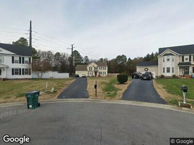
10608 Sands Ct Glen Allen, VA 23060
Estimated Value: $494,906 - $535,000
4
Beds
3
Baths
2,360
Sq Ft
$216/Sq Ft
Est. Value
About This Home
This home is located at 10608 Sands Ct, Glen Allen, VA 23060 and is currently estimated at $508,977, approximately $215 per square foot. 10608 Sands Ct is a home located in Henrico County with nearby schools including Glen Allen Elementary School, Hungary Creek Middle School, and Glen Allen High School.
Ownership History
Date
Name
Owned For
Owner Type
Purchase Details
Closed on
Nov 28, 2000
Sold by
Ray Cattie
Bought by
Gray Franklin T and Diane H Gray
Current Estimated Value
Home Financials for this Owner
Home Financials are based on the most recent Mortgage that was taken out on this home.
Original Mortgage
$153,000
Interest Rate
7.78%
Mortgage Type
Credit Line Revolving
Purchase Details
Closed on
Mar 23, 1999
Bought by
Ray Cattie
Create a Home Valuation Report for This Property
The Home Valuation Report is an in-depth analysis detailing your home's value as well as a comparison with similar homes in the area
Home Values in the Area
Average Home Value in this Area
Purchase History
| Date | Buyer | Sale Price | Title Company |
|---|---|---|---|
| Gray Franklin T | $153,500 | -- | |
| Ray Cattie | $146,500 | -- |
Source: Public Records
Mortgage History
| Date | Status | Borrower | Loan Amount |
|---|---|---|---|
| Open | Gray Franklin Todd | $54,000 | |
| Open | Gray Franklin Todd | $272,000 | |
| Closed | Gray Franklin Todd | $242,700 | |
| Closed | Gray Franklin Todd | $240,614 | |
| Closed | Ray Cattie | $153,000 |
Source: Public Records
Tax History Compared to Growth
Tax History
| Year | Tax Paid | Tax Assessment Tax Assessment Total Assessment is a certain percentage of the fair market value that is determined by local assessors to be the total taxable value of land and additions on the property. | Land | Improvement |
|---|---|---|---|---|
| 2025 | $3,801 | $429,200 | $95,000 | $334,200 |
| 2024 | $3,801 | $393,000 | $95,000 | $298,000 |
| 2023 | $3,341 | $393,000 | $95,000 | $298,000 |
| 2022 | $3,221 | $378,900 | $80,800 | $298,100 |
| 2021 | $2,841 | $326,500 | $71,300 | $255,200 |
| 2020 | $2,841 | $326,500 | $71,300 | $255,200 |
| 2019 | $2,663 | $306,100 | $71,300 | $234,800 |
| 2018 | $2,471 | $284,000 | $71,300 | $212,700 |
| 2017 | $2,327 | $267,500 | $71,300 | $196,200 |
| 2016 | $2,252 | $258,900 | $62,700 | $196,200 |
| 2015 | $2,252 | $258,900 | $62,700 | $196,200 |
| 2014 | $2,252 | $258,900 | $62,700 | $196,200 |
Source: Public Records
Map
Nearby Homes
- 3813 Mill Place Dr
- 3821 Mill Place Dr
- 11600 Heverley Ct
- 10317 White Marsh Rd
- 8001 Lake Laurel Ln Unit B
- 8001 Lake Laurel Ln Unit A
- 9608 Pointe Laurel Ln
- 3323 Corrotoman Rd
- 2920 Ridgegate Place
- 2804 Lakewood Rd
- 10214 Mobjack Ave Unit 2
- 11405 Hunton Ridge Ln
- 3503 Bayon Way
- 3904 Links Ln
- 3900 Links Ln
- 10232 Locklies Dr
- 3401 Coles Point Way Unit A
- 3908 Links Ln
- 11400 Long Meadow Dr
- 3421 Coles Point Way Unit A
- 10608 Sands Ct
- 10605 Sands Ct
- 10604 Sands Ct
- 3419 Mountain Rd
- 10601 Sands Ct
- 10600 Sands Ct
- 10698 Courtney Rd
- 3400 Collier Ct
- 3412 Collier Ct
- 3407 Collier Ct
- 3507 Mountain Rd
- 3401 Collier Ct
- 3515 Mountain Rd
- 3511 Mountain Rd
- 3416 Collier Ct
- 10681 Courtney Rd
- 10640 Courtney Rd
- 3411 Collier Ct
- 10671 Courtney Rd
- 3415 Collier Ct
