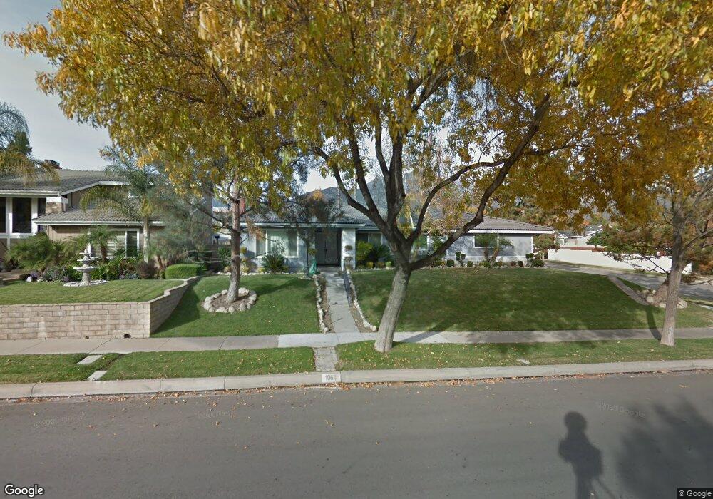
1061 W 21st St Upland, CA 91784
Estimated Value: $852,129 - $926,000
3
Beds
2
Baths
1,752
Sq Ft
$509/Sq Ft
Est. Value
About This Home
This home is located at 1061 W 21st St, Upland, CA 91784 and is currently estimated at $892,532, approximately $509 per square foot. 1061 W 21st St is a home located in San Bernardino County with nearby schools including Valencia Elementary, Pioneer Junior High School, and Upland High School.
Ownership History
Date
Name
Owned For
Owner Type
Purchase Details
Closed on
Mar 29, 2000
Sold by
Olmos Mark
Bought by
Olmos Mark and Olmos Mary K
Current Estimated Value
Home Financials for this Owner
Home Financials are based on the most recent Mortgage that was taken out on this home.
Original Mortgage
$168,000
Interest Rate
3.95%
Create a Home Valuation Report for This Property
The Home Valuation Report is an in-depth analysis detailing your home's value as well as a comparison with similar homes in the area
Home Values in the Area
Average Home Value in this Area
Purchase History
| Date | Buyer | Sale Price | Title Company |
|---|---|---|---|
| Olmos Mark | -- | First American Title Co |
Source: Public Records
Mortgage History
| Date | Status | Borrower | Loan Amount |
|---|---|---|---|
| Closed | Olmos Mark | $168,000 |
Source: Public Records
Tax History Compared to Growth
Tax History
| Year | Tax Paid | Tax Assessment Tax Assessment Total Assessment is a certain percentage of the fair market value that is determined by local assessors to be the total taxable value of land and additions on the property. | Land | Improvement |
|---|---|---|---|---|
| 2025 | $4,466 | $417,657 | $147,194 | $270,463 |
| 2024 | $4,466 | $409,468 | $144,308 | $265,160 |
| 2023 | $4,397 | $401,439 | $141,478 | $259,961 |
| 2022 | $4,300 | $393,568 | $138,704 | $254,864 |
| 2021 | $4,293 | $385,851 | $135,984 | $249,867 |
| 2020 | $4,176 | $381,895 | $134,590 | $247,305 |
| 2019 | $4,161 | $374,407 | $131,951 | $242,456 |
| 2018 | $4,059 | $367,066 | $129,364 | $237,702 |
| 2017 | $3,941 | $359,868 | $126,827 | $233,041 |
| 2016 | $3,733 | $352,812 | $124,340 | $228,472 |
| 2015 | $3,647 | $347,512 | $122,472 | $225,040 |
| 2014 | $3,552 | $340,705 | $120,073 | $220,632 |
Source: Public Records
Map
Nearby Homes
- 907 Pineridge St
- 2166 Malati Cir
- 1328 Sunrise Cir S
- 1070 Emerson St
- 1992 Moonbeam Cir
- 785 W Dalton Ct
- 937 Emerson St
- 2183 Paris Cir
- 666 W 21st St
- 2163 Pinot Cir
- 1363 Running Creek Ln
- 860 Emerson St
- 1243 Jacaranda Place
- 2304 Rosedale Curve
- 2335 N San Antonio Ave
- 1252 Granada St
- 1842 Balboa Way
- 2279 Wisteria Ave
- 1931 N Redding Way
- 1992 Windemere Ct
- 1077 W 21st St
- 1041 W 21st St
- 1062 Jefferson St
- 1085 W 21st St
- 1076 Jefferson St
- 2096 N Omalley Way Unit O
- 2096 N Omalley Way
- 1042 Jefferson St
- 1029 W 21st St
- 1095 W 21st St
- 1080 Jefferson St
- 1044 W 21st St
- 1030 Jefferson St
- 2090 N Omalley Way Unit O
- 2090 N Omalley Way
- 2095 N Omalley Way
- 1032 W 21st St
- 1017 W 21st St
- 2132 Jill Way
- 2125 Jill Way