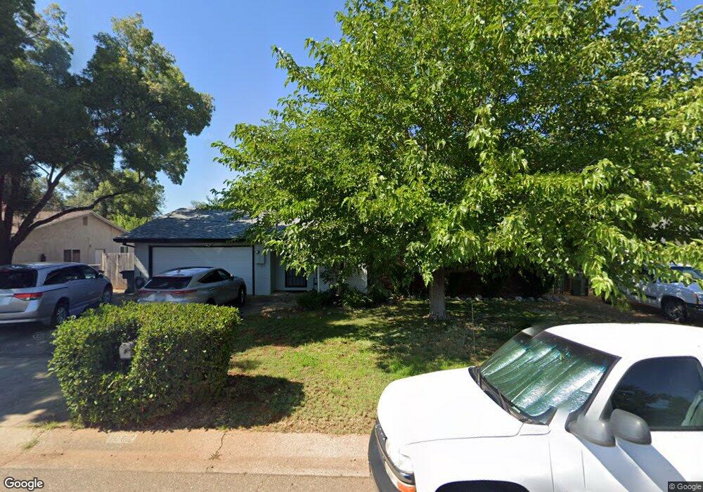
1062 Denton Way Redding, CA 96002
Enterprise NeighborhoodEstimated Value: $311,096 - $333,000
3
Beds
2
Baths
1,308
Sq Ft
$244/Sq Ft
Est. Value
About This Home
This home is located at 1062 Denton Way, Redding, CA 96002 and is currently estimated at $318,774, approximately $243 per square foot. 1062 Denton Way is a home located in Shasta County with nearby schools including Lassen View Elementary School, Parsons Junior High School, and Enterprise High School.
Ownership History
Date
Name
Owned For
Owner Type
Purchase Details
Closed on
Sep 3, 2025
Sold by
Gray Michael T and Gray Christena I
Bought by
Gray Family Trust and Gray
Current Estimated Value
Purchase Details
Closed on
May 9, 2006
Sold by
Gray Michael T and Gray Christena I
Bought by
Gray Michael T and Gray Christena I
Home Financials for this Owner
Home Financials are based on the most recent Mortgage that was taken out on this home.
Original Mortgage
$89,720
Interest Rate
6.41%
Mortgage Type
Credit Line Revolving
Purchase Details
Closed on
Oct 8, 2002
Sold by
Webb William Winford and Webb Annanell
Bought by
Gray Michael T and Gray Christena I
Home Financials for this Owner
Home Financials are based on the most recent Mortgage that was taken out on this home.
Original Mortgage
$121,250
Interest Rate
6.09%
Mortgage Type
Purchase Money Mortgage
Create a Home Valuation Report for This Property
The Home Valuation Report is an in-depth analysis detailing your home's value as well as a comparison with similar homes in the area
Home Values in the Area
Average Home Value in this Area
Purchase History
| Date | Buyer | Sale Price | Title Company |
|---|---|---|---|
| Gray Family Trust | -- | None Listed On Document | |
| Gray Michael T | -- | None Available | |
| Gray Michael T | $125,000 | First American Title Co |
Source: Public Records
Mortgage History
| Date | Status | Borrower | Loan Amount |
|---|---|---|---|
| Previous Owner | Gray Michael T | $89,720 | |
| Previous Owner | Gray Michael T | $121,250 |
Source: Public Records
Tax History
| Year | Tax Paid | Tax Assessment Tax Assessment Total Assessment is a certain percentage of the fair market value that is determined by local assessors to be the total taxable value of land and additions on the property. | Land | Improvement |
|---|---|---|---|---|
| 2025 | $1,906 | $181,018 | $50,680 | $130,338 |
| 2024 | $1,878 | $177,470 | $49,687 | $127,783 |
| 2023 | $1,878 | $173,991 | $48,713 | $125,278 |
| 2022 | $1,823 | $170,580 | $47,758 | $122,822 |
| 2021 | $1,760 | $167,236 | $46,822 | $120,414 |
| 2020 | $1,751 | $165,522 | $46,342 | $119,180 |
| 2019 | $1,736 | $162,278 | $45,434 | $116,844 |
| 2018 | $1,714 | $159,097 | $44,544 | $114,553 |
| 2017 | $1,742 | $155,978 | $43,671 | $112,307 |
| 2016 | $1,629 | $152,920 | $42,815 | $110,105 |
| 2015 | $1,614 | $150,624 | $42,172 | $108,452 |
| 2014 | $1,601 | $147,674 | $41,346 | $106,328 |
Source: Public Records
Map
Nearby Homes
- 4323 Churn Crk Rd
- 751 Woodacre Dr
- 4302 Paulson Ln
- 607 Woodacre Dr
- 1354 Harpole Rd
- 737 Estate St
- 688 Julie Way
- 1513 Harpole Rd
- 3708 Traverse St
- 4724 Squirrel Run Ct
- 1289 Arizona St
- 3527 Adams Ln
- 4877 Squirrel Run Ct
- 952 Camino Ct
- 1209 C St
- 3428 Adams Ln
- 3857 Eagle Pkwy
- 3650 Cheryl Dr
- 1115 2nd St
- 1091 Del Sol Place
- 1046 Denton Way
- 1096 Denton Way
- 1079 Ledell Dr
- 1095 Ledell Dr
- 1030 Denton Way
- 1063 Ledell Dr
- 1112 Denton Way
- 1081 Denton Way
- 1097 Denton Way
- 1065 Denton Way
- 1111 Ledell Dr
- 4129 Churn Creek Rd
- 1113 Denton Way
- 1128 Denton Way
- 1031 Ledell Dr
- 1078 Ledell Dr
- 1094 Ledell Dr
- 1111 Dominion Dr Unit ONE
- 1111 Dominion Dr
- 1064 Ledell Dr
Your Personal Tour Guide
Ask me questions while you tour the home.