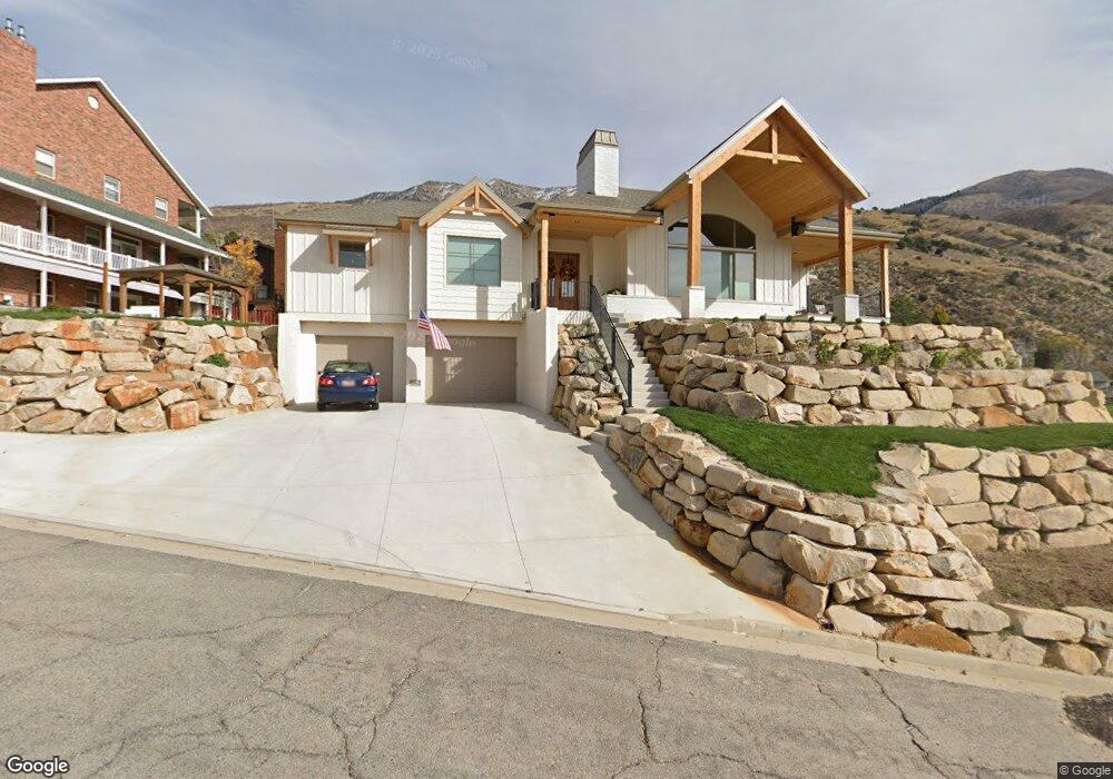
1062 Hillside Dr Unit 236 Provo, UT 84604
Rock Canyon NeighborhoodEstimated Value: $844,000 - $1,013,967
1
Bed
3
Baths
2,218
Sq Ft
$419/Sq Ft
Est. Value
About This Home
This home is located at 1062 Hillside Dr Unit 236, Provo, UT 84604 and is currently estimated at $928,322, approximately $418 per square foot. 1062 Hillside Dr Unit 236 is a home located in Utah County with nearby schools including Canyon Crest Elementary School, Centennial Middle School, and Timpview High School.
Ownership History
Date
Name
Owned For
Owner Type
Purchase Details
Closed on
Aug 18, 2023
Sold by
Vela Max and Vela Julie
Bought by
Vela Family Trust and Vela
Current Estimated Value
Purchase Details
Closed on
Sep 28, 2020
Sold by
Nielsen Greg Ross and Beer Nielsen Jo
Bought by
Vela Max and Vela Julie
Purchase Details
Closed on
Apr 18, 2017
Sold by
Pugh Charles Deuglas and Pugh Priscilla Litten
Bought by
Overson Merrill Richard
Home Financials for this Owner
Home Financials are based on the most recent Mortgage that was taken out on this home.
Original Mortgage
$100,000
Interest Rate
4.21%
Mortgage Type
New Conventional
Purchase Details
Closed on
Jun 29, 2005
Sold by
Seegmiller Robert E and Seegmiller Barbara B
Bought by
Pugh Charles Douglas and Pugh Priscilla Litten
Create a Home Valuation Report for This Property
The Home Valuation Report is an in-depth analysis detailing your home's value as well as a comparison with similar homes in the area
Home Values in the Area
Average Home Value in this Area
Purchase History
| Date | Buyer | Sale Price | Title Company |
|---|---|---|---|
| Vela Family Trust | -- | None Listed On Document | |
| Vela Max | -- | Old Republic Title | |
| Overson Merrill Richard | -- | None Available | |
| Pugh Charles Douglas | -- | Equity Title |
Source: Public Records
Mortgage History
| Date | Status | Borrower | Loan Amount |
|---|---|---|---|
| Previous Owner | Overson Merrill Richard | $100,000 |
Source: Public Records
Tax History
| Year | Tax Paid | Tax Assessment Tax Assessment Total Assessment is a certain percentage of the fair market value that is determined by local assessors to be the total taxable value of land and additions on the property. | Land | Improvement |
|---|---|---|---|---|
| 2025 | $4,640 | $474,265 | -- | -- |
| 2024 | $4,640 | $456,775 | $0 | $0 |
| 2023 | $4,412 | $428,120 | $0 | $0 |
| 2022 | $2,614 | $255,800 | $255,800 | $0 |
| 2021 | $1,817 | $170,500 | $170,500 | $0 |
| 2020 | $1,615 | $142,100 | $142,100 | $0 |
| 2019 | $1,553 | $142,100 | $142,100 | $0 |
| 2018 | $1,531 | $142,100 | $142,100 | $0 |
| 2017 | $1,348 | $142,100 | $0 | $0 |
Source: Public Records
Map
Nearby Homes
- 1085 Windsor Dr
- 4640 Brookshire Cir
- 924 Redford Dr
- 4601 Foothill Dr
- 4299 Ivy Ln
- 981 Waterford Dr Unit 5&6
- 645 Foothill Dr
- 285 Three Fountains Dr
- 3943 Foothill Dr
- 221 E 4735 N
- 144 E 4620 N
- 4161 N Canyon Rd Unit 2
- 3702 N 920 E
- 299 E 4000 N
- 3726 Devonshire Dr
- 5005 N Edgewood Dr Unit 310
- 407 E 3900 Rd N Unit 1
- 407 E 3900 Rd N
- 3711 N Canyon Rd
- 3690 N Canyon Rd
- 1078 Hillside Dr
- 1055 Hillside Dr
- 1022 Hillside Dr Unit 233
- 1064 Hillside Cir
- 1084 Hillside Dr
- 1028 Hillside Dr
- 1019 Hillside Dr
- 1050 Hillside Dr
- 1050 Hillside Dr Unit 1042
- 1050 Hillside Dr Unit 241
- 1050 Hillside Cir
- 1065 Hillside Cir
- 1077 Hillside Dr
- 1077 Hillside Dr
- 4702 Hillside Dr
- 1007 Hillside Dr
- 1041 Hillside Cir
- 1042 Hillside Dr
- 1042 Hillside Cir
- 1071 Windsor Dr
Your Personal Tour Guide
Ask me questions while you tour the home.