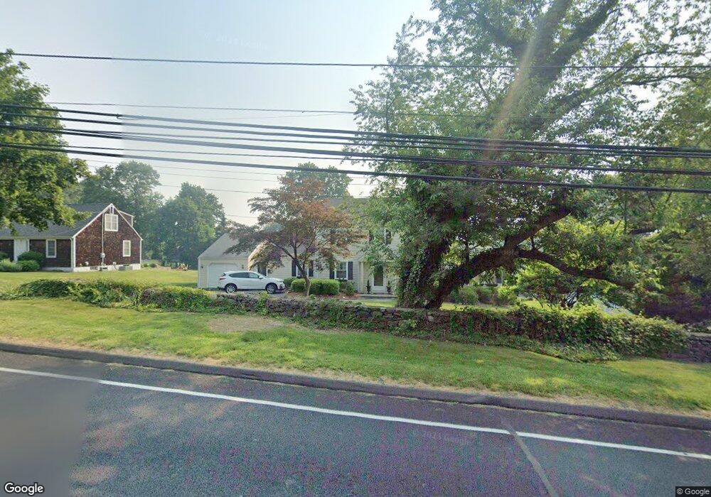
1062 N Benson Rd Fairfield, CT 06824
University NeighborhoodEstimated Value: $963,000 - $1,277,000
3
Beds
3
Baths
2,640
Sq Ft
$446/Sq Ft
Est. Value
About This Home
This home is located at 1062 N Benson Rd, Fairfield, CT 06824 and is currently estimated at $1,177,424, approximately $445 per square foot. 1062 N Benson Rd is a home located in Fairfield County with nearby schools including Osborn Hill Elementary School, Fairfield Woods Middle School, and Fairfield Ludlowe High School.
Ownership History
Date
Name
Owned For
Owner Type
Purchase Details
Closed on
Feb 13, 2013
Sold by
Gander Charles
Bought by
Gander Charles
Current Estimated Value
Purchase Details
Closed on
May 15, 1997
Sold by
Dematteo Anthony F and Dematteo Irene T
Bought by
Gander Charles K and Stadler-Gander Lisa
Purchase Details
Closed on
Mar 2, 1990
Sold by
Effron Janet
Bought by
Demattei Anthony F
Create a Home Valuation Report for This Property
The Home Valuation Report is an in-depth analysis detailing your home's value as well as a comparison with similar homes in the area
Home Values in the Area
Average Home Value in this Area
Purchase History
| Date | Buyer | Sale Price | Title Company |
|---|---|---|---|
| Gander Charles | -- | -- | |
| Gander Charles | -- | -- | |
| Gander Charles K | $255,000 | -- | |
| Gander Charles K | $255,000 | -- | |
| Demattei Anthony F | $233,500 | -- |
Source: Public Records
Mortgage History
| Date | Status | Borrower | Loan Amount |
|---|---|---|---|
| Previous Owner | Demattei Anthony F | $100,000 | |
| Previous Owner | Demattei Anthony F | $222,000 |
Source: Public Records
Tax History
| Year | Tax Paid | Tax Assessment Tax Assessment Total Assessment is a certain percentage of the fair market value that is determined by local assessors to be the total taxable value of land and additions on the property. | Land | Improvement |
|---|---|---|---|---|
| 2025 | $13,233 | $466,130 | $279,090 | $187,040 |
| 2024 | $13,005 | $466,130 | $279,090 | $187,040 |
| 2023 | $12,823 | $466,130 | $279,090 | $187,040 |
| 2022 | $12,697 | $466,130 | $279,090 | $187,040 |
| 2021 | $4,537 | $466,130 | $279,090 | $187,040 |
| 2020 | $13,181 | $492,030 | $276,150 | $215,880 |
| 2019 | $13,181 | $492,030 | $276,150 | $215,880 |
| 2018 | $12,970 | $492,030 | $276,150 | $215,880 |
| 2017 | $4,574 | $492,030 | $276,150 | $215,880 |
| 2016 | $12,522 | $492,030 | $276,150 | $215,880 |
| 2015 | $11,948 | $481,950 | $325,360 | $156,590 |
| 2014 | $11,760 | $481,950 | $325,360 | $156,590 |
Source: Public Records
Map
Nearby Homes
- 1478 Jennings Rd
- 15 Barton Rd
- 1091 Round Hill Rd
- 68 Figlar Ave
- 70 Meadow Ridge Rd
- 164 Wakeman Rd
- 77 Meadowbrook Rd
- 42 Robin Cir
- 1353 Mill Plain Rd
- 20 Ermine St
- 274 High St
- 196 Robin Ln
- 359 Reid St
- 245 Reid St
- 12 Reynolds Dr
- 240 Sunnyridge Ave Unit 63
- 610 Unquowa Rd
- 11 Tuckahoe Ln
- 28 Country Rd
- 218 Lower Farm Rd
- 1058 N Benson Rd
- 1082 N Benson Rd
- 1102 N Benson Rd
- 1036 N Benson Rd
- 379 Wormwood Rd
- 395 Wormwood Rd
- 363 Wormwood Rd
- 439 Wormwood Rd
- 1014 N Benson Rd
- 1124 N Benson Rd
- 414 Wormwood Rd
- 425 Wormwood Rd
- 347 Wormwood Rd
- 457 Wormwood Rd
- 400 Wormwood Rd
- 384 Wormwood Rd
- 331 Wormwood Rd
- 994 N Benson Rd
- 1146 N Benson Rd
- 366 Wormwood Rd
Your Personal Tour Guide
Ask me questions while you tour the home.