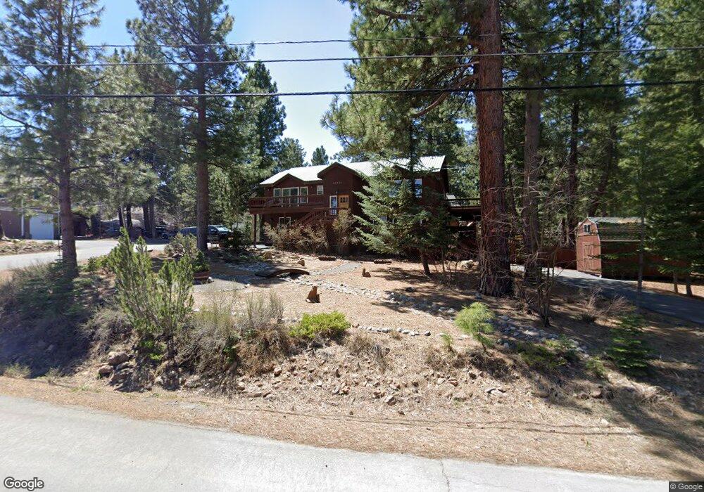
10634 Royal Crest Unit 3 Truckee, CA 96161
Glenshire-Devonshire NeighborhoodEstimated Value: $988,000 - $1,191,330
3
Beds
3
Baths
2,397
Sq Ft
$460/Sq Ft
Est. Value
About This Home
This home is located at 10634 Royal Crest Unit 3, Truckee, CA 96161 and is currently estimated at $1,102,583, approximately $459 per square foot. 10634 Royal Crest Unit 3 is a home located in Nevada County with nearby schools including Glenshire Elementary School, Alder Creek Middle School, and Tahoe Truckee High School.
Ownership History
Date
Name
Owned For
Owner Type
Purchase Details
Closed on
Dec 21, 2012
Sold by
Hagan Timothy R and Hagan Carol A
Bought by
Borden Robert S and Borden Kendra L
Current Estimated Value
Home Financials for this Owner
Home Financials are based on the most recent Mortgage that was taken out on this home.
Original Mortgage
$165,000
Outstanding Balance
$113,778
Interest Rate
3.27%
Mortgage Type
New Conventional
Estimated Equity
$988,805
Purchase Details
Closed on
Jun 24, 2004
Sold by
Jones Claudia
Bought by
Hagan Timothy R and Hagan Carol A
Home Financials for this Owner
Home Financials are based on the most recent Mortgage that was taken out on this home.
Original Mortgage
$451,200
Interest Rate
5.87%
Mortgage Type
Purchase Money Mortgage
Create a Home Valuation Report for This Property
The Home Valuation Report is an in-depth analysis detailing your home's value as well as a comparison with similar homes in the area
Home Values in the Area
Average Home Value in this Area
Purchase History
| Date | Buyer | Sale Price | Title Company |
|---|---|---|---|
| Borden Robert S | $390,000 | Fidelity National Title Comp | |
| Hagan Timothy R | $564,000 | California Land Title Co |
Source: Public Records
Mortgage History
| Date | Status | Borrower | Loan Amount |
|---|---|---|---|
| Open | Borden Robert S | $165,000 | |
| Previous Owner | Hagan Timothy R | $451,200 |
Source: Public Records
Tax History Compared to Growth
Tax History
| Year | Tax Paid | Tax Assessment Tax Assessment Total Assessment is a certain percentage of the fair market value that is determined by local assessors to be the total taxable value of land and additions on the property. | Land | Improvement |
|---|---|---|---|---|
| 2025 | $6,791 | $480,244 | $73,880 | $406,364 |
| 2024 | $6,696 | $470,829 | $72,432 | $398,397 |
| 2023 | $6,696 | $461,598 | $71,012 | $390,586 |
| 2022 | $6,531 | $452,548 | $69,620 | $382,928 |
| 2021 | $6,194 | $443,675 | $68,255 | $375,420 |
| 2020 | $6,141 | $439,127 | $67,556 | $371,571 |
| 2019 | $6,122 | $430,518 | $66,232 | $364,286 |
| 2018 | $5,547 | $422,078 | $64,934 | $357,144 |
| 2017 | $5,409 | $413,803 | $63,661 | $350,142 |
| 2016 | $5,361 | $405,690 | $62,413 | $343,277 |
| 2015 | $5,243 | $399,597 | $61,476 | $338,121 |
| 2014 | $5,042 | $391,770 | $60,272 | $331,498 |
Source: Public Records
Map
Nearby Homes
- 10625 Royal Crest Dr
- 15106 Cavalier Rise
- 10854 Royal Crest Dr
- 10644 Codogan St
- 15198 Chatham Reach
- 10577 Stuart Staithe
- 15675 Donnington Ln
- 14567 Royal Way
- 10332 Eton Place
- 14975 Donnington Ln
- 10318 Eton Place
- 15375 Kent Dr
- 15556 Lois Ln
- 15031 Glenshire Dr
- 10390 Manchester Dr
- 13035 Glenshire Dr
- 000 Glenshire Dr
- 16029 Glenshire Dr
- 11368 The Strand
- 15518 Chelmsford
- 10634 Royal Crest Dr
- 15030 Cavalier Rise
- 10817 Royal Crest Dr
- Lot-22 Royal Crest Dr
- 10658 Royal Crest Dr
- 10658 Royal Crest Unit 3
- 15004 Cavalier Rise
- 10602 Royal Crest
- 10625 Royal Crest
- 10625 Saxon Way
- 10682 Royal Crest Dr
- 15029 Cavalier Rise
- 10605 Saxon Way
- 10651 Royal Crest
- 10682 Royal Crest
- 10601 Royal Crest
- 10651 Royal Crest Dr
- 14962 Cavalier Rise
- 10588 Royal Crest Unit 3
- 15011 Cavalier Rise