A
Seller's Agent in 2021
Angela Simmons
Berkshire Hathaway HomeServices-Cabin & Creek
(601) 680-4606
65 Total Sales
Estimated Value: $189,000 - $216,000
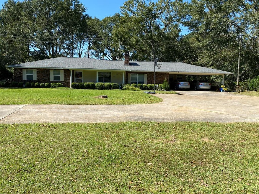
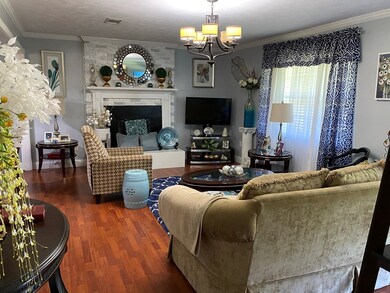
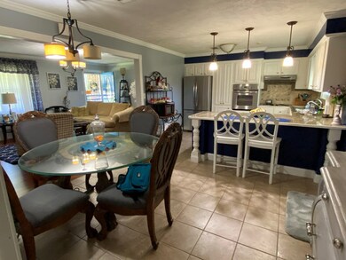
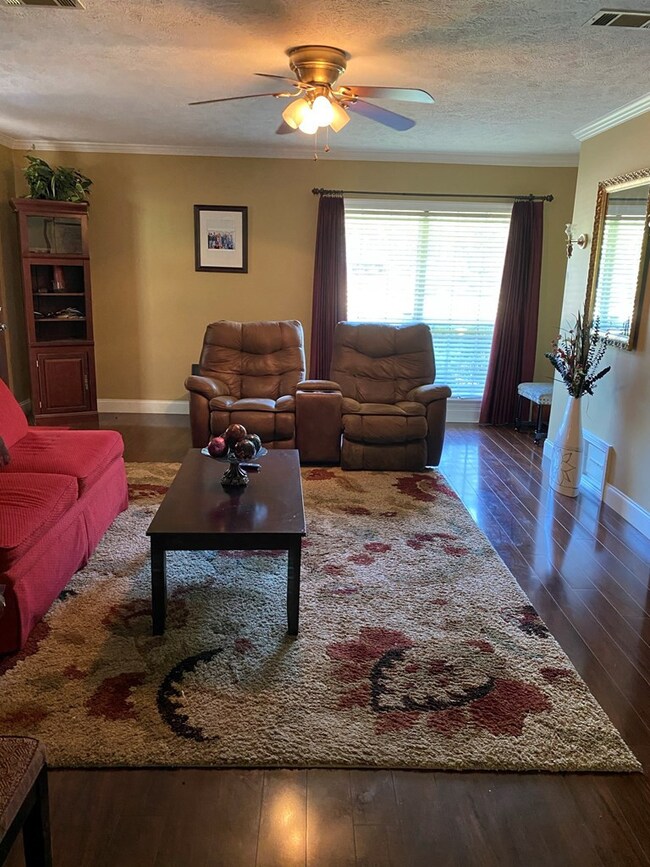
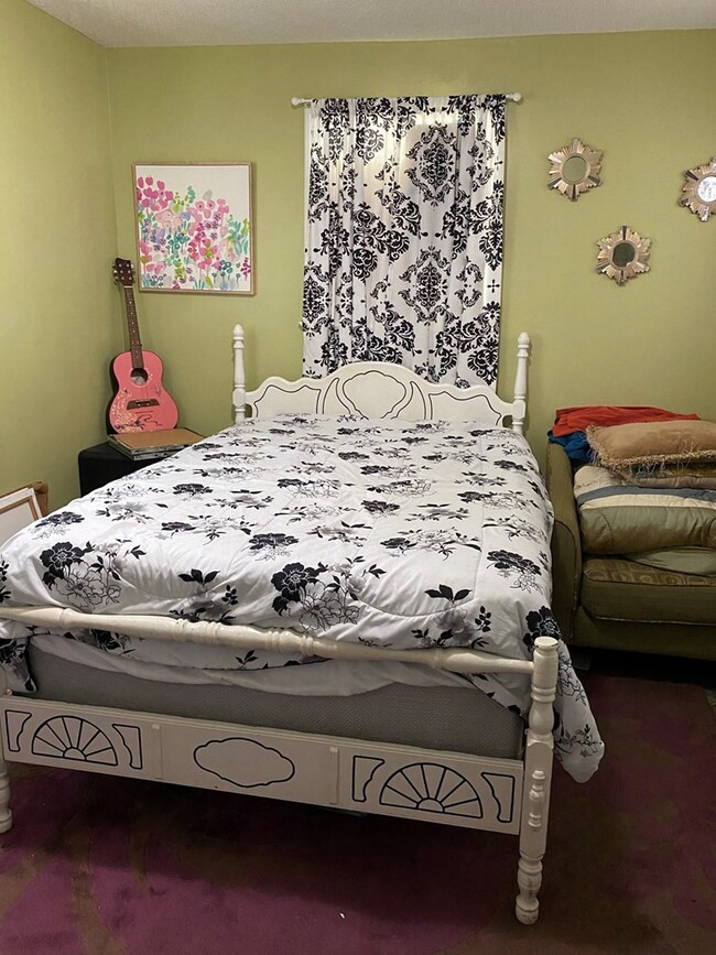
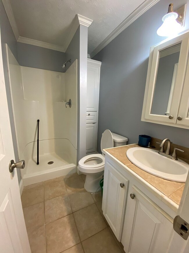
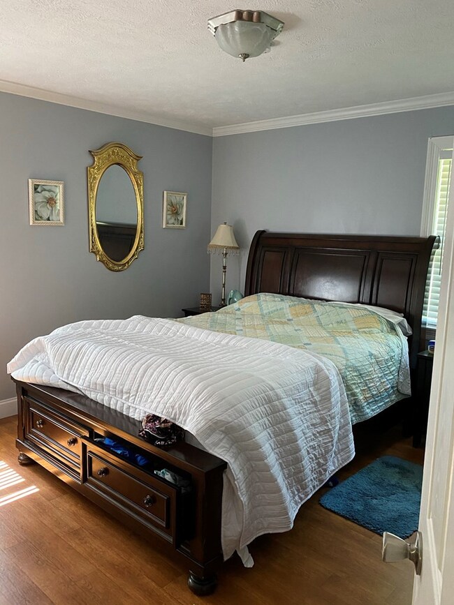
Take a look at this wonderful find in Pike County! Originally a 3 bedroom, 2 bath yet now offers another room that can be utilized as a bedroom/office space. Nestled on 2+ acres and providing over 1700 square feet of living space, this charming home has two living areas, one with a wood fireplace and an open concept to the dining area and the cozy kitchen with an adorable backsplash plus offering a nice size kitchen bar for additional seating. The other living area is just as spacious with beautiful laminate wood flooring and crown moulding provided in both. The appealing landscaping gives such an inviting environment with a backyard providing plenty of room for privacy and entertainment. There's a workshop/shed with power and is placed on a concrete slab. Perfect for additional storage! Literally 3 minutes away from North Pike High and Elementary. You must check out this alluring home for yourself to see all it has to offer you. Schedule your appointment to view today!
Last Agent to Sell the Property
Berkshire Hathaway HomeServices-Cabin & Creek License #S50725 Listed on: 10/30/2020
Last Buyer's Agent
Fallback Agent
FBS Fallback Office
| Date | Buyer | Sale Price | Title Company |
|---|---|---|---|
| Canton Treasure K | -- | None Available | |
| Hughes Inez Martin | -- | None Available |
| Date | Status | Borrower | Loan Amount |
|---|---|---|---|
| Open | Canton Treasure K | $151,515 |
| Date | Event | Price | List to Sale | Price per Sq Ft |
|---|---|---|---|---|
| 02/18/2021 02/18/21 | Sold | -- | -- | -- |
| 11/04/2020 11/04/20 | Pending | -- | -- | -- |
| 10/30/2020 10/30/20 | For Sale | $140,000 | -- | $79 / Sq Ft |
| Year | Tax Paid | Tax Assessment Tax Assessment Total Assessment is a certain percentage of the fair market value that is determined by local assessors to be the total taxable value of land and additions on the property. | Land | Improvement |
|---|---|---|---|---|
| 2025 | $1,956 | $14,448 | $0 | $0 |
| 2024 | $1,676 | $12,199 | $0 | $0 |
| 2023 | $1,640 | $12,199 | $0 | $0 |
| 2022 | $1,617 | $12,199 | $0 | $0 |
| 2021 | $84 | $8,132 | $0 | $0 |
| 2020 | $114 | $8,471 | $0 | $0 |
| 2019 | $112 | $8,361 | $0 | $0 |
| 2018 | $111 | $8,361 | $0 | $0 |
| 2017 | $108 | $8,361 | $0 | $0 |
| 2016 | $74 | $8,170 | $0 | $0 |
| 2015 | $58 | $8,030 | $0 | $0 |
| 2014 | $56 | $8,029 | $0 | $0 |
| 2013 | -- | $8,029 | $0 | $0 |
A
Seller's Agent in 2021
Angela Simmons
Berkshire Hathaway HomeServices-Cabin & Creek
(601) 680-4606
65 Total Sales
F
Buyer's Agent in 2021
Fallback Agent
FBS Fallback Office
Source: MLS United
MLS Number: 133515
APN: 812862-A
Disclaimer: Certain information contained herein is derived from information provided by parties other than Homes.com. All information provided is deemed reliable, but is not guaranteed to be accurate and should be independently verified.
![]() Information is deemed to be reliable but not guaranteed. Copyright 2026 MLS United, LLC.
Information is deemed to be reliable but not guaranteed. Copyright 2026 MLS United, LLC.
Ask me questions while you tour the home.
