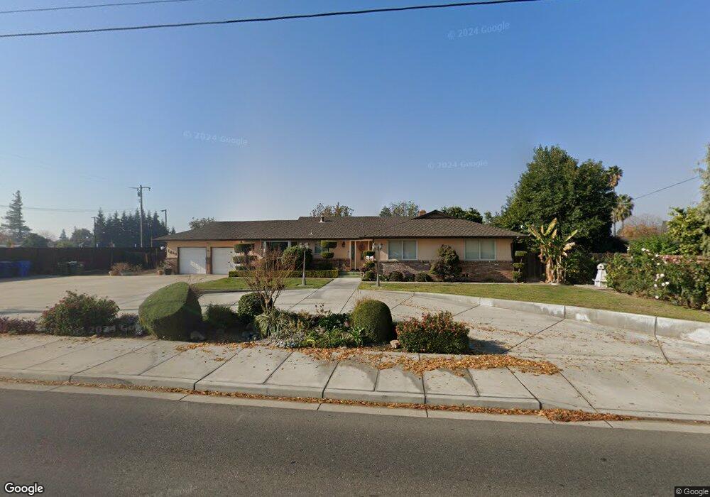
1065 S Union Rd Manteca, CA 95337
Estimated Value: $583,000 - $668,000
4
Beds
3
Baths
2,239
Sq Ft
$280/Sq Ft
Est. Value
About This Home
This home is located at 1065 S Union Rd, Manteca, CA 95337 and is currently estimated at $626,223, approximately $279 per square foot. 1065 S Union Rd is a home located in San Joaquin County with nearby schools including Brock Elliott Elementary School and Sierra High School.
Ownership History
Date
Name
Owned For
Owner Type
Purchase Details
Closed on
Jun 13, 2022
Sold by
Hedegard Family Trust
Bought by
Hedegard Family Trust
Current Estimated Value
Purchase Details
Closed on
Feb 23, 2021
Sold by
Irrigations South San Joaquin
Bought by
Nur Al Huda Academy
Purchase Details
Closed on
Feb 2, 2005
Sold by
Hedegard Sanford N and Hedegard Julie G
Bought by
City Of Manteca
Purchase Details
Closed on
Sep 7, 2000
Sold by
Hedegard Sanford N and G J
Bought by
Hedegard Sanford N and Hedegard Julie G
Purchase Details
Closed on
Jul 25, 2000
Sold by
Maybee Alice
Bought by
Maybee Alice and The Alice Maybee Trust
Purchase Details
Closed on
Apr 17, 2000
Sold by
Moebius Michael
Bought by
Maybee Alice
Purchase Details
Closed on
Mar 25, 2000
Sold by
Hodge Frances
Bought by
Maybee Alice
Purchase Details
Closed on
Mar 24, 2000
Sold by
Cullison June
Bought by
Maybee Alice
Create a Home Valuation Report for This Property
The Home Valuation Report is an in-depth analysis detailing your home's value as well as a comparison with similar homes in the area
Purchase History
| Date | Buyer | Sale Price | Title Company |
|---|---|---|---|
| Hedegard Family Trust | -- | -- | |
| Nur Al Huda Academy | -- | None Available | |
| City Of Manteca | -- | Placer Title Company | |
| Hedegard Sanford N | -- | -- | |
| Maybee Alice | -- | -- | |
| Maybee Alice | -- | -- | |
| Maybee Alice | -- | -- | |
| Maybee Alice | -- | -- | |
| Maybee Alice | -- | -- |
Source: Public Records
Tax History
| Year | Tax Paid | Tax Assessment Tax Assessment Total Assessment is a certain percentage of the fair market value that is determined by local assessors to be the total taxable value of land and additions on the property. | Land | Improvement |
|---|---|---|---|---|
| 2025 | $1,294 | $120,845 | $10,290 | $110,555 |
| 2024 | $1,257 | $118,477 | $10,089 | $108,388 |
| 2023 | $1,241 | $116,155 | $9,892 | $106,263 |
| 2022 | $1,220 | $113,879 | $9,699 | $104,180 |
| 2021 | $1,206 | $111,647 | $9,509 | $102,138 |
| 2020 | $1,157 | $110,503 | $9,412 | $101,091 |
| 2019 | $1,141 | $108,337 | $9,228 | $99,109 |
| 2018 | $1,125 | $106,214 | $9,048 | $97,166 |
| 2017 | $1,107 | $104,132 | $8,871 | $95,261 |
| 2016 | $1,079 | $102,090 | $8,697 | $93,393 |
| 2014 | $1,000 | $98,588 | $8,399 | $90,189 |
Source: Public Records
Map
Nearby Homes
- 1015 Tenaya Ct
- 578 Schooner Place
- 896 Cinnamon Teal Ct
- 1432 Driftwood Way
- 938 Snowgoose Ln
- 865 Locust Ave
- 848 Edythe St
- 776 Folsom Way
- 1142 Mammoth Dr
- 778 Mission Ridge Dr
- 707 Chenin Blanc Dr
- 1176 Junction Dr
- 1821 Avo Way
- 1025 Barbados St
- 1432 Meridian St
- 1444 Meridian St
- 628 Mission Ridge Dr
- 462 Chablis Way
- 119 Almond Ave
- 802 W Center St
- 1024 Sanford Place
- 1085 S Union Rd
- 1023 Sanford Place
- 1058 S Union Rd
- 1016 Sanford Place
- 1015 Sanford Place
- 1191 Mission Ridge Dr
- 1008 Sanford Place
- 1032 Magrath Place
- 1185 Mission Ridge Dr
- 1246 Wawona St
- 1026 Magrath Place
- 1038 Magrath Place
- 1179 Mission Ridge Dr
- 1264 Wawona St
- 1276 Wawona St
- 1192 Mission Ridge Dr
- 1070 Suess Ct
- 1167 Mission Ridge Dr
- 1066 Suess Ct
Your Personal Tour Guide
Ask me questions while you tour the home.