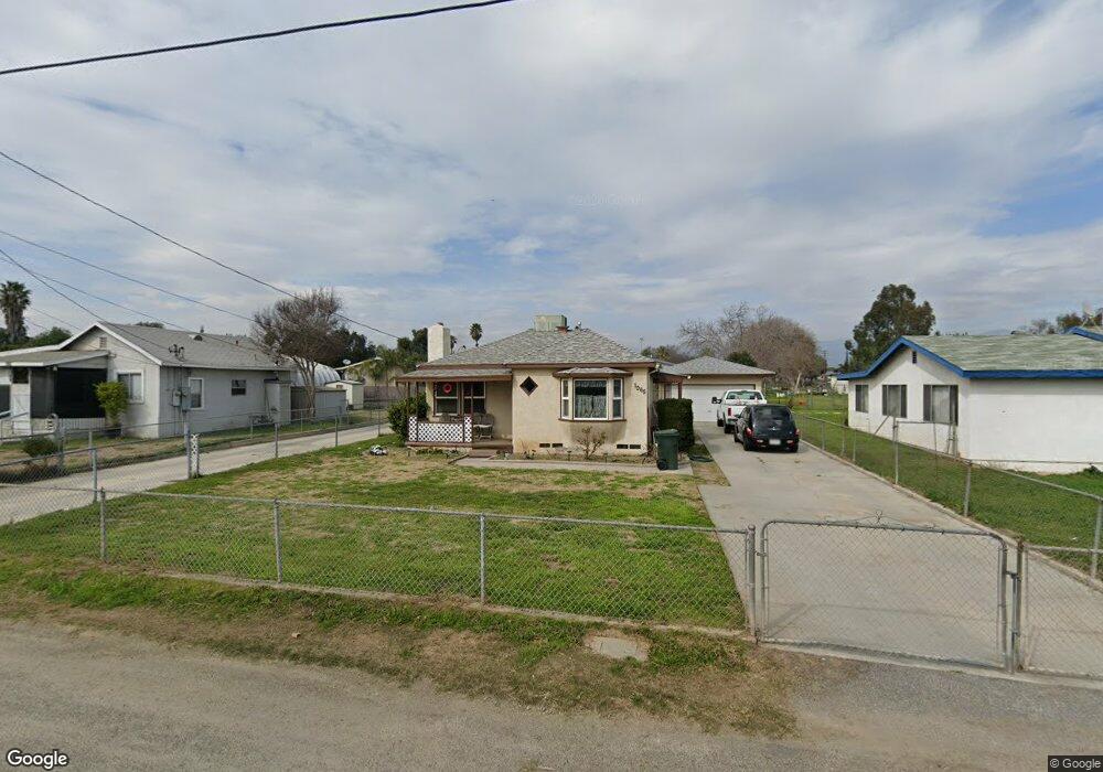
1065 Stevenson St Unit A Colton, CA 92324
Estimated Value: $579,000 - $644,000
2
Beds
1
Bath
829
Sq Ft
$749/Sq Ft
Est. Value
About This Home
This home is located at 1065 Stevenson St Unit A, Colton, CA 92324 and is currently estimated at $620,700, approximately $748 per square foot. 1065 Stevenson St Unit A is a home located in San Bernardino County with nearby schools including Paul Rogers Elementary School, Colton Middle School, and Colton High School.
Ownership History
Date
Name
Owned For
Owner Type
Purchase Details
Closed on
Feb 26, 2005
Sold by
Mccutchen Glenn and Mccutchen Diana
Bought by
Mccutchen Glenn and Mccutchen Diana
Current Estimated Value
Home Financials for this Owner
Home Financials are based on the most recent Mortgage that was taken out on this home.
Original Mortgage
$105,100
Interest Rate
5.66%
Mortgage Type
Stand Alone Refi Refinance Of Original Loan
Create a Home Valuation Report for This Property
The Home Valuation Report is an in-depth analysis detailing your home's value as well as a comparison with similar homes in the area
Home Values in the Area
Average Home Value in this Area
Purchase History
| Date | Buyer | Sale Price | Title Company |
|---|---|---|---|
| Mccutchen Glenn | -- | Orange Coast Title | |
| Mccutchen Glenn | -- | Orange Coast Title |
Source: Public Records
Mortgage History
| Date | Status | Borrower | Loan Amount |
|---|---|---|---|
| Closed | Mccutchen Glenn | $105,100 |
Source: Public Records
Tax History
| Year | Tax Paid | Tax Assessment Tax Assessment Total Assessment is a certain percentage of the fair market value that is determined by local assessors to be the total taxable value of land and additions on the property. | Land | Improvement |
|---|---|---|---|---|
| 2025 | $560 | $108,912 | $15,202 | $93,710 |
| 2024 | $538 | $28,607 | $14,905 | $13,702 |
| 2023 | $534 | $28,046 | $14,613 | $13,433 |
| 2022 | $357 | $27,496 | $14,326 | $13,170 |
| 2021 | $364 | $26,957 | $14,045 | $12,912 |
| 2020 | $366 | $26,681 | $13,901 | $12,780 |
| 2019 | $356 | $26,157 | $13,628 | $12,529 |
| 2018 | $351 | $25,644 | $13,361 | $12,283 |
| 2017 | $339 | $25,141 | $13,099 | $12,042 |
| 2016 | $347 | $24,648 | $12,842 | $11,806 |
| 2015 | $336 | $24,278 | $12,649 | $11,629 |
| 2014 | $315 | $23,802 | $12,401 | $11,401 |
Source: Public Records
Map
Nearby Homes
- 1065 Stevenson St Unit A & B
- 895 Orange St
- 1210 Tejon Ave
- 1261 N Rancho Ave
- 1075 Leslie Ct
- 711 N Meridian Ave
- 941 W F St
- 732 S Lassen Ave
- 773 W C St
- 648 San Carlo Ave
- 805 Valencia Dr
- 1734 Kippy Dr
- 1150 Express Cir
- 1844 Alston Ave
- 2250 W Mill St Unit 19
- 2250 W Mill St Unit 68
- 2250 W Mill #70 St
- 881 S Lamarr St
- 464 W E St
- 494 S Macy St Unit 8
- 1067 Stevenson St Unit A & B
- 1067 Stevenson St Unit A
- 1061 Stevenson St Unit A
- 1057 Stevenson St
- 1071 Stevenson St
- 970 W Laurel St
- 1053 Stevenson St
- 1091 Stevenson St
- 1073 Stevenson St
- 1058 Stevenson St
- 1045 Stevenson St
- 1068 Stevenson St
- 1070 Stevenson St
- 1041 Stevenson St
- 1175 Cypress Ave
- 1095 Stevenson St
- 1037 Stevenson St
- 1072 Stevenson St
- 1180 Cypress Ave
- 1117 Cypress Ave
Your Personal Tour Guide
Ask me questions while you tour the home.