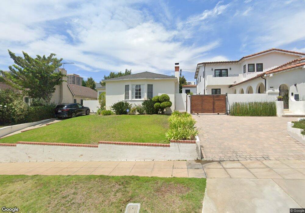
10667 Ohio Ave Los Angeles, CA 90024
Westwood NeighborhoodEstimated Value: $2,241,831 - $2,621,000
3
Beds
2
Baths
1,884
Sq Ft
$1,257/Sq Ft
Est. Value
About This Home
This home is located at 10667 Ohio Ave, Los Angeles, CA 90024 and is currently estimated at $2,367,708, approximately $1,256 per square foot. 10667 Ohio Ave is a home located in Los Angeles County with nearby schools including Fairburn Avenue Elementary, Westwood Charter School, and Ralph Waldo Emerson Community Charter Middle School.
Ownership History
Date
Name
Owned For
Owner Type
Purchase Details
Closed on
Jun 17, 1996
Sold by
Averill Susan Linda Robinson
Bought by
Campbell Scott H and Campbell Melissa J
Current Estimated Value
Home Financials for this Owner
Home Financials are based on the most recent Mortgage that was taken out on this home.
Original Mortgage
$335,200
Interest Rate
7.75%
Purchase Details
Closed on
Aug 18, 1995
Sold by
Averill Rick Jon
Bought by
Averill Susan Linda Robinson
Home Financials for this Owner
Home Financials are based on the most recent Mortgage that was taken out on this home.
Original Mortgage
$200,000
Interest Rate
7.63%
Create a Home Valuation Report for This Property
The Home Valuation Report is an in-depth analysis detailing your home's value as well as a comparison with similar homes in the area
Home Values in the Area
Average Home Value in this Area
Purchase History
| Date | Buyer | Sale Price | Title Company |
|---|---|---|---|
| Campbell Scott H | $419,000 | Southland Title Company | |
| Averill Susan Linda Robinson | -- | Chicago Title Insurance Co |
Source: Public Records
Mortgage History
| Date | Status | Borrower | Loan Amount |
|---|---|---|---|
| Previous Owner | Campbell Scott H | $335,200 | |
| Previous Owner | Averill Susan Linda Robinson | $200,000 |
Source: Public Records
Tax History Compared to Growth
Tax History
| Year | Tax Paid | Tax Assessment Tax Assessment Total Assessment is a certain percentage of the fair market value that is determined by local assessors to be the total taxable value of land and additions on the property. | Land | Improvement |
|---|---|---|---|---|
| 2025 | $8,317 | $682,397 | $489,086 | $193,311 |
| 2024 | $8,317 | $669,018 | $479,497 | $189,521 |
| 2023 | $8,161 | $655,901 | $470,096 | $185,805 |
| 2022 | $7,790 | $643,041 | $460,879 | $182,162 |
| 2021 | $7,686 | $630,434 | $451,843 | $178,591 |
| 2019 | $7,459 | $611,737 | $438,442 | $173,295 |
| 2018 | $7,361 | $599,744 | $429,846 | $169,898 |
| 2016 | $7,031 | $576,456 | $413,155 | $163,301 |
| 2015 | $6,929 | $567,799 | $406,950 | $160,849 |
| 2014 | $6,956 | $556,678 | $398,979 | $157,699 |
Source: Public Records
Map
Nearby Homes
- 10671 Wilkins Ave Unit 5
- 10687 Wilkins Ave Unit 1
- 10721 Ohio Ave
- 10725 Ohio Ave Unit PH2
- 10725 Ohio Ave Unit 301
- 1551 Manning Ave Unit 101
- 10633 Kinnard Ave Unit 1
- 10735 Rochester Ave
- 10600 Wilkins Ave Unit 3D
- 10745 Ohio Ave
- 1601 Hilts Ave Unit 3
- 1567 Westholme Ave Unit 4A
- 10627 Ashton Ave Unit 103
- 10611 Ashton Ave Unit 1
- 10660 Wilshire Blvd Unit 609
- 1621 Manning Ave
- 1230 Westholme Ave Unit 104
- 10724 Wilshire Blvd Unit 1001
- 10724 Wilshire Blvd Unit 1209
- 10724 Wilshire Blvd Unit 1501
- 10661 Ohio Ave
- 10671 Ohio Ave
- 10657 Ohio Ave
- 10677 Ohio Ave
- 10670 Rochester Ave
- 10664 Rochester Ave
- 10674 Rochester Ave
- 10651 Ohio Ave
- 10660 Rochester Ave
- 10678 Rochester Ave
- 10666 Ohio Ave
- 10654 Rochester Ave
- 10662 Ohio Ave
- 10672 Ohio Ave
- 10647 Ohio Ave
- 10658 Ohio Ave
- 10701 Ohio Ave
- 1501 Manning Ave
- 1500 Manning Ave
- 1503 Manning Ave