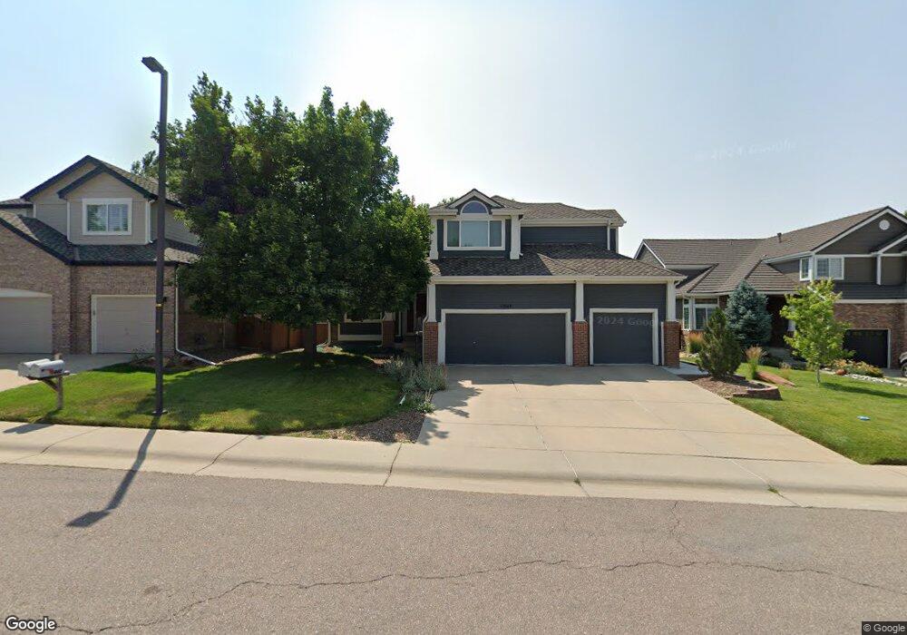
10669 Singleleaf Ct Parker, CO 80134
Stonegate NeighborhoodEstimated Value: $762,387 - $807,000
5
Beds
4
Baths
3,804
Sq Ft
$205/Sq Ft
Est. Value
About This Home
This home is located at 10669 Singleleaf Ct, Parker, CO 80134 and is currently estimated at $780,347, approximately $205 per square foot. 10669 Singleleaf Ct is a home located in Douglas County with nearby schools including Pine Grove Elementary School, Sierra Middle School, and Chaparral High School.
Ownership History
Date
Name
Owned For
Owner Type
Purchase Details
Closed on
Jan 9, 2024
Sold by
Landers Michael E
Bought by
Michael E Landers Revocable Trust
Current Estimated Value
Purchase Details
Closed on
Mar 15, 2019
Sold by
Stark Amy Kathryn
Bought by
Landers Michael E
Home Financials for this Owner
Home Financials are based on the most recent Mortgage that was taken out on this home.
Original Mortgage
$380,625
Interest Rate
4.4%
Mortgage Type
New Conventional
Purchase Details
Closed on
Sep 14, 2018
Sold by
Stark Richard and Stark Amy
Bought by
The Richard C Stark Living Trust
Purchase Details
Closed on
Aug 21, 2013
Sold by
Stark Richard Christopjer
Bought by
Stark Richard and Stark Amy
Purchase Details
Closed on
Mar 29, 2007
Sold by
Laue Steven R and Laue Lorilee L
Bought by
Stark Richard Christopher
Home Financials for this Owner
Home Financials are based on the most recent Mortgage that was taken out on this home.
Original Mortgage
$302,400
Interest Rate
6.24%
Mortgage Type
Unknown
Purchase Details
Closed on
Mar 28, 2001
Sold by
Larry G Mccormick Revocable Trust
Bought by
Laue Steven R and Laue Lorilee L
Home Financials for this Owner
Home Financials are based on the most recent Mortgage that was taken out on this home.
Original Mortgage
$239,900
Interest Rate
7.13%
Purchase Details
Closed on
Oct 26, 1999
Sold by
Mccormick Larry G and Mccormick Carolyn D
Bought by
Larry G Mccormick Revocable Trust
Purchase Details
Closed on
Jul 31, 1997
Sold by
Turner David H
Bought by
Mccormick Larry G and Mccormick Carolyn D
Home Financials for this Owner
Home Financials are based on the most recent Mortgage that was taken out on this home.
Original Mortgage
$120,000
Interest Rate
7.6%
Purchase Details
Closed on
Jun 20, 1997
Sold by
Turner David H
Bought by
Caro Mccormick Larry G Et Al Mc Cor
Home Financials for this Owner
Home Financials are based on the most recent Mortgage that was taken out on this home.
Original Mortgage
$120,000
Interest Rate
7.6%
Purchase Details
Closed on
Oct 27, 1995
Sold by
Falcon Partnership Ltd
Bought by
Turner David H
Purchase Details
Closed on
Jun 30, 1994
Sold by
Stonegate Dev Inc
Bought by
Falcon Partnership Ltd
Create a Home Valuation Report for This Property
The Home Valuation Report is an in-depth analysis detailing your home's value as well as a comparison with similar homes in the area
Home Values in the Area
Average Home Value in this Area
Purchase History
| Date | Buyer | Sale Price | Title Company |
|---|---|---|---|
| Michael E Landers Revocable Trust | -- | None Listed On Document | |
| Landers Michael E | $507,500 | Land Title Guarantee Co | |
| The Richard C Stark Living Trust | -- | None Available | |
| Stark Richard | -- | None Available | |
| Stark Richard Christopher | $378,000 | Chicago Title Co | |
| Laue Steven R | $339,900 | Stewart Title | |
| Larry G Mccormick Revocable Trust | -- | -- | |
| Mccormick Larry G | $220,000 | -- | |
| Caro Mccormick Larry G Et Al Mc Cor | $220,000 | -- | |
| Turner David H | $200,000 | Land Title | |
| Falcon Partnership Ltd | $343,800 | -- |
Source: Public Records
Mortgage History
| Date | Status | Borrower | Loan Amount |
|---|---|---|---|
| Previous Owner | Landers Michael E | $380,625 | |
| Previous Owner | Stark Richard Christopher | $302,400 | |
| Previous Owner | Laue Steven R | $239,900 | |
| Previous Owner | Mccormick Larry G | $120,000 |
Source: Public Records
Tax History
| Year | Tax Paid | Tax Assessment Tax Assessment Total Assessment is a certain percentage of the fair market value that is determined by local assessors to be the total taxable value of land and additions on the property. | Land | Improvement |
|---|---|---|---|---|
| 2025 | $5,735 | $47,240 | $10,400 | $36,840 |
| 2024 | $5,735 | $57,240 | $9,540 | $47,700 |
| 2023 | $5,785 | $57,240 | $9,540 | $47,700 |
| 2022 | $4,258 | $38,570 | $6,430 | $32,140 |
| 2021 | $4,380 | $38,570 | $6,430 | $32,140 |
| 2020 | $4,292 | $38,760 | $7,040 | $31,720 |
| 2019 | $4,188 | $38,760 | $7,040 | $31,720 |
| 2018 | $3,847 | $35,130 | $6,350 | $28,780 |
| 2017 | $3,629 | $35,130 | $6,350 | $28,780 |
| 2016 | $3,630 | $34,590 | $5,570 | $29,020 |
| 2015 | $3,700 | $34,590 | $5,570 | $29,020 |
| 2014 | $3,586 | $30,230 | $5,410 | $24,820 |
Source: Public Records
Map
Nearby Homes
- 16042 Crestrock Cir
- 10553 Stonemeadow Dr
- 16230 Martingale Dr
- 16116 Martingale Dr
- 10857 Tundra Top Dr
- 10866 Tundra Top Dr
- 10626 Oakmoor Ct
- 10874 Tundra Top Dr
- 10873 Tundra Top Dr
- 10890 Tundra Top Dr
- 10794 Tomboy Dr
- 10912 Snowdon St
- 15733 Mccauley Dr
- 10619 Winterflower Way
- 15362 Foxglove Ct
- 10730 Tomboy Dr
- 10734 Tomboy Dr
- 10776 Tomboy Dr
- 10965 Hayloft St
- 16145 Peregrine Dr
- 10679 Singleleaf Ct
- 10659 Singleleaf Ct
- 10658 Stone Creek Ct
- 10689 Singleleaf Ct
- 10668 Stone Creek Ct
- 10648 Stone Creek Ct
- 10649 Singleleaf Ct
- 10670 Singleleaf Ct
- 10638 Stone Creek Ct
- 16031 Crestrock Cir
- 10660 Singleleaf Ct
- 10618 Stone Creek Ct
- 16051 Crestrock Cir
- 16012 Crestrock Cir
- 16002 Crestrock Cir
- 10657 Stone Creek Ct
- 10667 Stone Creek Ct
- 16022 Crestrock Cir
- 16061 Crestrock Cir
- 15992 Crestrock Cir
Your Personal Tour Guide
Ask me questions while you tour the home.