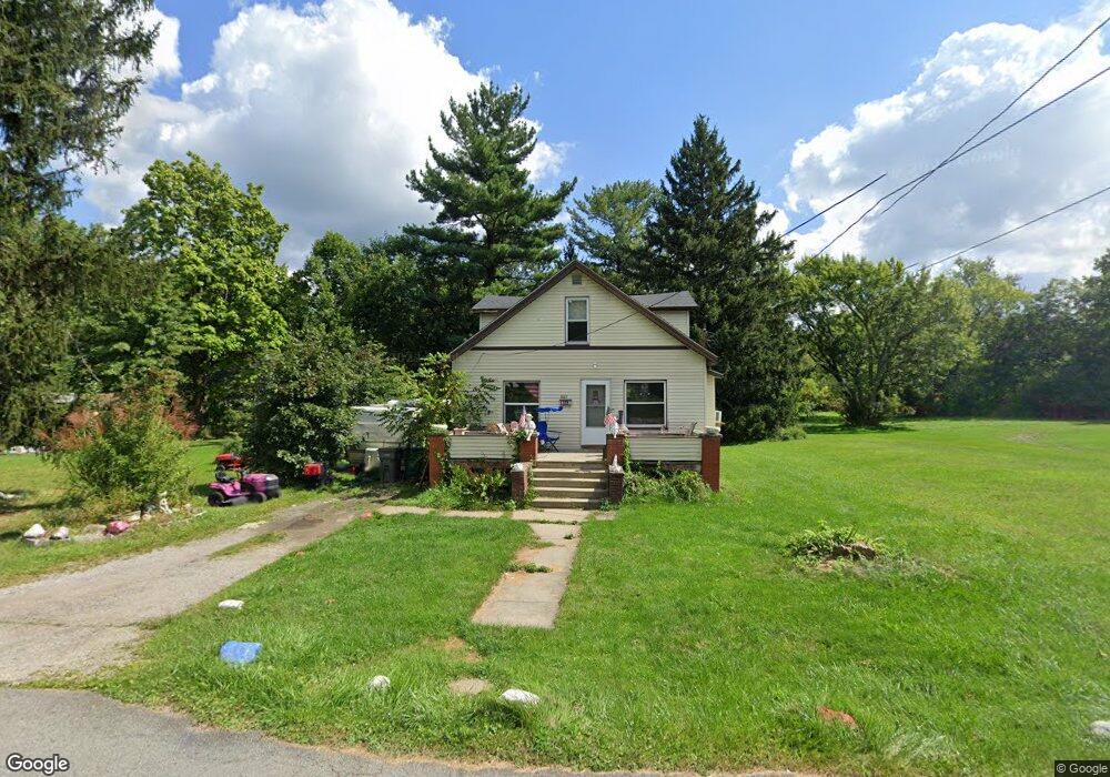
1067 N Gray Ave Youngstown, OH 44505
Landsdowne NeighborhoodEstimated Value: $70,437 - $91,000
4
Beds
1
Bath
1,756
Sq Ft
$45/Sq Ft
Est. Value
About This Home
This home is located at 1067 N Gray Ave, Youngstown, OH 44505 and is currently estimated at $79,109, approximately $45 per square foot. 1067 N Gray Ave is a home located in Mahoning County with nearby schools including M.L. King Elementary School, East High School, and Youngstown Preparatory Academy.
Ownership History
Date
Name
Owned For
Owner Type
Purchase Details
Closed on
Jan 9, 2018
Sold by
Mahoning County Land Reutilization Corpo and Yemma Daniel R
Bought by
Youngstown Neighborhood Development Corp
Current Estimated Value
Home Financials for this Owner
Home Financials are based on the most recent Mortgage that was taken out on this home.
Original Mortgage
$24,619
Outstanding Balance
$20,754
Interest Rate
3.9%
Mortgage Type
Future Advance Clause Open End Mortgage
Estimated Equity
$58,355
Purchase Details
Closed on
Nov 26, 2012
Sold by
Mcconnell Charles
Bought by
Bentley Tammy
Purchase Details
Closed on
Jan 1, 1990
Bought by
Mcconnell Thomas
Create a Home Valuation Report for This Property
The Home Valuation Report is an in-depth analysis detailing your home's value as well as a comparison with similar homes in the area
Home Values in the Area
Average Home Value in this Area
Purchase History
| Date | Buyer | Sale Price | Title Company |
|---|---|---|---|
| Youngstown Neighborhood Development Corp | -- | None Available | |
| Bentley Tammy | $83,500 | Attorney | |
| Mcconnell Thomas | -- | -- |
Source: Public Records
Mortgage History
| Date | Status | Borrower | Loan Amount |
|---|---|---|---|
| Open | Youngstown Neighborhood Development Corp | $24,619 |
Source: Public Records
Tax History Compared to Growth
Tax History
| Year | Tax Paid | Tax Assessment Tax Assessment Total Assessment is a certain percentage of the fair market value that is determined by local assessors to be the total taxable value of land and additions on the property. | Land | Improvement |
|---|---|---|---|---|
| 2024 | $369 | $7,510 | $560 | $6,950 |
| 2023 | $367 | $7,510 | $560 | $6,950 |
| 2022 | $178 | $2,650 | $480 | $2,170 |
| 2021 | $170 | $2,650 | $480 | $2,170 |
| 2020 | $171 | $2,650 | $480 | $2,170 |
| 2019 | $179 | $2,460 | $450 | $2,010 |
| 2018 | $209 | $2,460 | $450 | $2,010 |
| 2017 | $178 | $2,460 | $450 | $2,010 |
| 2016 | $205 | $3,060 | $450 | $2,610 |
| 2015 | $211 | $3,060 | $450 | $2,610 |
| 2014 | $200 | $3,060 | $450 | $2,610 |
| 2013 | $197 | $3,060 | $450 | $2,610 |
Source: Public Records
Map
Nearby Homes
- 1325 Miami Ave
- 902 Miami St
- 1538 Republic Ave
- 566 Sunshine Ave
- 405 Drake Ave
- 1214 Brighton St
- 1720 Jacobs Rd
- 598 Cassius Ave
- 3209 Castalia Ave
- 2160 Lansdowne Blvd
- 0 Homestead Rd
- V/L Jacobs Rd
- 3244 Nelson Ave
- 0 Mccartney Rd Unit 5030673
- 2951 Megan Cir
- 2831 Benford Ln
- 217 S Jackson St
- 2954 Megan Cir
- 2824 Benford Ln
- 250 Harold Ln
- 1093 N Gray Ave
- 1070 N Gray Ave
- 1076 Devon Ave
- 1089 N Gray Ave
- 1045 N Gray Ave
- 1080 Devon Ave
- 1060 N Gray Ave
- 1084 Devon Ave
- 1054 N Gray Ave
- 1046 N Gray Ave
- 1306 N Gray Ave
- 2259 Kimmel St
- 1035 N Gray Ave
- 2255 Kimmel St
- 1042 N Gray Ave
- 1313 N Gray Ave
- 1032 N Gray Ave
- 1314 N Gray Ave
- 2258 Kimmel St
- 1027 N Gray Ave