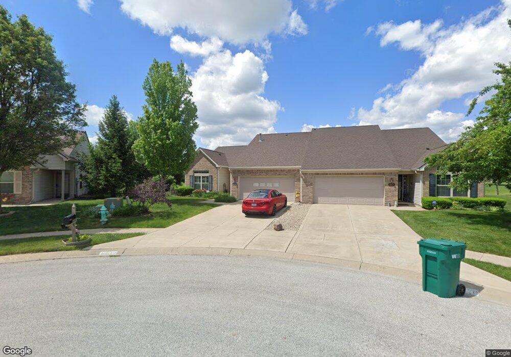
10670 Swan Ct Indianapolis, IN 46231
Estimated Value: $260,000 - $271,000
3
Beds
2
Baths
1,789
Sq Ft
$148/Sq Ft
Est. Value
About This Home
This home is located at 10670 Swan Ct, Indianapolis, IN 46231 and is currently estimated at $264,479, approximately $147 per square foot. 10670 Swan Ct is a home located in Hendricks County with nearby schools including White Oak Elementary School, Avon Intermediate School West, and Hickory Elementary School.
Ownership History
Date
Name
Owned For
Owner Type
Purchase Details
Closed on
Mar 3, 2014
Sold by
Woolard Shirley L
Bought by
Woolard Michael A and Woolard Christopher D
Current Estimated Value
Purchase Details
Closed on
Apr 27, 2007
Sold by
Wooland Lester G
Bought by
Wooland Shirley L
Home Financials for this Owner
Home Financials are based on the most recent Mortgage that was taken out on this home.
Original Mortgage
$86,625
Outstanding Balance
$52,806
Interest Rate
6.21%
Mortgage Type
New Conventional
Estimated Equity
$211,673
Purchase Details
Closed on
Sep 14, 2006
Sold by
Precendent Residential Development Llc
Bought by
Adams And Marshall Homes Inc
Create a Home Valuation Report for This Property
The Home Valuation Report is an in-depth analysis detailing your home's value as well as a comparison with similar homes in the area
Home Values in the Area
Average Home Value in this Area
Purchase History
| Date | Buyer | Sale Price | Title Company |
|---|---|---|---|
| Woolard Michael A | -- | -- | |
| Wooland Shirley L | -- | None Available | |
| Woolard Lester G | -- | None Available | |
| Adams And Marshall Homes Inc | -- | None Available |
Source: Public Records
Mortgage History
| Date | Status | Borrower | Loan Amount |
|---|---|---|---|
| Open | Woolard Lester G | $86,625 |
Source: Public Records
Tax History Compared to Growth
Tax History
| Year | Tax Paid | Tax Assessment Tax Assessment Total Assessment is a certain percentage of the fair market value that is determined by local assessors to be the total taxable value of land and additions on the property. | Land | Improvement |
|---|---|---|---|---|
| 2024 | $2,359 | $211,400 | $40,700 | $170,700 |
| 2023 | $2,110 | $190,500 | $36,300 | $154,200 |
| 2022 | $1,985 | $178,400 | $33,600 | $144,800 |
| 2021 | $1,798 | $161,600 | $33,600 | $128,000 |
| 2020 | $1,753 | $156,500 | $33,600 | $122,900 |
| 2019 | $1,690 | $149,500 | $31,700 | $117,800 |
| 2018 | $1,665 | $145,300 | $31,700 | $113,600 |
| 2017 | $1,350 | $135,000 | $30,200 | $104,800 |
| 2016 | $1,318 | $131,800 | $30,200 | $101,600 |
| 2014 | $1,199 | $119,900 | $27,400 | $92,500 |
| 2013 | $1,209 | $120,900 | $27,400 | $93,500 |
Source: Public Records
Map
Nearby Homes
- 1449 Danielle Dr
- 10795 Albertson Dr
- 1422 Fortner Dr
- 1585 Danielle Dr
- 1076 Halifax Ln
- 10816 Zimmerman Ln
- 10882 Zimmerman Ln
- 10712 Huntwick Dr
- 9144 Timpani Way
- 10644 Wiley Ln
- 1256 Tenor Place
- 9038 Cardinal Flower Ct
- 1640 Walpole Way
- 10761 Parker Dr
- 8945 Poppy Ln
- 2032 Blue Pine Ln
- 2114 Southernwood Ln
- 1940 Orchid Bloom Dr
- 9105 Southernwood Way
- 606 Bakeway Cir