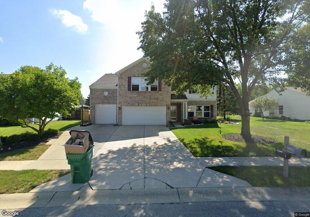
10683 Howe Rd Fishers, IN 46038
Estimated Value: $411,000 - $477,580
--
Bed
3
Baths
4,014
Sq Ft
$111/Sq Ft
Est. Value
About This Home
This home is located at 10683 Howe Rd, Fishers, IN 46038 and is currently estimated at $445,645, approximately $111 per square foot. 10683 Howe Rd is a home located in Hamilton County with nearby schools including Sand Creek Elementary School, Fishers Junior High School, and Sand Creek Intermediate School.
Ownership History
Date
Name
Owned For
Owner Type
Purchase Details
Closed on
Mar 11, 2002
Sold by
C P Morgan Communities Lp
Bought by
Buonaiuto Louis O and Buonaiuto Cherisse M
Current Estimated Value
Home Financials for this Owner
Home Financials are based on the most recent Mortgage that was taken out on this home.
Original Mortgage
$136,600
Interest Rate
7.11%
Mortgage Type
Balloon
Purchase Details
Closed on
Nov 16, 2001
Sold by
Pleasantview Development Company Llc
Bought by
C P Morgan Communities L P
Create a Home Valuation Report for This Property
The Home Valuation Report is an in-depth analysis detailing your home's value as well as a comparison with similar homes in the area
Home Values in the Area
Average Home Value in this Area
Purchase History
| Date | Buyer | Sale Price | Title Company |
|---|---|---|---|
| Buonaiuto Louis O | -- | -- | |
| C P Morgan Communities L P | -- | -- |
Source: Public Records
Mortgage History
| Date | Status | Borrower | Loan Amount |
|---|---|---|---|
| Closed | Buonaiuto Louis O | $136,600 | |
| Closed | Buonaiuto Louis O | $15,000 |
Source: Public Records
Tax History Compared to Growth
Tax History
| Year | Tax Paid | Tax Assessment Tax Assessment Total Assessment is a certain percentage of the fair market value that is determined by local assessors to be the total taxable value of land and additions on the property. | Land | Improvement |
|---|---|---|---|---|
| 2024 | $4,212 | $378,900 | $46,700 | $332,200 |
| 2023 | $4,212 | $371,200 | $46,700 | $324,500 |
| 2022 | $3,925 | $332,000 | $46,700 | $285,300 |
| 2021 | $3,452 | $290,600 | $46,700 | $243,900 |
| 2020 | $3,022 | $254,800 | $46,700 | $208,100 |
| 2019 | $2,880 | $243,300 | $43,200 | $200,100 |
| 2018 | $2,764 | $233,500 | $43,200 | $190,300 |
| 2017 | $2,528 | $219,700 | $43,200 | $176,500 |
| 2016 | $2,394 | $211,600 | $43,200 | $168,400 |
| 2014 | $2,070 | $198,200 | $46,400 | $151,800 |
| 2013 | $2,070 | $190,300 | $46,400 | $143,900 |
Source: Public Records
Map
Nearby Homes
- 12638 Granite Ridge Cir
- 12783 Granite Ridge Cir
- 12662 Granite Ridge Cir
- 12807 Granite Ridge Cir
- 12650 Granite Ridge Cir
- 12687 Granite Ridge Cir
- 10671 Pleasant View Ln
- 10873 Glazer Way
- 12966 Pleasant View Ln
- 13048 Ross Crossing
- 10713 Summerwood Ln
- 13125 Zinfandel Place
- 10513 Blue Springs Ln
- 10798 Sweet Creek Trail
- 13068 Lamarque Place
- 10066 Perlita Place
- 13281 Middlewood Ln
- 12220 Sweet Creek Trail
- 12438 Berry Patch Ln
- 10150 Beresford Ct
- 10693 Howe Rd
- 10673 Howe Rd
- 12702 Arvada Place
- 12718 Arvada Place
- 12686 Arvada Place
- 10703 Howe Rd
- 10663 Howe Rd
- 12734 Arvada Place
- 10662 Howe Rd
- 10692 Howe Rd
- 10653 Howe Rd
- 10805 Arvada Place
- 12750 Arvada Place
- 10702 Howe Rd
- 10713 Howe Rd
- 10643 Howe Rd
- 10712 Howe Rd
- 10821 Dillon Place
- 10814 Arvada Place
- 12766 Arvada Place