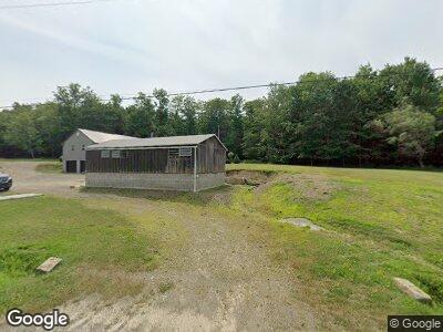
10684 Route 59 Cyclone, PA 16726
Estimated Value: $59,000 - $194,000
--
Bed
--
Bath
1,248
Sq Ft
$120/Sq Ft
Est. Value
About This Home
This home is located at 10684 Route 59, Cyclone, PA 16726 and is currently estimated at $149,739, approximately $119 per square foot. 10684 Route 59 is a home located in McKean County with nearby schools including Smethport Area Elementary School and Smethport Area Junior/Senior High School.
Ownership History
Date
Name
Owned For
Owner Type
Purchase Details
Closed on
Aug 17, 2022
Sold by
Irons Gordon B and Irons Sherry L
Bought by
Neilly Rolland and Neilly Haley
Current Estimated Value
Home Financials for this Owner
Home Financials are based on the most recent Mortgage that was taken out on this home.
Original Mortgage
$154,257
Outstanding Balance
$148,462
Interest Rate
5.51%
Mortgage Type
FHA
Estimated Equity
$1,277
Create a Home Valuation Report for This Property
The Home Valuation Report is an in-depth analysis detailing your home's value as well as a comparison with similar homes in the area
Home Values in the Area
Average Home Value in this Area
Purchase History
| Date | Buyer | Sale Price | Title Company |
|---|---|---|---|
| Neilly Rolland | $162,500 | Amrock |
Source: Public Records
Mortgage History
| Date | Status | Borrower | Loan Amount |
|---|---|---|---|
| Open | Neilly Rolland | $154,257 | |
| Previous Owner | Irons Gordon B | $51,000 |
Source: Public Records
Tax History Compared to Growth
Tax History
| Year | Tax Paid | Tax Assessment Tax Assessment Total Assessment is a certain percentage of the fair market value that is determined by local assessors to be the total taxable value of land and additions on the property. | Land | Improvement |
|---|---|---|---|---|
| 2025 | $2,094 | $58,680 | $11,290 | $47,390 |
| 2024 | $1,979 | $57,460 | $11,290 | $46,170 |
| 2023 | $1,979 | $57,460 | $11,290 | $46,170 |
| 2022 | $1,979 | $57,460 | $11,290 | $46,170 |
| 2021 | $1,955 | $57,460 | $11,290 | $46,170 |
| 2020 | $1,955 | $57,460 | $11,290 | $46,170 |
| 2019 | $1,955 | $57,460 | $11,290 | $46,170 |
| 2018 | $18 | $57,460 | $11,290 | $46,170 |
| 2017 | -- | $57,460 | $11,290 | $46,170 |
| 2016 | $1,683 | $57,460 | $11,290 | $46,170 |
| 2015 | $646 | $57,460 | $11,290 | $46,170 |
| 2014 | $646 | $57,460 | $11,290 | $46,170 |
Source: Public Records
Map
Nearby Homes
- 186 Sprester Rd
- 0 Rte 59 Smethport Ormsby Rd Unit 24-264
- 0 Lindholm Rd
- TBD2 Elk Lik Rd
- TBD Elk Lik Rd
- 25 Spring St
- 23 Willoughby Rd
- 22 Elm Rd
- 1408 W Main St
- 1400 W Main St
- 246 S Marvin St
- 1010 W Main St
- 916 W Main St
- 6 Bordell Rd
- 305 State St
- 408 W Water St
- 19 W Willow St
- 402 E Main St
- 308 Emerald Isle
- 41 Bank St