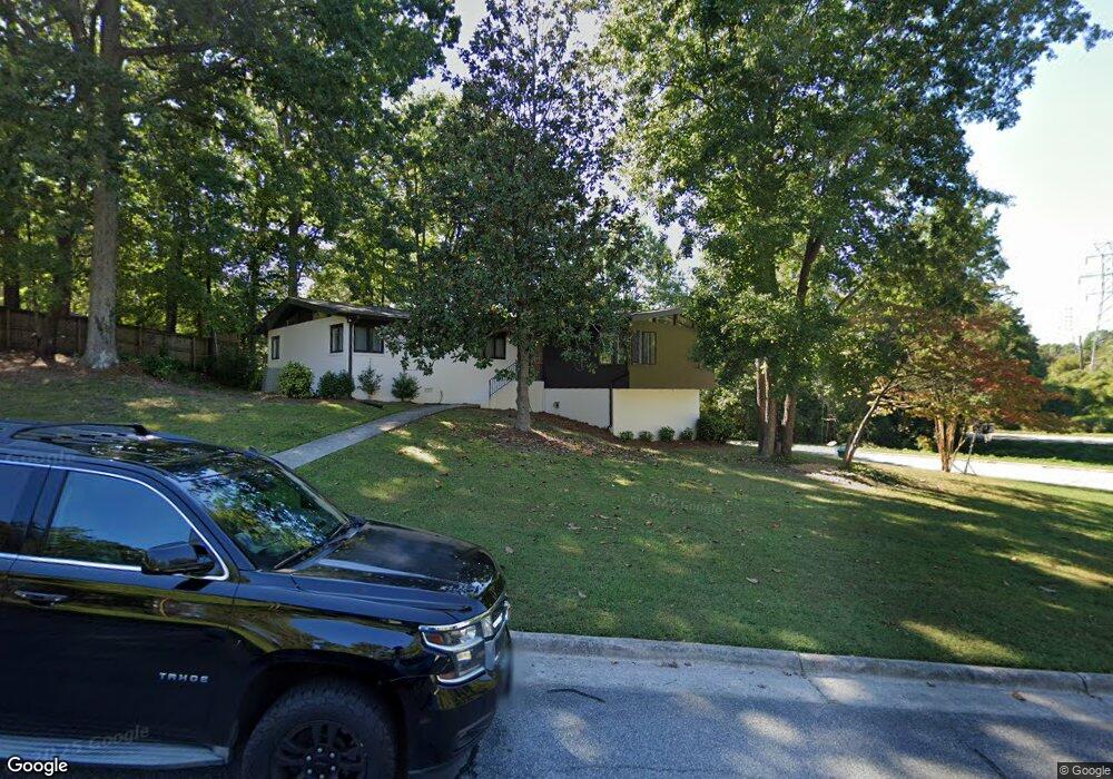
1069 Cantering Rd High Point, NC 27262
Greater High Point NeighborhoodEstimated Value: $347,689 - $404,000
4
Beds
3
Baths
2,855
Sq Ft
$135/Sq Ft
Est. Value
About This Home
This home is located at 1069 Cantering Rd, High Point, NC 27262 and is currently estimated at $385,172, approximately $134 per square foot. 1069 Cantering Rd is a home located in Guilford County with nearby schools including Northwood Elementary School, Ferndale Middle School, and High Point Central High School.
Ownership History
Date
Name
Owned For
Owner Type
Purchase Details
Closed on
Dec 16, 2020
Sold by
Daurity Timothy M
Bought by
Randall Aaron O
Current Estimated Value
Home Financials for this Owner
Home Financials are based on the most recent Mortgage that was taken out on this home.
Original Mortgage
$153,900
Outstanding Balance
$137,017
Interest Rate
2.7%
Mortgage Type
New Conventional
Estimated Equity
$248,155
Purchase Details
Closed on
May 29, 2019
Sold by
Sparks Amanda and Sparks Archie A
Bought by
Daurity Timohty M
Home Financials for this Owner
Home Financials are based on the most recent Mortgage that was taken out on this home.
Original Mortgage
$166,500
Interest Rate
4.1%
Mortgage Type
New Conventional
Purchase Details
Closed on
Jun 27, 2007
Sold by
Risdon Delbert S
Bought by
Daurity Timothy M and Daurity Amanda A
Home Financials for this Owner
Home Financials are based on the most recent Mortgage that was taken out on this home.
Original Mortgage
$167,400
Interest Rate
6.16%
Mortgage Type
Purchase Money Mortgage
Create a Home Valuation Report for This Property
The Home Valuation Report is an in-depth analysis detailing your home's value as well as a comparison with similar homes in the area
Home Values in the Area
Average Home Value in this Area
Purchase History
| Date | Buyer | Sale Price | Title Company |
|---|---|---|---|
| Randall Aaron O | $171,000 | None Available | |
| Daurity Timohty M | -- | None Available | |
| Daurity Timothy M | $186,000 | None Available |
Source: Public Records
Mortgage History
| Date | Status | Borrower | Loan Amount |
|---|---|---|---|
| Open | Randall Aaron O | $153,900 | |
| Previous Owner | Daurity Timohty M | $166,500 | |
| Previous Owner | Daurity Timothy M | $167,400 |
Source: Public Records
Tax History
| Year | Tax Paid | Tax Assessment Tax Assessment Total Assessment is a certain percentage of the fair market value that is determined by local assessors to be the total taxable value of land and additions on the property. | Land | Improvement |
|---|---|---|---|---|
| 2025 | $2,613 | $189,600 | $50,000 | $139,600 |
| 2024 | $2,613 | $189,600 | $50,000 | $139,600 |
| 2023 | $2,613 | $189,600 | $50,000 | $139,600 |
| 2022 | $2,556 | $189,600 | $50,000 | $139,600 |
| 2021 | $2,235 | $162,200 | $30,000 | $132,200 |
| 2020 | $2,235 | $162,200 | $30,000 | $132,200 |
| 2019 | $2,235 | $162,200 | $0 | $0 |
| 2018 | $2,224 | $162,200 | $0 | $0 |
| 2017 | $2,235 | $162,200 | $0 | $0 |
| 2016 | $2,185 | $155,800 | $0 | $0 |
| 2015 | $2,197 | $155,800 | $0 | $0 |
| 2014 | $2,234 | $155,800 | $0 | $0 |
Source: Public Records
Map
Nearby Homes
- 1405 Lyndhurst Dr
- 1108 Gatehouse Rd
- 1410 Fernwood Dr
- 2844 Saint Giles Ct
- 2860 Saint Giles Ct
- 2888 Saint Giles Ct
- 2849 Saint Giles Ct
- 1122 Kensington Dr
- 2893 Saint Giles Ct
- 1711 Myerwood Dr
- 931 Nottingham Rd
- 1116 Ferndale Blvd
- 2126 Chestnut Dr
- 1042 Rockford Rd
- 1314 Hempshire Ct
- 1200 Devlin Ct
- 2365 Addison Blvd
- 420 N Rotary Dr
- 1307 Gilbrook Ct
- 705 Carr St
- 1067 Cantering Rd
- 1072 Cantering Rd
- 1411 Longcreek Dr
- 1064 Cantering Rd
- 1412 Wickliff Ave
- 1102 Sweetbriar Rd
- 1407-1409 Sweetbriar Ct
- 1056 Cantering Rd
- 1053 Cantering Rd
- 1315 Longcreek Dr
- 1407 Sweetbriar Ct
- 4216 Cantering Rd
- 1406 Wickliff Ave
- 1048 Cantering Rd
- 1409 Sweetbriar Ct
- 1104 Sweetbriar Rd
- 1043 Cantering Rd
- 1313 Longcreek Dr
- 1040 Cantering Rd
- 1031 Cantering Rd