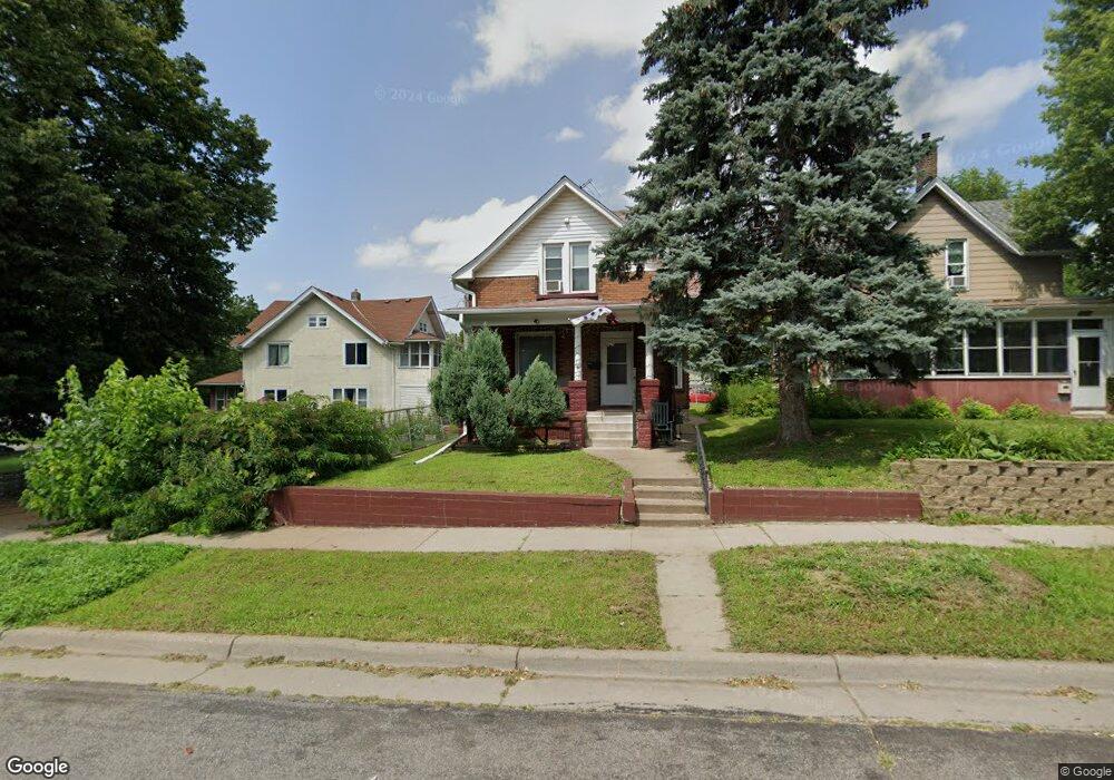
1069 Suburban Ave Saint Paul, MN 55106
Dayton's Bluff NeighborhoodEstimated Value: $254,037 - $265,000
3
Beds
1
Bath
1,237
Sq Ft
$210/Sq Ft
Est. Value
About This Home
This home is located at 1069 Suburban Ave, Saint Paul, MN 55106 and is currently estimated at $259,759, approximately $209 per square foot. 1069 Suburban Ave is a home located in Ramsey County with nearby schools including Dayton's Bluff Achievement Plus Elementary School, Battle Creek Middle School, and Harding Senior High School.
Ownership History
Date
Name
Owned For
Owner Type
Purchase Details
Closed on
Sep 17, 2018
Sold by
Voreis Aaron and Voreis Robin
Bought by
Mills Nathan and Mills Crystal
Current Estimated Value
Home Financials for this Owner
Home Financials are based on the most recent Mortgage that was taken out on this home.
Original Mortgage
$171,731
Outstanding Balance
$149,451
Interest Rate
4.5%
Mortgage Type
FHA
Estimated Equity
$110,308
Purchase Details
Closed on
Feb 27, 2018
Sold by
Moore Noreen Ann
Bought by
Voreis Aaron and Voreis Robin
Create a Home Valuation Report for This Property
The Home Valuation Report is an in-depth analysis detailing your home's value as well as a comparison with similar homes in the area
Home Values in the Area
Average Home Value in this Area
Purchase History
| Date | Buyer | Sale Price | Title Company |
|---|---|---|---|
| Mills Nathan | $174,900 | Network Title Inc | |
| Voreis Aaron | $47,393 | Network Title Inc |
Source: Public Records
Mortgage History
| Date | Status | Borrower | Loan Amount |
|---|---|---|---|
| Open | Mills Nathan | $171,731 | |
| Closed | Voreis Aaron | $0 |
Source: Public Records
Tax History
| Year | Tax Paid | Tax Assessment Tax Assessment Total Assessment is a certain percentage of the fair market value that is determined by local assessors to be the total taxable value of land and additions on the property. | Land | Improvement |
|---|---|---|---|---|
| 2025 | $3,326 | $250,700 | $21,900 | $228,800 |
| 2023 | $3,326 | $225,000 | $14,000 | $211,000 |
| 2022 | $2,756 | $214,700 | $14,000 | $200,700 |
| 2021 | $2,434 | $185,100 | $14,000 | $171,100 |
| 2020 | $2,522 | $171,400 | $14,000 | $157,400 |
| 2019 | $1,098 | $164,000 | $14,000 | $150,000 |
| 2018 | $1,128 | $86,000 | $14,000 | $72,000 |
| 2017 | $1,208 | $76,700 | $14,000 | $62,700 |
| 2016 | $912 | $0 | $0 | $0 |
| 2015 | $772 | $68,800 | $12,300 | $56,500 |
| 2014 | $870 | $0 | $0 | $0 |
Source: Public Records
Map
Nearby Homes
- 1025 Mclean Ave
- 1173 Mclean Ave
- 1166 Burns Ave
- 1043 Wilson Ave
- 1223 Mclean Ave
- 884 Mound St
- 943 Wakefield Ave
- 986 Euclid St
- 926 Wilson Ave
- 426 Griffith St
- 967 Euclid St
- 455 Griffith St
- 929 Euclid St
- 1220 Conway St
- 1311 Pacific St
- 1277 Wilson Ave
- 856 Euclid St
- 1333 Pacific St
- 725 Wilson Ave
- 721 Wilson Ave
- 1073 Suburban Ave
- 290 Earl St
- 1075 Suburban Ave
- 1070 Mclean Ave
- 1064 Mclean Ave
- 1079 Suburban Ave
- 1078 Mclean Ave
- 1062 Mclean Ave
- 270 Earl St
- 270 270 Earl-Street-
- 1082 Mclean Ave
- 1082 1082 McLean-avenue-
- 1089 Suburban Ave
- 1072 Suburban Ave
- 1076 Suburban Ave
- 1076 1076 Suburban-Avenue-
- 1086 Mclean Ave
- 291 291 Earl St
- 1051 Suburban Ave
- 291 Earl St
Your Personal Tour Guide
Ask me questions while you tour the home.