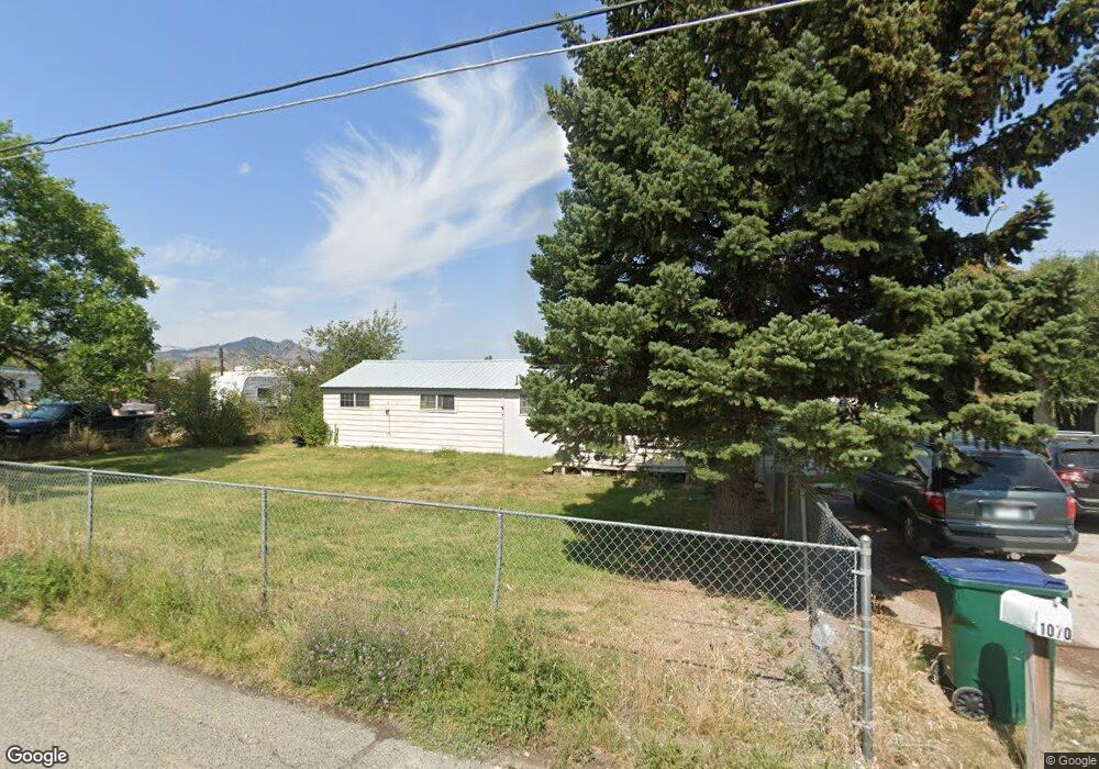
1070 Phillips Rd Unit 1072, 1064 Phillips Helena, MT 59602
West Helena Valley NeighborhoodEstimated Value: $368,000 - $450,000
11
Beds
5
Baths
768
Sq Ft
$532/Sq Ft
Est. Value
About This Home
This home is located at 1070 Phillips Rd Unit 1072, 1064 Phillips, Helena, MT 59602 and is currently estimated at $408,490, approximately $531 per square foot. 1070 Phillips Rd Unit 1072, 1064 Phillips is a home located in Lewis and Clark County with nearby schools including Four Georgians Elementary School, C.R. Anderson Middle School, and Calvary Christian School.
Ownership History
Date
Name
Owned For
Owner Type
Purchase Details
Closed on
Jun 13, 2007
Sold by
Pickett Randy
Bought by
Mcphail Kathleen R
Current Estimated Value
Home Financials for this Owner
Home Financials are based on the most recent Mortgage that was taken out on this home.
Original Mortgage
$185,250
Outstanding Balance
$113,476
Interest Rate
6.21%
Mortgage Type
New Conventional
Estimated Equity
$295,014
Purchase Details
Closed on
Feb 28, 2005
Sold by
Kincl Frank and Kincl Anna
Bought by
Pickett Randy
Home Financials for this Owner
Home Financials are based on the most recent Mortgage that was taken out on this home.
Original Mortgage
$80,000
Interest Rate
5.65%
Mortgage Type
New Conventional
Create a Home Valuation Report for This Property
The Home Valuation Report is an in-depth analysis detailing your home's value as well as a comparison with similar homes in the area
Home Values in the Area
Average Home Value in this Area
Purchase History
| Date | Buyer | Sale Price | Title Company |
|---|---|---|---|
| Mcphail Kathleen R | -- | First Montana Title Company | |
| Pickett Randy | -- | First Montana Title |
Source: Public Records
Mortgage History
| Date | Status | Borrower | Loan Amount |
|---|---|---|---|
| Open | Mcphail Kathleen R | $185,250 | |
| Previous Owner | Pickett Randy | $80,000 |
Source: Public Records
Tax History Compared to Growth
Tax History
| Year | Tax Paid | Tax Assessment Tax Assessment Total Assessment is a certain percentage of the fair market value that is determined by local assessors to be the total taxable value of land and additions on the property. | Land | Improvement |
|---|---|---|---|---|
| 2025 | $1,630 | $361,016 | $0 | $0 |
| 2024 | $2,858 | $347,879 | $0 | $0 |
| 2023 | $3,123 | $347,879 | $0 | $0 |
| 2022 | $2,473 | $228,489 | $0 | $0 |
| 2021 | $2,185 | $228,489 | $0 | $0 |
| 2020 | $2,268 | $204,173 | $0 | $0 |
| 2019 | $2,284 | $204,173 | $0 | $0 |
| 2018 | $2,046 | $177,799 | $0 | $0 |
| 2017 | $1,530 | $177,799 | $0 | $0 |
| 2016 | $1,711 | $173,050 | $0 | $0 |
| 2015 | $1,521 | $173,050 | $0 | $0 |
| 2014 | $1,275 | $79,451 | $0 | $0 |
Source: Public Records
Map
Nearby Homes
- 1030 Motsiff Rd
- 1010 Motsiff Rd
- 4435 Woodchuck Dr
- 4506 Porcupine Dr
- 4350 N Montana Ave Unit 5
- 4324 N Montana Ave
- 630 Stadler Rd
- 1344 Beaverhead Rd
- 5288 Glacier Point Loop
- 1650 Karmen Rd
- 5277 Glacier Point Loop
- 3960 Canal Dr
- 5530 N Montana Ave
- 835 Onyx Place
- 5420 Robin Dr
- 845 Faw Rd
- 1698 Kelly Rd
- 3570 Juniper Dr
- 1325 Cambray Loop
- 885 Amethyst Ave
- 1070 &1072 Phillips Rd
- 1072 Phillips Rd
- 1060 Phillips Rd
- 1076 Phillips Rd
- 1075 Isy Loop
- 1075 Isy Rd
- 1067 Phillips Rd
- 1175 Phillips Rd
- 1095 Isy Rd
- 1098 Lost Trail Rd
- 1070 Isy Loop
- 4810 N Montana Ave
- 1066 Lost Trail Rd
- 1185 Phillips Rd
- 1050 Isy Loop
- 1023 Phillips Rd
- 1023 and 1 Phillips Rd
- 1125 Cap Rd
- 1085 Cap Rd
- 1085 Cap Rd Unit Lot 35 Bryant No. 3