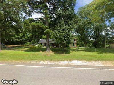
10705 State Highway 21 S Fort Deposit, AL 36032
Estimated Value: $184,000 - $279,000
--
Bed
1
Bath
1,641
Sq Ft
$134/Sq Ft
Est. Value
About This Home
This home is located at 10705 State Highway 21 S, Fort Deposit, AL 36032 and is currently estimated at $219,475, approximately $133 per square foot. 10705 State Highway 21 S is a home located in Lowndes County.
Ownership History
Date
Name
Owned For
Owner Type
Purchase Details
Closed on
Jun 11, 2015
Sold by
Coleman Arthur L and Coleman Arthur Lee
Bought by
Coleman Arthur Lee
Current Estimated Value
Home Financials for this Owner
Home Financials are based on the most recent Mortgage that was taken out on this home.
Original Mortgage
$42,135
Interest Rate
3.75%
Mortgage Type
Purchase Money Mortgage
Purchase Details
Closed on
Oct 6, 2005
Sold by
Antle Patricia W
Bought by
Coleman Arthur L
Create a Home Valuation Report for This Property
The Home Valuation Report is an in-depth analysis detailing your home's value as well as a comparison with similar homes in the area
Home Values in the Area
Average Home Value in this Area
Purchase History
| Date | Buyer | Sale Price | Title Company |
|---|---|---|---|
| Coleman Arthur Lee | -- | None Available | |
| Coleman Arthur L | -- | -- |
Source: Public Records
Mortgage History
| Date | Status | Borrower | Loan Amount |
|---|---|---|---|
| Closed | Coleman Arthur Lee | $42,135 |
Source: Public Records
Tax History Compared to Growth
Tax History
| Year | Tax Paid | Tax Assessment Tax Assessment Total Assessment is a certain percentage of the fair market value that is determined by local assessors to be the total taxable value of land and additions on the property. | Land | Improvement |
|---|---|---|---|---|
| 2024 | $1,549 | $34,420 | $3,720 | $30,700 |
| 2023 | $1,549 | $35,060 | $4,360 | $30,700 |
| 2022 | $1,549 | $34,420 | $3,720 | $30,700 |
| 2021 | $1,224 | $27,200 | $3,640 | $23,560 |
| 2020 | $1,224 | $27,200 | $3,640 | $23,560 |
| 2019 | $1,396 | $31,020 | $3,640 | $27,380 |
| 2018 | $1,451 | $32,240 | $4,860 | $27,380 |
| 2017 | $1,149 | $25,540 | $5,040 | $20,500 |
| 2016 | $361 | $8,020 | $1,740 | $6,280 |
| 2015 | $361 | $80,460 | $0 | $0 |
| 2014 | $359 | $79,980 | $0 | $0 |
| 2013 | $356 | $79,260 | $0 | $0 |
Source: Public Records
Map
Nearby Homes
- 0 Crook Rd
- 354 County Road 12
- 0 Alabama 21
- 0 Blue Hill Rd
- 7534 County Road 17
- 0 Main St
- . Main St
- 1122 Main St
- 115 Bishop St
- 0 Mitchell Rd
- 905 Pat Patterson Rd
- 704 Lee St
- 0 Bishop Bottom Rd
- 132 W Tuskeena St
- 00 Alabama 21
- 550 E Tuskeena St
- 0 Sherling Lake Rd
- 9705 Braggs Rd
- 104 Pine Hill Ln
- 1 County Road 63
- 10988 State Highway 21 S
- 10777 State Highway 21 S
- 10705 State Highway 21 S
- 10548 State Highway 21 S
- 10710 State Highway 21 S
- 11469 State Highway 21 S
- 11069 State Highway 21 S
- 574 Sellers Dirt Rd
- 385 Snow Hill Dr
- 8420 County Road 45
- 8327 County Road 45
- 173 Snow Hill Dr
- 10548 Highway 21 S
- 10548 Alabama 21
- 10336 State Highway 21 S
- 8295 County Road 45
- 8330 County Road 45
- 5194 Blue Hill Rd
