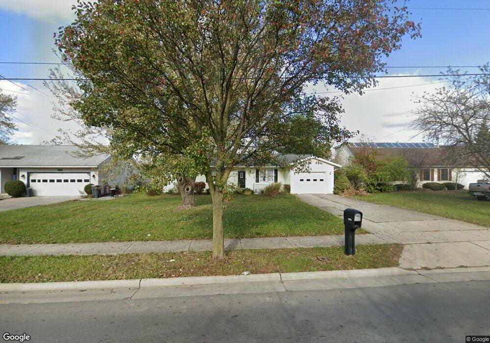
1072 Brower Rd Lima, OH 45801
Northside Lima NeighborhoodEstimated Value: $152,777 - $176,000
3
Beds
2
Baths
1,276
Sq Ft
$125/Sq Ft
Est. Value
About This Home
This home is located at 1072 Brower Rd, Lima, OH 45801 and is currently estimated at $159,194, approximately $124 per square foot. 1072 Brower Rd is a home located in Allen County with nearby schools including Elida Elementary School, Elida Middle School, and Elida High School.
Ownership History
Date
Name
Owned For
Owner Type
Purchase Details
Closed on
May 2, 2018
Sold by
Riepenhoff Patricia A
Bought by
Riepenhoff Sara Mary
Current Estimated Value
Purchase Details
Closed on
Dec 6, 2005
Sold by
Fisher Paul E
Bought by
Riepenhoff Patricia A
Home Financials for this Owner
Home Financials are based on the most recent Mortgage that was taken out on this home.
Original Mortgage
$58,000
Interest Rate
6.2%
Mortgage Type
Future Advance Clause Open End Mortgage
Purchase Details
Closed on
Aug 25, 1995
Sold by
Ester Rodney
Bought by
Riepenhoff Patricia
Home Financials for this Owner
Home Financials are based on the most recent Mortgage that was taken out on this home.
Original Mortgage
$49,600
Interest Rate
7.43%
Mortgage Type
New Conventional
Purchase Details
Closed on
Apr 28, 1989
Bought by
Estes Rodney L
Create a Home Valuation Report for This Property
The Home Valuation Report is an in-depth analysis detailing your home's value as well as a comparison with similar homes in the area
Home Values in the Area
Average Home Value in this Area
Purchase History
| Date | Buyer | Sale Price | Title Company |
|---|---|---|---|
| Riepenhoff Sara Mary | -- | None Available | |
| Riepenhoff Patricia A | -- | None Available | |
| Riepenhoff Patricia | $62,000 | -- | |
| Estes Rodney L | -- | -- |
Source: Public Records
Mortgage History
| Date | Status | Borrower | Loan Amount |
|---|---|---|---|
| Closed | Riepenhoff Patricia A | $58,000 | |
| Previous Owner | Riepenhoff Patricia | $49,600 |
Source: Public Records
Tax History
| Year | Tax Paid | Tax Assessment Tax Assessment Total Assessment is a certain percentage of the fair market value that is determined by local assessors to be the total taxable value of land and additions on the property. | Land | Improvement |
|---|---|---|---|---|
| 2024 | $1,428 | $35,110 | $5,360 | $29,750 |
| 2023 | $1,288 | $28,530 | $4,340 | $24,190 |
| 2022 | $1,308 | $28,530 | $4,340 | $24,190 |
| 2021 | $1,315 | $28,530 | $4,340 | $24,190 |
| 2020 | $1,198 | $24,370 | $4,100 | $20,270 |
| 2019 | $1,198 | $24,370 | $4,100 | $20,270 |
| 2018 | $784 | $24,370 | $4,100 | $20,270 |
| 2017 | $759 | $24,370 | $4,100 | $20,270 |
| 2016 | $758 | $24,370 | $4,100 | $20,270 |
| 2015 | $834 | $24,370 | $4,100 | $20,270 |
| 2014 | $834 | $25,560 | $4,100 | $21,460 |
| 2013 | $810 | $25,560 | $4,100 | $21,460 |
Source: Public Records
Map
Nearby Homes
- 2371 Mandolin Dr
- 2381 Mandolin Dr
- 2380 Mandolin Dr
- 2355 Burden Dr
- 2286 N Cole St
- 2224 N Metcalf St
- 2126 N Metcalf St
- 660 W Lane Ave
- 2113 Kimberly Dr
- 2598 Kimberly Dr
- 500 W Northern Ave
- 2129 Reinell Ave
- 1705 Karen St
- 1734 Tahoe Place
- 520 Kenmore St
- 1889 N Metcalf St
- 1809 N Metcalf St
- 475 Kenmore St
- 1743 Sherry Lee Dr
- 1212 Virginia Ave
Your Personal Tour Guide
Ask me questions while you tour the home.