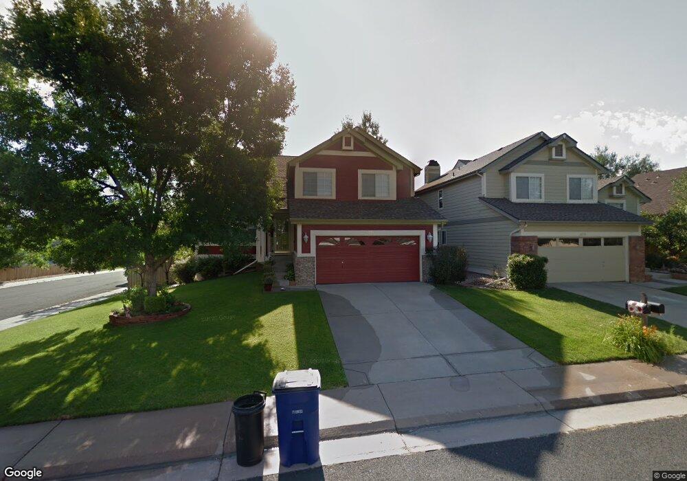
10720 Kimball St Parker, CO 80134
Clarke Farms NeighborhoodEstimated Value: $572,689 - $589,000
4
Beds
4
Baths
1,971
Sq Ft
$296/Sq Ft
Est. Value
About This Home
This home is located at 10720 Kimball St, Parker, CO 80134 and is currently estimated at $582,672, approximately $295 per square foot. 10720 Kimball St is a home located in Douglas County with nearby schools including Cherokee Trail Elementary School, Sierra Middle School, and Chaparral High School.
Ownership History
Date
Name
Owned For
Owner Type
Purchase Details
Closed on
Sep 25, 1992
Sold by
Us Home Corp
Bought by
Pulk Peter C and Pulk Lisa A
Current Estimated Value
Purchase Details
Closed on
Mar 30, 1992
Sold by
Colorado Land Source Ltd
Bought by
Us Home Corp
Purchase Details
Closed on
Dec 27, 1991
Sold by
Silverado Elektra Venture Ltd & Silverad
Bought by
Colorado Land Source Ltd
Create a Home Valuation Report for This Property
The Home Valuation Report is an in-depth analysis detailing your home's value as well as a comparison with similar homes in the area
Home Values in the Area
Average Home Value in this Area
Purchase History
| Date | Buyer | Sale Price | Title Company |
|---|---|---|---|
| Pulk Peter C | $115,100 | -- | |
| Us Home Corp | $106,000 | -- | |
| Colorado Land Source Ltd | -- | -- |
Source: Public Records
Tax History Compared to Growth
Tax History
| Year | Tax Paid | Tax Assessment Tax Assessment Total Assessment is a certain percentage of the fair market value that is determined by local assessors to be the total taxable value of land and additions on the property. | Land | Improvement |
|---|---|---|---|---|
| 2024 | $3,204 | $40,360 | $8,410 | $31,950 |
| 2023 | $3,242 | $40,360 | $8,410 | $31,950 |
| 2022 | $2,400 | $27,760 | $5,090 | $22,670 |
| 2021 | $2,499 | $27,760 | $5,090 | $22,670 |
| 2020 | $2,426 | $27,400 | $4,810 | $22,590 |
| 2019 | $2,441 | $27,400 | $4,810 | $22,590 |
| 2018 | $2,135 | $23,360 | $4,880 | $18,480 |
| 2017 | $1,981 | $23,360 | $4,880 | $18,480 |
| 2016 | $1,776 | $20,560 | $4,220 | $16,340 |
| 2015 | $1,809 | $20,560 | $4,220 | $16,340 |
| 2014 | $1,652 | $16,740 | $4,220 | $12,520 |
Source: Public Records
Map
Nearby Homes
- 10721 Kimball St
- 10811 Shaw Ct
- 17033 Numa Place
- 10858 Willow Reed Cir E
- 17050 E Wiley Place
- 17024 E Carr Ave
- 10890 Willow Reed Cir W
- 17046 Wellington Dr
- 11613 Masonville Dr
- 17045 Hastings Ave
- 17109 Campion Way
- 16641 Martingale Dr
- 17040 Hastings Ave
- 11629 Masonville Dr
- 11632 Masonville Dr
- 17039 Foxton Dr
- 17502 Lamar Ct
- 16362 Oakmoor Place
- 17611 Hoyt Place
- 10818 Mcclellan Rd
- 10722 Kimball St
- 10801 Milliken St
- 10724 Kimball St
- 10803 Milliken St
- 10716 Kimball St
- 10709 Milliken St
- 10719 Kimball St
- 10805 Milliken St
- 10723 Kimball St
- 10726 Kimball St
- 10714 Kimball St
- 10717 Kimball St
- 10725 Kimball St
- 10807 Milliken St
- 10715 Kimball St
- 10727 Kimball St
- 10728 Kimball St
- 10712 Kimball St
- 17026 E Wiley Place
- 10705 Milliken St