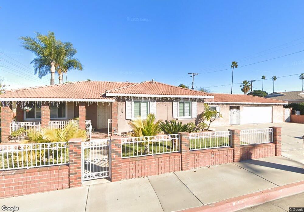
10727 Hole Ave Riverside, CA 92505
La Sierra NeighborhoodEstimated Value: $577,000 - $716,000
3
Beds
3
Baths
1,804
Sq Ft
$358/Sq Ft
Est. Value
About This Home
This home is located at 10727 Hole Ave, Riverside, CA 92505 and is currently estimated at $645,901, approximately $358 per square foot. 10727 Hole Ave is a home located in Riverside County with nearby schools including Myra Linn Elementary School, Arizona Middle School, and La Sierra High School.
Ownership History
Date
Name
Owned For
Owner Type
Purchase Details
Closed on
Aug 3, 2020
Sold by
Arias Miguel Jimenez and Arias Eloisa Nunez
Bought by
Arias Miguel Jimenez and Arias Eloisa Nunez
Current Estimated Value
Home Financials for this Owner
Home Financials are based on the most recent Mortgage that was taken out on this home.
Original Mortgage
$300,000
Outstanding Balance
$266,612
Interest Rate
3.1%
Mortgage Type
New Conventional
Estimated Equity
$379,289
Purchase Details
Closed on
Jun 10, 1999
Sold by
Outland Tressie
Bought by
Arias Miguel J and Arias Eloisa N
Home Financials for this Owner
Home Financials are based on the most recent Mortgage that was taken out on this home.
Original Mortgage
$112,500
Interest Rate
7.24%
Purchase Details
Closed on
Sep 9, 1996
Sold by
Rosales Raul
Bought by
Outland Tressie
Create a Home Valuation Report for This Property
The Home Valuation Report is an in-depth analysis detailing your home's value as well as a comparison with similar homes in the area
Home Values in the Area
Average Home Value in this Area
Purchase History
| Date | Buyer | Sale Price | Title Company |
|---|---|---|---|
| Arias Miguel Jimenez | -- | Pacific Coast Title Company | |
| Arias Miguel J | $125,000 | Benefit Land Title | |
| Outland Tressie | -- | -- |
Source: Public Records
Mortgage History
| Date | Status | Borrower | Loan Amount |
|---|---|---|---|
| Open | Arias Miguel Jimenez | $300,000 | |
| Closed | Arias Miguel J | $112,500 |
Source: Public Records
Tax History Compared to Growth
Tax History
| Year | Tax Paid | Tax Assessment Tax Assessment Total Assessment is a certain percentage of the fair market value that is determined by local assessors to be the total taxable value of land and additions on the property. | Land | Improvement |
|---|---|---|---|---|
| 2025 | $2,984 | $245,883 | $53,777 | $192,106 |
| 2023 | $2,984 | $236,338 | $51,690 | $184,648 |
| 2022 | $2,763 | $231,705 | $50,677 | $181,028 |
| 2021 | $2,726 | $227,163 | $49,684 | $177,479 |
| 2020 | $2,683 | $224,835 | $49,175 | $175,660 |
| 2019 | $2,648 | $220,427 | $48,211 | $172,216 |
| 2018 | $2,612 | $216,106 | $47,266 | $168,840 |
| 2017 | $2,564 | $211,870 | $46,340 | $165,530 |
| 2016 | $2,523 | $207,717 | $45,432 | $162,285 |
| 2015 | $2,486 | $204,599 | $44,750 | $159,849 |
| 2014 | $2,477 | $200,593 | $43,874 | $156,719 |
Source: Public Records
Map
Nearby Homes
- 10716 Hollenbeck Dr
- 10742 Jeri Dr
- 4271 Hines Ave
- 10495 Cook Ave
- 10467 California Ave
- 4088 Lively St
- 4847 Hedrick Ave
- 10372 Wells Ave
- 4459 Clarksdale Dr
- 4290 Tyler St
- 10384 Hole Ave
- 4254 Azure Ct
- 4998 Bushnell Ave
- 10337 Mull Ave
- 3920 Polk St Unit C
- 11141 Gardenhurst Ct
- 4201 Ferguson Ct
- 0 Bushnell Ave
- 4247 Bravado
- 10362 Wagner Way