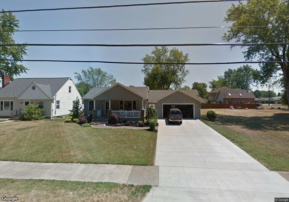
1073 Lake Rd Conneaut, OH 44030
Estimated Value: $193,253 - $393,000
3
Beds
2
Baths
1,636
Sq Ft
$169/Sq Ft
Est. Value
About This Home
This home is located at 1073 Lake Rd, Conneaut, OH 44030 and is currently estimated at $276,313, approximately $168 per square foot. 1073 Lake Rd is a home located in Ashtabula County with nearby schools including Lakeshore Primary Elementary School, Gateway Elementary School, and Conneaut Middle School.
Ownership History
Date
Name
Owned For
Owner Type
Purchase Details
Closed on
Aug 2, 2018
Sold by
Suscheck Erika S and Rutkowski Ii Michael J
Bought by
Rutkowski Ii Michael J and Rutkowski Erika S
Current Estimated Value
Purchase Details
Closed on
Jan 26, 2005
Sold by
Demarco Patricia M and Demarco Robert C
Bought by
Suscheck Erika S
Home Financials for this Owner
Home Financials are based on the most recent Mortgage that was taken out on this home.
Original Mortgage
$56,000
Outstanding Balance
$28,501
Interest Rate
5.77%
Mortgage Type
Unknown
Estimated Equity
$247,812
Create a Home Valuation Report for This Property
The Home Valuation Report is an in-depth analysis detailing your home's value as well as a comparison with similar homes in the area
Home Values in the Area
Average Home Value in this Area
Purchase History
| Date | Buyer | Sale Price | Title Company |
|---|---|---|---|
| Rutkowski Ii Michael J | -- | None Available | |
| Suscheck Erika S | $70,000 | Standard Title Agency Inc |
Source: Public Records
Mortgage History
| Date | Status | Borrower | Loan Amount |
|---|---|---|---|
| Open | Suscheck Erika S | $56,000 | |
| Closed | Suscheck Erika S | $10,500 |
Source: Public Records
Tax History Compared to Growth
Tax History
| Year | Tax Paid | Tax Assessment Tax Assessment Total Assessment is a certain percentage of the fair market value that is determined by local assessors to be the total taxable value of land and additions on the property. | Land | Improvement |
|---|---|---|---|---|
| 2024 | $4,294 | $58,700 | $4,200 | $54,500 |
| 2023 | $2,721 | $58,700 | $4,200 | $54,500 |
| 2022 | $2,150 | $40,810 | $3,220 | $37,590 |
| 2021 | $2,188 | $40,810 | $3,220 | $37,590 |
| 2020 | $2,187 | $40,810 | $3,220 | $37,590 |
| 2019 | $1,726 | $31,610 | $2,660 | $28,950 |
| 2018 | $1,677 | $31,610 | $2,660 | $28,950 |
| 2017 | $1,659 | $31,610 | $2,660 | $28,950 |
| 2016 | $1,627 | $33,390 | $2,800 | $30,590 |
| 2015 | $1,644 | $33,390 | $2,800 | $30,590 |
| 2014 | $1,034 | $23,700 | $2,800 | $20,900 |
| 2013 | $1,174 | $27,690 | $2,630 | $25,060 |
Source: Public Records
Map
Nearby Homes
- 1036 Golfview Dr
- 1145 Lake Rd
- 2663 Lake Rd
- 1185 Lake Rd
- 247 Whitney St
- 681 Madison St
- 1300 Lake Rd
- 716 Chestnut St
- 0 Chestnut St Unit 5120761
- 202 W Main Rd Unit Lot 150
- 210 W Main Rd
- 527 State St
- 429 Depot St
- 405 Bliss Ave
- 381 Bliss Ave
- 919 Lincoln Dr
- 533 Mill St
- 459 Mill St
- 688 Grove St
- 536 Mill St