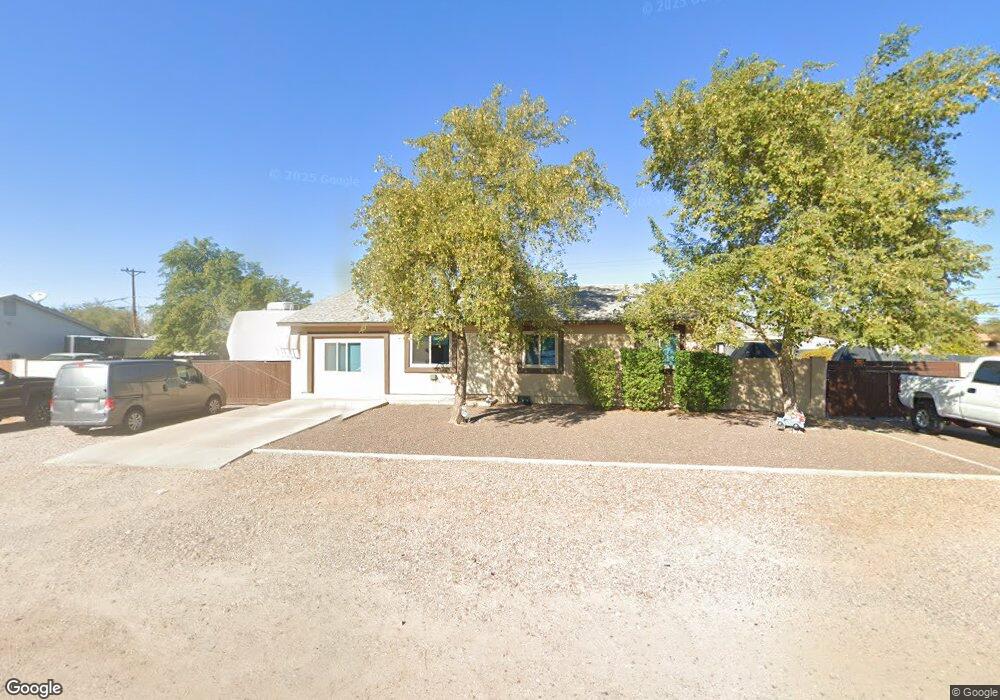
10736 E Boulder Dr Apache Junction, AZ 85120
University Manor NeighborhoodEstimated Value: $394,000 - $441,000
Studio
2
Baths
1,660
Sq Ft
$251/Sq Ft
Est. Value
About This Home
This home is located at 10736 E Boulder Dr, Apache Junction, AZ 85120 and is currently estimated at $416,404, approximately $250 per square foot. 10736 E Boulder Dr is a home located in Maricopa County with nearby schools including Sousa Elementary School, Franklin at Brimhall Elementary School, and Franklin West Elementary School.
Ownership History
Date
Name
Owned For
Owner Type
Purchase Details
Closed on
Apr 6, 1998
Sold by
Gurr Malan L and Gurr Deanna L
Bought by
Eastham Michael L and Eastham Tonya D
Current Estimated Value
Home Financials for this Owner
Home Financials are based on the most recent Mortgage that was taken out on this home.
Original Mortgage
$80,400
Outstanding Balance
$15,209
Interest Rate
7.06%
Mortgage Type
New Conventional
Estimated Equity
$401,195
Purchase Details
Closed on
Dec 15, 1997
Sold by
Hyer Lawrence and Hyer Corriann
Bought by
Gurr Malan L and Gurr Deanna L
Purchase Details
Closed on
May 28, 1996
Sold by
Mann Evert Michael and Mann William Walter
Bought by
Rasmussen Charles D and Rasmussen Holly
Purchase Details
Closed on
Jul 10, 1995
Sold by
Mann Gene L R and Gilchrist Thelma Mann
Bought by
Mann Evert Michael and Mann William Walter
Create a Home Valuation Report for This Property
The Home Valuation Report is an in-depth analysis detailing your home's value as well as a comparison with similar homes in the area
Home Values in the Area
Average Home Value in this Area
Purchase History
| Date | Buyer | Sale Price | Title Company |
|---|---|---|---|
| Eastham Michael L | $82,900 | Chicago Title Insurance Co | |
| Gurr Malan L | $38,667 | Chicago Title Insurance Co | |
| Rasmussen Charles D | $38,667 | Chicago Title Insurance Co | |
| Rasmussen Charles D | -- | Chicago Title Insurance Co | |
| Gurr Malan L | $38,666 | Chicago Title Insurance Co | |
| Gurr Malan L | -- | Chicago Title Insurance Co | |
| Mann Evert Michael | -- | -- |
Source: Public Records
Mortgage History
| Date | Status | Borrower | Loan Amount |
|---|---|---|---|
| Open | Eastham Michael L | $80,400 |
Source: Public Records
Tax History
| Year | Tax Paid | Tax Assessment Tax Assessment Total Assessment is a certain percentage of the fair market value that is determined by local assessors to be the total taxable value of land and additions on the property. | Land | Improvement |
|---|---|---|---|---|
| 2025 | $912 | $12,248 | -- | -- |
| 2024 | $933 | $11,665 | -- | -- |
| 2023 | $933 | $32,100 | $6,420 | $25,680 |
| 2022 | $909 | $24,770 | $4,950 | $19,820 |
| 2021 | $919 | $21,320 | $4,260 | $17,060 |
| 2020 | $912 | $17,480 | $3,490 | $13,990 |
| 2019 | $836 | $15,730 | $3,140 | $12,590 |
| 2018 | $813 | $12,750 | $2,550 | $10,200 |
| 2017 | $782 | $11,430 | $2,280 | $9,150 |
| 2016 | $766 | $10,270 | $2,050 | $8,220 |
Source: Public Records
Map
Nearby Homes
- 10813 E Boston St
- 345 N Signal Butte Rd Unit 23
- 10620 E Caballero St
- 10540 E Apache Trail Unit 15
- 10540 E Apache Trail Unit 6
- 10540 E Apache Trail Unit 91
- 10540 E Apache Trail Unit 93
- 10540 E Apache Trail Unit 127
- 10540 E Apache Trail Unit 182
- 535 N Bailey Cir
- 10936 E Apache Trail Unit 121
- 538 N 110th St
- 10411 E 1st St
- 7000 E Arbor Ave
- 11100 E Apache Trail Unit 37
- 11100 E Apache Trail
- 11100 E Apache Trail Unit 8
- 11100 E Apache Trail Unit 16
- 11100 E Apache Trail Unit 48
- 433 N 111th Place
- 10728 E Boulder Dr
- 10740 E Boulder Dr
- 10735 E Mercury Dr
- 10747 E Boulder Dr
- 10727 E Mercury Dr
- 10741 E Boulder Dr
- 10720 E Boulder Dr
- 222 N Signal Butte Rd
- 10719 E Mercury Dr
- 10712 E Boulder Dr
- 10735 E Boulder Dr
- 10752 E Mercury Dr
- 10711 E Mercury Dr
- 10742 E Mercury Dr
- 308 N Signal Butte Rd
- 208 N Signal Butte Rd
- 10709 E Boulder Dr
- 10706 E Boulder Dr
- 10801 E Boston St
- 10805 E Boston St
Your Personal Tour Guide
Ask me questions while you tour the home.