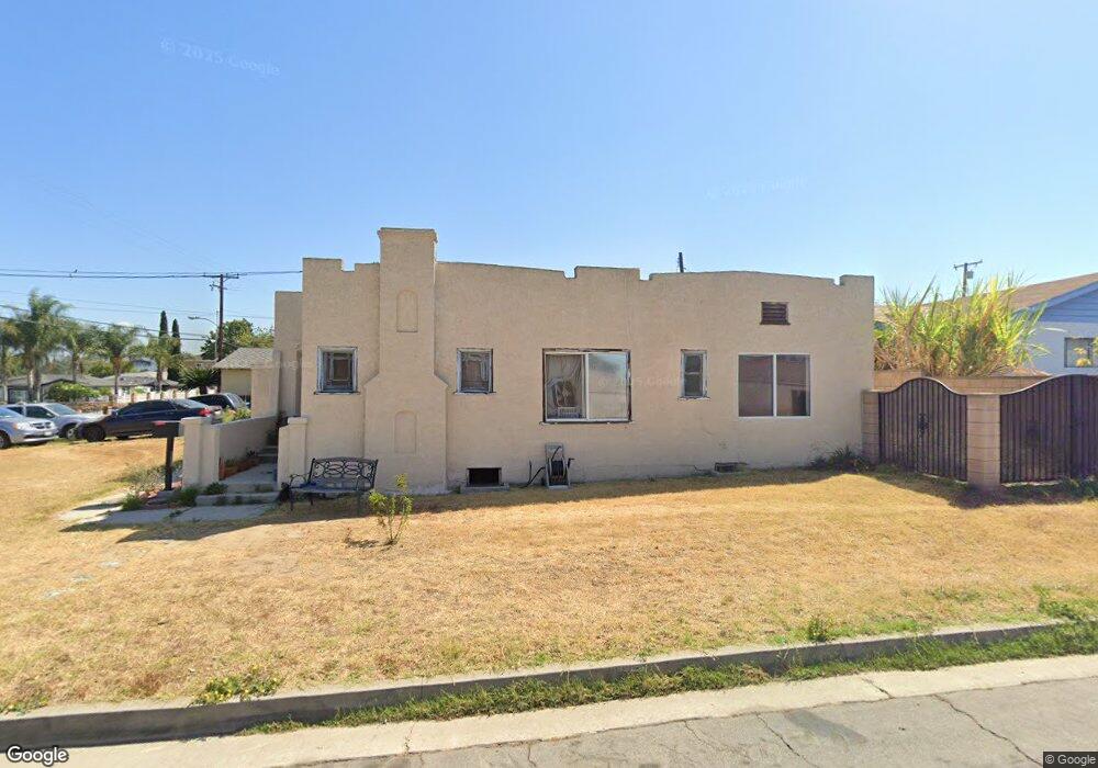
10744 Ceres Ave Whittier, CA 90604
South Whittier NeighborhoodEstimated Value: $740,910 - $810,000
3
Beds
1
Bath
1,242
Sq Ft
$621/Sq Ft
Est. Value
About This Home
This home is located at 10744 Ceres Ave, Whittier, CA 90604 and is currently estimated at $771,478, approximately $621 per square foot. 10744 Ceres Ave is a home located in Los Angeles County with nearby schools including Ceres Elementary School, Granada Middle School, and California High School.
Ownership History
Date
Name
Owned For
Owner Type
Purchase Details
Closed on
Jan 7, 2004
Sold by
Portillo Stella Amelia and Portillo Roy L
Bought by
Portillo Stella Amelia and Portillo Roy L
Current Estimated Value
Home Financials for this Owner
Home Financials are based on the most recent Mortgage that was taken out on this home.
Original Mortgage
$130,000
Outstanding Balance
$60,712
Interest Rate
5.88%
Mortgage Type
New Conventional
Estimated Equity
$710,766
Purchase Details
Closed on
Nov 1, 1994
Sold by
Portillo Stella Amelia and Portillo Roy L
Bought by
Portillo Stella Amelia and Portillo Roy Lee
Home Financials for this Owner
Home Financials are based on the most recent Mortgage that was taken out on this home.
Original Mortgage
$52,000
Interest Rate
8.91%
Purchase Details
Closed on
May 3, 1983
Sold by
Portillo Roy Lee and Portillo Stella Amelia
Bought by
Portillo Stella Amelia and Portillo Roy L
Create a Home Valuation Report for This Property
The Home Valuation Report is an in-depth analysis detailing your home's value as well as a comparison with similar homes in the area
Home Values in the Area
Average Home Value in this Area
Purchase History
| Date | Buyer | Sale Price | Title Company |
|---|---|---|---|
| Portillo Stella Amelia | -- | Ort | |
| Portillo Stella Amelia | -- | Old Republic Title Company | |
| Portillo Stella Amelia | -- | United Title Company |
Source: Public Records
Mortgage History
| Date | Status | Borrower | Loan Amount |
|---|---|---|---|
| Open | Portillo Stella Amelia | $130,000 | |
| Closed | Portillo Stella Amelia | $52,000 |
Source: Public Records
Tax History Compared to Growth
Tax History
| Year | Tax Paid | Tax Assessment Tax Assessment Total Assessment is a certain percentage of the fair market value that is determined by local assessors to be the total taxable value of land and additions on the property. | Land | Improvement |
|---|---|---|---|---|
| 2025 | $1,321 | $68,822 | $38,456 | $30,366 |
| 2024 | $1,321 | $67,473 | $37,702 | $29,771 |
| 2023 | $1,302 | $66,151 | $36,963 | $29,188 |
| 2022 | $1,276 | $64,855 | $36,239 | $28,616 |
| 2021 | $1,248 | $63,584 | $35,529 | $28,055 |
| 2019 | $1,223 | $61,700 | $34,476 | $27,224 |
| 2018 | $1,073 | $60,491 | $33,800 | $26,691 |
| 2016 | $1,005 | $58,144 | $32,489 | $25,655 |
| 2015 | $995 | $57,271 | $32,001 | $25,270 |
| 2014 | $990 | $56,150 | $31,375 | $24,775 |
Source: Public Records
Map
Nearby Homes
- 10955 Parise Dr
- 14076 Cornishcrest Rd
- 11102 Eagle Ln
- 11118 Bunker Ln
- 10745 Victoria Ave Unit 4
- 10745 Victoria Ave Unit 6
- 10745 Victoria Ave
- 11531 Sunnybrook Ln
- 0 Telegraph Rd Unit DW24244539
- 14037 Mystic St
- 10241 Ruoff Ave
- 11624 Starlight Ave
- 11111 Colima Rd
- 14520 Mulberry Dr
- 13752 Bentongrove Dr
- 10855 Colima Rd
- 11116 Leland Ave
- 11813 Colima Rd
- 14034 Coteau Dr Unit 1103
- 10822 Colima Rd
- 10734 Ceres Ave
- 14213 Allegan St
- 10756 Ceres Ave
- 14217 Allegan St
- 14190 Cornishcrest Rd
- 14202 Cornishcrest Rd
- 14208 Cornishcrest Rd
- 14223 Allegan St
- 14214 Cornishcrest Rd
- 10751 Ceres Ave
- 10762 Ceres Ave
- 14216 Allegan St
- 14184 Cornishcrest Rd
- 14218 Cornishcrest Rd
- 10757 Ceres Ave
- 14227 Allegan St
- 14222 Allegan St
- 14191 Cornishcrest Rd
- 14224 Cornishcrest Rd
- 10802 Ceres Ave