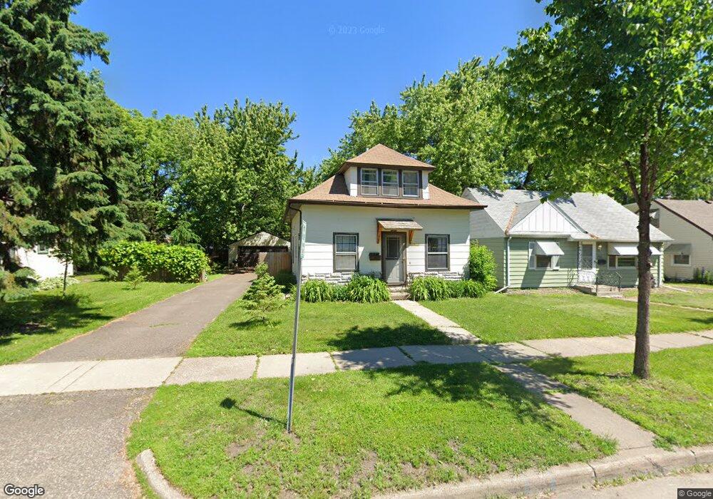
1075 Hubbard Ave Saint Paul, MN 55104
Frogtown NeighborhoodEstimated Value: $259,000 - $265,000
3
Beds
2
Baths
909
Sq Ft
$289/Sq Ft
Est. Value
About This Home
This home is located at 1075 Hubbard Ave, Saint Paul, MN 55104 and is currently estimated at $262,347, approximately $288 per square foot. 1075 Hubbard Ave is a home located in Ramsey County with nearby schools including Maxfield Magnet Elementary School, Hidden River Middle School, and Central Senior High School.
Ownership History
Date
Name
Owned For
Owner Type
Purchase Details
Closed on
Sep 25, 2018
Bought by
Spidahl Benjamin
Current Estimated Value
Home Financials for this Owner
Home Financials are based on the most recent Mortgage that was taken out on this home.
Original Mortgage
$174,600
Outstanding Balance
$152,746
Interest Rate
4.65%
Estimated Equity
$109,601
Purchase Details
Closed on
Jun 30, 2016
Sold by
Hartigan John P and Hartigan Julie Threase
Bought by
Crowder Amy and Crowder Deborah
Home Financials for this Owner
Home Financials are based on the most recent Mortgage that was taken out on this home.
Original Mortgage
$104,850
Interest Rate
3.41%
Mortgage Type
New Conventional
Create a Home Valuation Report for This Property
The Home Valuation Report is an in-depth analysis detailing your home's value as well as a comparison with similar homes in the area
Home Values in the Area
Average Home Value in this Area
Purchase History
| Date | Buyer | Sale Price | Title Company |
|---|---|---|---|
| Spidahl Benjamin | $180,000 | -- | |
| Crowder Amy | $120,030 | Trademark Title Services Inc |
Source: Public Records
Mortgage History
| Date | Status | Borrower | Loan Amount |
|---|---|---|---|
| Open | Spidahl Benjamin | $174,600 | |
| Closed | Spidahl Benjamin | -- | |
| Previous Owner | Crowder Amy | $104,850 |
Source: Public Records
Tax History Compared to Growth
Tax History
| Year | Tax Paid | Tax Assessment Tax Assessment Total Assessment is a certain percentage of the fair market value that is determined by local assessors to be the total taxable value of land and additions on the property. | Land | Improvement |
|---|---|---|---|---|
| 2025 | $3,242 | $237,900 | $25,000 | $212,900 |
| 2023 | $3,242 | $212,600 | $20,000 | $192,600 |
| 2022 | $2,540 | $225,100 | $20,000 | $205,100 |
| 2021 | $2,386 | $172,600 | $20,000 | $152,600 |
| 2020 | $2,700 | $168,800 | $15,700 | $153,100 |
| 2019 | $2,028 | $176,700 | $15,700 | $161,000 |
| 2018 | $1,736 | $128,700 | $15,700 | $113,000 |
| 2017 | $2,034 | $118,000 | $15,700 | $102,300 |
| 2016 | $1,378 | $0 | $0 | $0 |
| 2015 | $1,628 | $105,800 | $15,700 | $90,100 |
| 2014 | $1,518 | $0 | $0 | $0 |
Source: Public Records
Map
Nearby Homes
- 1030 Englewood Ave
- 999 Minnehaha Ave W
- 687 Lexington Pkwy N
- 951 Front Ave
- 1174 Lafond Ave
- 1282 Hewitt Ave
- 1215 Lafond Ave
- 1294 Hubbard Ave
- 1039 Argyle St
- 895 Front Ave
- 1292 Taylor Ave W
- 1056 Lexington Pkwy N
- 1258 Blair Ave
- 1231 Thomas Ave
- 1135 Charles Ave
- 1126 Charles Ave
- 1134 Charles Ave
- 989 Barrett St
- 708 Hamline Ave N
- 885 Edmund Ave
- 1081 Hubbard Ave
- 1069 Hubbard Ave
- 1063 Hubbard Ave
- 1057 Hubbard Ave
- 814 Lexington Pkwy N
- 828 Lexington Pkwy N
- 1097 Hubbard Ave
- 830 Lexington Pkwy N
- 1064 Hubbard Ave
- 1076 Hubbard Ave
- 1072 Hubbard Ave
- 1080 Hubbard Ave
- 808 Lexington Pkwy N
- 1053 Hubbard Ave
- 804 Lexington Pkwy N
- 1058 Hubbard Ave
- 1047 Hubbard Ave
- 1052 Hubbard Ave
- 794 Lexington Pkwy N
- 1043 Hubbard Ave