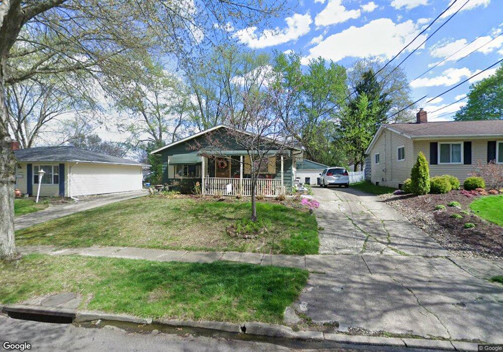
1075 Middlecoff Dr Akron, OH 44313
Merriman Valley NeighborhoodEstimated Value: $161,000 - $239,000
4
Beds
2
Baths
1,120
Sq Ft
$177/Sq Ft
Est. Value
About This Home
This home is located at 1075 Middlecoff Dr, Akron, OH 44313 and is currently estimated at $198,278, approximately $177 per square foot. 1075 Middlecoff Dr is a home located in Summit County with nearby schools including King Community Learning Center, Our Lady Of The Elms Elementary School, and Immaculate Heart Of Mary School.
Ownership History
Date
Name
Owned For
Owner Type
Purchase Details
Closed on
Sep 5, 2000
Sold by
Hale Tammie
Bought by
Hale Bill J
Current Estimated Value
Home Financials for this Owner
Home Financials are based on the most recent Mortgage that was taken out on this home.
Original Mortgage
$6,000
Interest Rate
8.14%
Mortgage Type
Seller Take Back
Create a Home Valuation Report for This Property
The Home Valuation Report is an in-depth analysis detailing your home's value as well as a comparison with similar homes in the area
Home Values in the Area
Average Home Value in this Area
Purchase History
| Date | Buyer | Sale Price | Title Company |
|---|---|---|---|
| Hale Bill J | -- | -- |
Source: Public Records
Mortgage History
| Date | Status | Borrower | Loan Amount |
|---|---|---|---|
| Closed | Hale Bill J | $6,000 |
Source: Public Records
Tax History
| Year | Tax Paid | Tax Assessment Tax Assessment Total Assessment is a certain percentage of the fair market value that is determined by local assessors to be the total taxable value of land and additions on the property. | Land | Improvement |
|---|---|---|---|---|
| 2024 | $2,779 | $51,079 | $9,814 | $41,265 |
| 2023 | $2,779 | $51,079 | $9,814 | $41,265 |
| 2022 | $2,524 | $36,247 | $6,864 | $29,383 |
| 2021 | $2,526 | $36,247 | $6,864 | $29,383 |
| 2020 | $2,412 | $36,240 | $6,860 | $29,380 |
| 2019 | $2,139 | $29,050 | $6,860 | $22,190 |
| 2018 | $2,110 | $29,050 | $6,860 | $22,190 |
| 2017 | $1,969 | $29,050 | $6,860 | $22,190 |
| 2016 | $1,971 | $26,580 | $6,860 | $19,720 |
| 2015 | $1,969 | $26,580 | $6,860 | $19,720 |
| 2014 | $1,953 | $26,580 | $6,860 | $19,720 |
| 2013 | $2,131 | $29,740 | $6,860 | $22,880 |
Source: Public Records
Map
Nearby Homes
- 1054 Karen Dr
- 1057 Kevin Dr
- 1173 Madrid Dr
- 1393 Waters Edge Dr Unit 26C
- 822 Castle Blvd
- 1409 Waters Edge Dr Unit 15B
- 725 N Hawkins Ave
- 1173 Bean Ln
- 635 N Hawkins Ave
- 1631 Springer Ct
- 1138 Bean Ln
- 1700 Karg Dr
- 1113 Bean Ln
- 469 Garnette Rd
- 1561 Treetop Trail Unit B
- 1123 Courtleigh Dr
- 1609 Treetop Trail Unit 39
- 1722 Treetop Trail Unit 11
- 1612 Fairfax Rd
- 335 Melbourne Ave
- 1081 Middlecoff Dr
- 1065 Middlecoff Dr
- 1087 Middlecoff Dr
- 1040 Endicott Dr
- 1046 Endicott Dr
- 1036 Endicott Dr
- 1052 Endicott Dr
- 1059 Middlecoff Dr
- 1091 Middlecoff Dr
- 1030 Endicott Dr
- 1076 Middlecoff Dr
- 1056 Endicott Dr
- 1082 Middlecoff Dr
- 1024 Endicott Dr
- 1055 Middlecoff Dr
- 1097 Middlecoff Dr
- 1088 Middlecoff Dr
- 1064 Middlecoff Dr
- 1062 Endicott Dr
- 1094 Middlecoff Dr
Your Personal Tour Guide
Ask me questions while you tour the home.