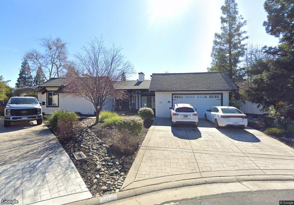
108 Crow Canyon Dr Folsom, CA 95630
American River Canyon NeighborhoodEstimated Value: $576,000 - $919,649
4
Beds
3
Baths
2,543
Sq Ft
$320/Sq Ft
Est. Value
About This Home
This home is located at 108 Crow Canyon Dr, Folsom, CA 95630 and is currently estimated at $813,162, approximately $319 per square foot. 108 Crow Canyon Dr is a home located in Sacramento County with nearby schools including Ottomon Way Elementary School, Louis Pasteur Fundamental Middle School, and Casa Roble Fundamental High School.
Ownership History
Date
Name
Owned For
Owner Type
Purchase Details
Closed on
Dec 21, 2005
Sold by
Spero James G and Spero Terri
Bought by
Wendell Michael and Wendell Aimee J
Current Estimated Value
Home Financials for this Owner
Home Financials are based on the most recent Mortgage that was taken out on this home.
Original Mortgage
$400,000
Outstanding Balance
$231,438
Interest Rate
6.87%
Mortgage Type
New Conventional
Estimated Equity
$581,724
Create a Home Valuation Report for This Property
The Home Valuation Report is an in-depth analysis detailing your home's value as well as a comparison with similar homes in the area
Home Values in the Area
Average Home Value in this Area
Purchase History
| Date | Buyer | Sale Price | Title Company |
|---|---|---|---|
| Wendell Michael | $515,000 | Fidelity Natl Title Co Of Ca |
Source: Public Records
Mortgage History
| Date | Status | Borrower | Loan Amount |
|---|---|---|---|
| Open | Wendell Michael | $400,000 |
Source: Public Records
Tax History
| Year | Tax Paid | Tax Assessment Tax Assessment Total Assessment is a certain percentage of the fair market value that is determined by local assessors to be the total taxable value of land and additions on the property. | Land | Improvement |
|---|---|---|---|---|
| 2025 | $8,277 | $703,770 | $408,598 | $295,172 |
| 2024 | $8,277 | $689,972 | $400,587 | $289,385 |
| 2023 | $8,066 | $676,444 | $392,733 | $283,711 |
| 2022 | $8,024 | $663,182 | $385,033 | $278,149 |
| 2021 | $7,891 | $650,180 | $377,484 | $272,696 |
| 2020 | $7,276 | $604,738 | $351,103 | $253,635 |
| 2019 | $7,026 | $584,288 | $339,230 | $245,058 |
| 2018 | $6,747 | $556,466 | $323,077 | $233,389 |
| 2017 | $6,368 | $520,063 | $301,942 | $218,121 |
| 2016 | $5,704 | $486,041 | $282,189 | $203,852 |
| 2015 | $5,496 | $467,348 | $271,336 | $196,012 |
| 2014 | $5,386 | $458,185 | $266,016 | $192,169 |
Source: Public Records
Map
Nearby Homes
- 115 Canyon Rim Dr
- 300 Water View Way
- 116 Pheasant Ln
- 224 Oak Canyon Way
- 124 Winding Canyon Ln
- 119 Del Norte Vista Way
- 9431 Canyon Lake Ln
- 621 Landrise Ct
- 7314 Santa Juanita Ave
- 9666 Lake Natoma Dr
- 408 Sutter St
- 115 American River Canyon Dr
- 293 Leidesdorff St
- 900 Figueroa St Unit B
- 603 Figueroa St
- 105 Eagle Creek Ct
- 611 Mormon St
- 6132 Main Ave Unit 28
- 100 Hollyann Dr
- 111 Cool Springs Ct
- 104 Crow Canyon Dr
- 128 Gold Creek Cir
- 112 Crow Canyon Dr
- 130 Gold Creek Cir
- 100 Crow Canyon Dr
- 126 Gold Creek Cir
- 116 Crow Canyon Dr
- 132 Gold Creek Cir
- 144 Grey Canyon Dr
- 120 Crow Canyon Dr
- 131 Gold Creek Cir
- 100 Canyon Rim Dr
- 141 Grey Canyon Dr
- 124 Gold Creek Cir
- 124 Crow Canyon Dr
- 105 Crow Canyon Dr
- 101 Crow Canyon Dr
- 109 Crow Canyon Dr
- 140 Grey Canyon Dr
- 127 Gold Creek Cir