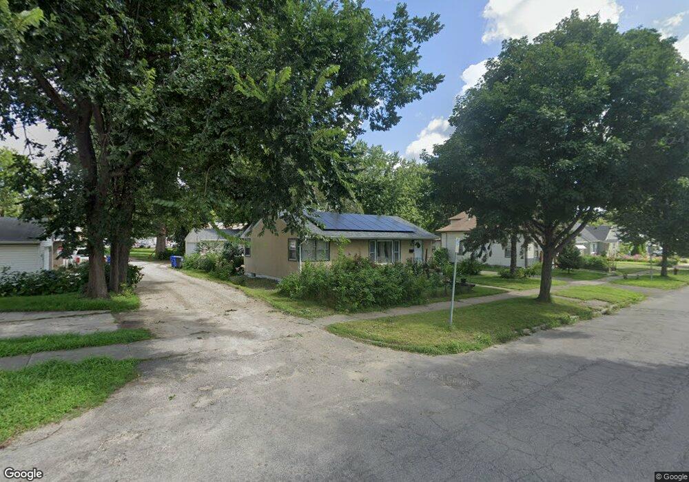
1081 Hubbard Ave Saint Paul, MN 55104
Frogtown NeighborhoodEstimated Value: $276,000 - $289,000
3
Beds
1
Bath
1,990
Sq Ft
$142/Sq Ft
Est. Value
About This Home
This home is located at 1081 Hubbard Ave, Saint Paul, MN 55104 and is currently estimated at $281,948, approximately $141 per square foot. 1081 Hubbard Ave is a home located in Ramsey County with nearby schools including Maxfield Magnet Elementary School, Hidden River Middle School, and Central Senior High School.
Ownership History
Date
Name
Owned For
Owner Type
Purchase Details
Closed on
Aug 28, 2019
Sold by
Kohan Eliot J and Devore Lindsay A
Bought by
Watkins Cecelia
Current Estimated Value
Home Financials for this Owner
Home Financials are based on the most recent Mortgage that was taken out on this home.
Original Mortgage
$168,560
Outstanding Balance
$147,947
Interest Rate
3.7%
Mortgage Type
New Conventional
Estimated Equity
$134,001
Purchase Details
Closed on
Feb 20, 2009
Sold by
Simek Jeffrey D and Simek Lisa M
Bought by
Kohan Eliot J and Devore Lindsay A
Purchase Details
Closed on
Nov 5, 2008
Sold by
Avelo Mortgage Llc
Bought by
Simek Jeffrey D
Purchase Details
Closed on
Jan 2, 1998
Sold by
Still Thomas J and Still Kendra K
Bought by
Yoeun Chea and Heap Koeun
Create a Home Valuation Report for This Property
The Home Valuation Report is an in-depth analysis detailing your home's value as well as a comparison with similar homes in the area
Home Values in the Area
Average Home Value in this Area
Purchase History
| Date | Buyer | Sale Price | Title Company |
|---|---|---|---|
| Watkins Cecelia | $210,700 | Burnet Title | |
| Kohan Eliot J | $143,000 | -- | |
| Simek Jeffrey D | $68,500 | -- | |
| Yoeun Chea | $75,000 | -- |
Source: Public Records
Mortgage History
| Date | Status | Borrower | Loan Amount |
|---|---|---|---|
| Open | Watkins Cecelia | $168,560 |
Source: Public Records
Tax History Compared to Growth
Tax History
| Year | Tax Paid | Tax Assessment Tax Assessment Total Assessment is a certain percentage of the fair market value that is determined by local assessors to be the total taxable value of land and additions on the property. | Land | Improvement |
|---|---|---|---|---|
| 2025 | $3,654 | $261,600 | $25,000 | $236,600 |
| 2023 | $3,654 | $245,100 | $20,000 | $225,100 |
| 2022 | $3,242 | $245,700 | $20,000 | $225,700 |
| 2021 | $3,038 | $213,300 | $20,000 | $193,300 |
| 2020 | $2,888 | $208,100 | $15,700 | $192,400 |
| 2019 | $2,486 | $181,500 | $15,700 | $165,800 |
| 2018 | $2,328 | $162,800 | $15,700 | $147,100 |
| 2017 | $2,312 | $137,500 | $15,700 | $121,800 |
| 2016 | $2,396 | $0 | $0 | $0 |
| 2015 | $2,046 | $142,300 | $15,700 | $126,600 |
| 2014 | $2,234 | $0 | $0 | $0 |
Source: Public Records
Map
Nearby Homes
- 1030 Englewood Ave
- 999 Minnehaha Ave W
- 687 Lexington Pkwy N
- 1282 Hewitt Ave
- 951 Front Ave
- 1294 Hubbard Ave
- 1174 Lafond Ave
- 1292 Taylor Ave W
- 1215 Lafond Ave
- 1039 Argyle St
- 1056 Lexington Pkwy N
- 1258 Blair Ave
- 895 Front Ave
- 1231 Thomas Ave
- 708 Hamline Ave N
- 1135 Charles Ave
- 1126 Charles Ave
- 1083 Chatsworth St N
- 1134 Charles Ave
- 1377 Hewitt Ave
- 1075 Hubbard Ave
- 814 Lexington Pkwy N
- 828 Lexington Pkwy N
- 1097 Hubbard Ave
- 1069 Hubbard Ave
- 830 Lexington Pkwy N
- 1063 Hubbard Ave
- 808 Lexington Pkwy N
- 1080 Hubbard Ave
- 1076 Hubbard Ave
- 804 Lexington Pkwy N
- 1057 Hubbard Ave
- 1064 Hubbard Ave
- 1072 Hubbard Ave
- 1053 Hubbard Ave
- 794 Lexington Pkwy N
- 1058 Hubbard Ave
- 790 Lexington Pkwy N
- 1047 Hubbard Ave
- 1052 Hubbard Ave