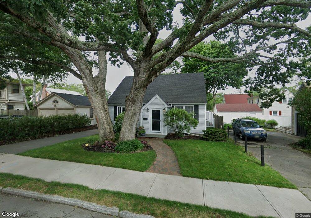
1081 Ray St Fall River, MA 02720
Highlands-Fall River NeighborhoodEstimated Value: $442,005 - $538,000
4
Beds
2
Baths
1,570
Sq Ft
$308/Sq Ft
Est. Value
About This Home
This home is located at 1081 Ray St, Fall River, MA 02720 and is currently estimated at $483,501, approximately $307 per square foot. 1081 Ray St is a home located in Bristol County with nearby schools including James Tansey Elementary School, Morton Middle School, and B M C Durfee High School.
Ownership History
Date
Name
Owned For
Owner Type
Purchase Details
Closed on
Feb 12, 2021
Sold by
Walter William R
Bought by
Walter Karen M
Current Estimated Value
Home Financials for this Owner
Home Financials are based on the most recent Mortgage that was taken out on this home.
Original Mortgage
$210,000
Outstanding Balance
$186,963
Interest Rate
2.7%
Mortgage Type
New Conventional
Estimated Equity
$296,538
Purchase Details
Closed on
Aug 20, 2003
Sold by
Plant Edwin
Bought by
Walter Karen M and Walter William R
Home Financials for this Owner
Home Financials are based on the most recent Mortgage that was taken out on this home.
Original Mortgage
$240,560
Interest Rate
5.52%
Mortgage Type
Purchase Money Mortgage
Create a Home Valuation Report for This Property
The Home Valuation Report is an in-depth analysis detailing your home's value as well as a comparison with similar homes in the area
Home Values in the Area
Average Home Value in this Area
Purchase History
| Date | Buyer | Sale Price | Title Company |
|---|---|---|---|
| Walter Karen M | -- | None Available | |
| Walter Karen M | $248,000 | -- |
Source: Public Records
Mortgage History
| Date | Status | Borrower | Loan Amount |
|---|---|---|---|
| Open | Walter Karen M | $210,000 | |
| Previous Owner | Walter Karen M | $240,560 |
Source: Public Records
Tax History
| Year | Tax Paid | Tax Assessment Tax Assessment Total Assessment is a certain percentage of the fair market value that is determined by local assessors to be the total taxable value of land and additions on the property. | Land | Improvement |
|---|---|---|---|---|
| 2025 | $4,135 | $361,100 | $134,000 | $227,100 |
| 2024 | $3,915 | $340,700 | $128,800 | $211,900 |
| 2023 | $3,902 | $318,000 | $115,700 | $202,300 |
| 2022 | $3,492 | $276,700 | $107,100 | $169,600 |
| 2021 | $3,510 | $253,800 | $101,100 | $152,700 |
| 2020 | $3,302 | $228,500 | $97,300 | $131,200 |
| 2019 | $3,267 | $224,100 | $97,300 | $126,800 |
| 2018 | $3,232 | $221,100 | $97,300 | $123,800 |
| 2017 | $3,065 | $218,900 | $97,300 | $121,600 |
| 2016 | $2,900 | $212,800 | $97,300 | $115,500 |
| 2015 | $2,701 | $206,500 | $91,000 | $115,500 |
| 2014 | $2,598 | $206,500 | $91,000 | $115,500 |
Source: Public Records
Map
Nearby Homes
- 274 Archer St
- 247 Albany St
- 230 College Park Rd
- 257 Calvin St
- 27 Kane St
- 201 Montgomery Cir
- 1810 Highland Ave Unit 22
- 29 Valentine St
- 333 Langley St
- 232 Mount Pleasant St
- 318 Crescent St Unit A
- Parcel 2 Highcrest Rd
- 195 Crescent St Unit 3
- 25 O'Hearn St
- 108 Stowe St Unit 108
- 208 Florence St
- 33 Warner St
- 164 Narragansett St
- 1231 Robeson St
- 131 Stewart St Unit 2
Your Personal Tour Guide
Ask me questions while you tour the home.