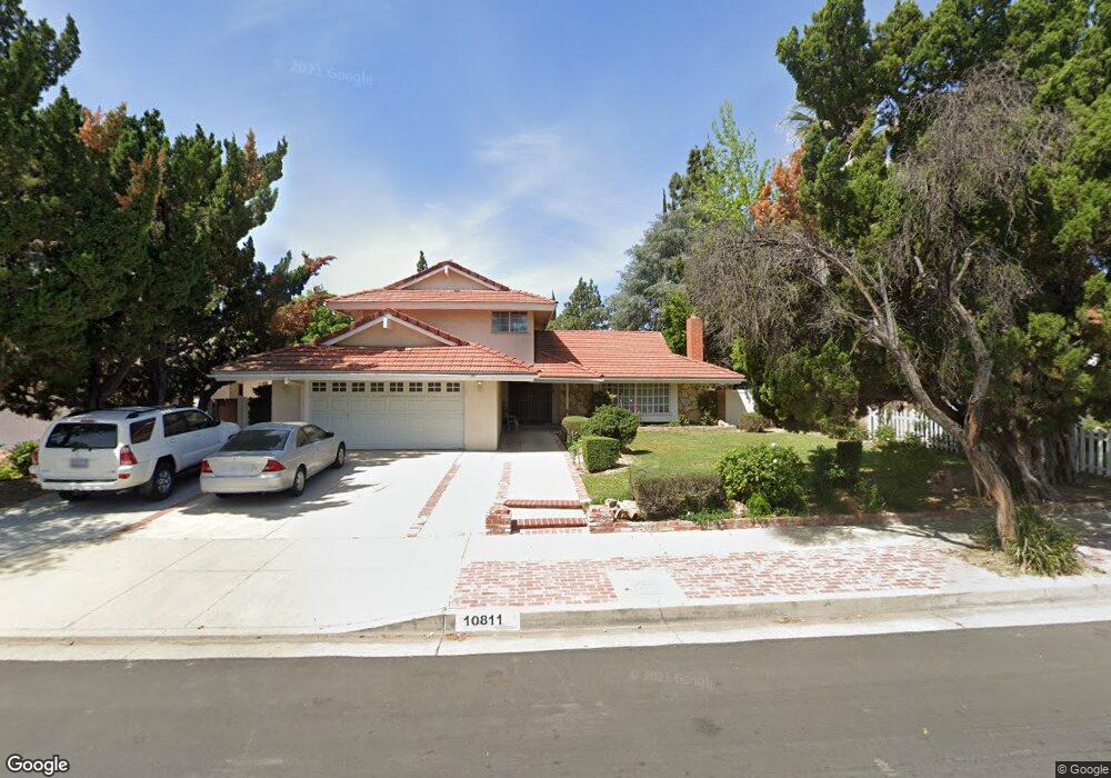
10811 Sylvia Ave Porter Ranch, CA 91326
Porter Ranch NeighborhoodEstimated Value: $1,273,439 - $1,584,000
5
Beds
3
Baths
2,792
Sq Ft
$502/Sq Ft
Est. Value
About This Home
This home is located at 10811 Sylvia Ave, Porter Ranch, CA 91326 and is currently estimated at $1,401,110, approximately $501 per square foot. 10811 Sylvia Ave is a home located in Los Angeles County with nearby schools including Valley Academy of Arts & Sciences, Northridge Academy High, and Topeka Charter School For Advanced Studies.
Ownership History
Date
Name
Owned For
Owner Type
Purchase Details
Closed on
Feb 27, 1995
Sold by
Arai Kunimasa and Arai Kayoko Hoshino
Bought by
Reyes Greg and Reyes Teresita
Current Estimated Value
Home Financials for this Owner
Home Financials are based on the most recent Mortgage that was taken out on this home.
Original Mortgage
$203,100
Interest Rate
8.9%
Create a Home Valuation Report for This Property
The Home Valuation Report is an in-depth analysis detailing your home's value as well as a comparison with similar homes in the area
Home Values in the Area
Average Home Value in this Area
Purchase History
| Date | Buyer | Sale Price | Title Company |
|---|---|---|---|
| Reyes Greg | $235,000 | Equity Title Company |
Source: Public Records
Mortgage History
| Date | Status | Borrower | Loan Amount |
|---|---|---|---|
| Closed | Reyes Greg | $203,100 |
Source: Public Records
Tax History Compared to Growth
Tax History
| Year | Tax Paid | Tax Assessment Tax Assessment Total Assessment is a certain percentage of the fair market value that is determined by local assessors to be the total taxable value of land and additions on the property. | Land | Improvement |
|---|---|---|---|---|
| 2025 | $5,634 | $444,646 | $163,082 | $281,564 |
| 2024 | $5,634 | $435,929 | $159,885 | $276,044 |
| 2023 | $5,530 | $427,382 | $156,750 | $270,632 |
| 2022 | $4,678 | $371,934 | $153,677 | $218,257 |
| 2021 | $4,612 | $364,642 | $150,664 | $213,978 |
| 2019 | $4,478 | $353,829 | $146,197 | $207,632 |
| 2018 | $4,355 | $346,892 | $143,331 | $203,561 |
| 2017 | $4,260 | $340,091 | $140,521 | $199,570 |
| 2016 | $4,144 | $333,423 | $137,766 | $195,657 |
| 2015 | $4,085 | $328,416 | $135,697 | $192,719 |
| 2014 | -- | $321,983 | $133,039 | $188,944 |
Source: Public Records
Map
Nearby Homes
- 19040 Celtic St
- 19259 Ludlow St
- 19121 Kenya St
- 19009 Celtic St
- 19520 Bermuda St
- 19166 Germain St
- 19559 Tulsa St
- 19140 Lahey St Unit 4
- 19200 Lahey St Unit 3
- 10801 Bothwell Rd
- 18741 Hillsboro Rd
- 11144 Viking Ave
- 19519 Rinaldi St Unit 57
- 11258 Yolanda Ave
- 10225 Donna Ave
- 10811 Amigo Ave
- 11311 Tampa Ave Unit 22
- 11426 Twin Hills Ave
- 18771 Clearbrook St
- 11416 Viking Ave
- 10823 Sylvia Ave
- 10801 Sylvia Ave
- 10808 Bismarck Ave
- 10800 Bismarck Ave
- 10831 Sylvia Ave
- 10814 Bismarck Ave
- 10816 Sylvia Ave
- 10810 Sylvia Ave
- 10820 Sylvia Ave
- 10800 Sylvia Ave
- 10826 Sylvia Ave
- 10820 Bismarck Ave
- 10839 Sylvia Ave
- 19200 Los Alimos St
- 19212 Los Alimos St
- 19174 Los Alimos St
- 19218 Los Alimos St
- 10834 Sylvia Ave
- 10819 Baton Rouge Ave
- 10827 Baton Rouge Ave