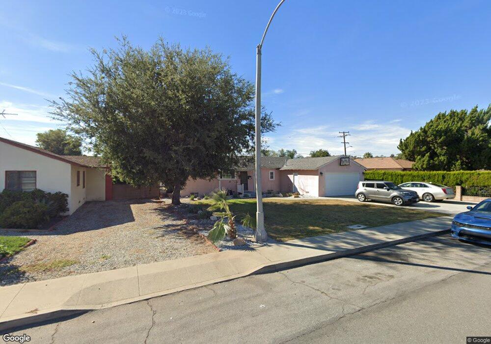
1083 Breon St Pomona, CA 91768
Ganesha NeighborhoodEstimated Value: $523,000 - $758,000
3
Beds
3
Baths
1,783
Sq Ft
$384/Sq Ft
Est. Value
About This Home
This home is located at 1083 Breon St, Pomona, CA 91768 and is currently estimated at $683,819, approximately $383 per square foot. 1083 Breon St is a home located in Los Angeles County with nearby schools including Roosevelt Elementary School, Marshall Middle School, and Ganesha High School.
Ownership History
Date
Name
Owned For
Owner Type
Purchase Details
Closed on
Mar 5, 2018
Sold by
Sharp Ray C
Bought by
Sharp Ray and Sharp Family Living Trust
Current Estimated Value
Purchase Details
Closed on
May 7, 2013
Sold by
Sharp Mary Ann
Bought by
Sharp Ray C
Home Financials for this Owner
Home Financials are based on the most recent Mortgage that was taken out on this home.
Original Mortgage
$196,377
Interest Rate
3.25%
Mortgage Type
FHA
Create a Home Valuation Report for This Property
The Home Valuation Report is an in-depth analysis detailing your home's value as well as a comparison with similar homes in the area
Home Values in the Area
Average Home Value in this Area
Purchase History
| Date | Buyer | Sale Price | Title Company |
|---|---|---|---|
| Sharp Ray | -- | None Available | |
| Sharp Ray C | $200,000 | Orange Coast Title |
Source: Public Records
Mortgage History
| Date | Status | Borrower | Loan Amount |
|---|---|---|---|
| Previous Owner | Sharp Ray C | $196,377 |
Source: Public Records
Tax History Compared to Growth
Tax History
| Year | Tax Paid | Tax Assessment Tax Assessment Total Assessment is a certain percentage of the fair market value that is determined by local assessors to be the total taxable value of land and additions on the property. | Land | Improvement |
|---|---|---|---|---|
| 2025 | $3,535 | $271,155 | $98,801 | $172,354 |
| 2024 | $3,535 | $265,839 | $96,864 | $168,975 |
| 2023 | $3,465 | $260,627 | $94,965 | $165,662 |
| 2022 | $3,409 | $255,517 | $93,103 | $162,414 |
| 2021 | $3,326 | $250,508 | $91,278 | $159,230 |
| 2019 | $3,392 | $243,080 | $88,572 | $154,508 |
| 2018 | $3,056 | $238,315 | $86,836 | $151,479 |
| 2016 | $2,857 | $229,063 | $83,465 | $145,598 |
| 2015 | $2,833 | $225,623 | $82,212 | $143,411 |
| 2014 | $2,323 | $182,004 | $80,602 | $101,402 |
Source: Public Records
Map
Nearby Homes
- 1071 Groff St
- 1385 Estel Dr
- 1003 Corinthian Way
- 871 W Wilson St
- 1196 N Hamilton Blvd
- 1010 W Wilson St
- 1240 Prabhu Way
- 1221 Bayport Cir
- 673 Randolph St
- 763 Lewis St
- 745 N Currier St
- 753 Lewis St
- 751 Lewis St
- 737 Lewis St
- 1326 Ashport St
- 1176 Laurel Ave
- 1384 Douglass Dr
- 795 Laurel Ave
- 0 Sycamore Place Unit 25-475597
- 1443 Laurel Ave
- 1071 Breon St
- 950 Pavilion Dr
- 1000 Pavilion Dr
- 1059 Breon St
- 1020 Pavilion Dr
- 1088 Breon St
- 1076 Breon St
- 1064 Breon St
- 1047 Breon St
- 981 Pavilion Dr
- 876 Pavilion Dr
- 1038 Pavilion Dr
- 1056 Breon St
- 951 Pavilion Dr
- 929 Pavilion Dr
- 959 Groff St
- 1146 Cleveland St
- 1044 Breon St
- 852 Pavilion Dr
- 1009 Groff St