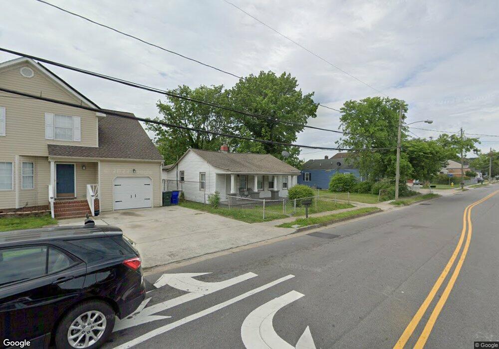
1083 Johnstons Rd Norfolk, VA 23513
Colonial Heights NeighborhoodEstimated Value: $149,000 - $211,000
3
Beds
1
Bath
1,335
Sq Ft
$134/Sq Ft
Est. Value
About This Home
This home is located at 1083 Johnstons Rd, Norfolk, VA 23513 and is currently estimated at $179,405, approximately $134 per square foot. 1083 Johnstons Rd is a home located in Norfolk City with nearby schools including Crossroads School, Norview Middle School, and Norview High School.
Ownership History
Date
Name
Owned For
Owner Type
Purchase Details
Closed on
Mar 22, 2021
Sold by
Dwellings Development Co
Bought by
Dwellings Investments Llc
Current Estimated Value
Purchase Details
Closed on
Dec 8, 2020
Sold by
Kondaur Capital Corp
Bought by
Dwellings Development Co
Purchase Details
Closed on
Jul 21, 2020
Sold by
Commonwealth Trustees Llc
Bought by
Kondaur Capital Corp
Purchase Details
Closed on
Sep 13, 2006
Sold by
Brown Anie A
Bought by
Brown Milton
Create a Home Valuation Report for This Property
The Home Valuation Report is an in-depth analysis detailing your home's value as well as a comparison with similar homes in the area
Home Values in the Area
Average Home Value in this Area
Purchase History
| Date | Buyer | Sale Price | Title Company |
|---|---|---|---|
| Dwellings Investments Llc | -- | None Available | |
| Dwellings Development Co | $100,500 | Attorney | |
| Kondaur Capital Corp | $99,000 | None Available | |
| Brown Milton | -- | -- |
Source: Public Records
Tax History Compared to Growth
Tax History
| Year | Tax Paid | Tax Assessment Tax Assessment Total Assessment is a certain percentage of the fair market value that is determined by local assessors to be the total taxable value of land and additions on the property. | Land | Improvement |
|---|---|---|---|---|
| 2025 | $1,813 | $145,000 | $47,500 | $97,500 |
| 2024 | $1,625 | $132,100 | $47,500 | $84,600 |
| 2023 | $1,586 | $126,900 | $43,000 | $83,900 |
| 2022 | $1,505 | $120,400 | $36,500 | $83,900 |
| 2021 | $1,301 | $104,100 | $27,000 | $77,100 |
| 2020 | $1,193 | $95,400 | $20,500 | $74,900 |
| 2019 | $1,168 | $93,400 | $18,500 | $74,900 |
| 2018 | $1,073 | $85,800 | $17,000 | $68,800 |
| 2017 | $972 | $84,500 | $17,000 | $67,500 |
| 2016 | $957 | $79,500 | $17,000 | $62,500 |
| 2015 | -- | $79,500 | $17,000 | $62,500 |
| 2014 | -- | $79,500 | $17,000 | $62,500 |
Source: Public Records
Map
Nearby Homes
- 1072 Kane St
- 1044 Kane St
- 977 Avenue G
- 1041 Tifton St
- 7446 Davidson St
- 1331 Branch Rd
- 935 Avenue I
- 7021 University Dr
- 983 Widgeon Rd
- 809 Craten Rd
- 985 Wolcott Ave
- 901 Lasser Dr
- 977 Wolcott Ave
- 936 Widgeon Rd
- 1038 Philpotts Rd
- 7801 Caribou Ave
- 1037 Philpotts Rd
- 720 Nickoles Ln
- 7929 Pythian Ave
- 974 Philpotts Rd
- 1081 Johnstons Rd
- 1089 Johnstons Rd
- 1079 Johnstons Rd
- 1088 Kane St
- 1093 Johnstons Rd
- 1075 Johnstons Rd
- 1092 Kane St
- 1084 Kane St
- 1080 Kane St
- 1097 Johnstons Rd
- 1094 Kane St
- 1078 Johnstons Rd
- 1084 Johnstons Rd
- 1074 Johnstons Rd
- 1071 Johnstons Rd
- 1087 Kane St
- 1076 Kane St
- 1093 Kane St
- 1085 Kane St
- 1072 Johnstons Rd