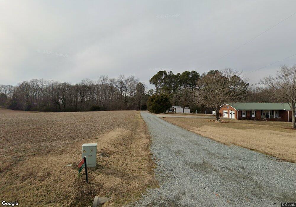
1083 N Nc Highway 150 Lexington, NC 27295
Estimated Value: $182,403 - $269,000
3
Beds
2
Baths
3,041
Sq Ft
$72/Sq Ft
Est. Value
About This Home
This home is located at 1083 N Nc Highway 150, Lexington, NC 27295 and is currently estimated at $218,101, approximately $71 per square foot. 1083 N Nc Highway 150 is a home located in Davidson County with nearby schools including Reeds Elementary School, Tyro Middle School, and West Davidson High School.
Ownership History
Date
Name
Owned For
Owner Type
Purchase Details
Closed on
Oct 18, 2024
Sold by
Mccullough Ronnie Shane and Mccullough Kameron M
Bought by
Mccullough Brody Shane
Current Estimated Value
Home Financials for this Owner
Home Financials are based on the most recent Mortgage that was taken out on this home.
Original Mortgage
$170,000
Outstanding Balance
$168,213
Interest Rate
6.35%
Mortgage Type
New Conventional
Estimated Equity
$49,888
Purchase Details
Closed on
Feb 20, 2024
Sold by
Warner Lonnie Dale and Warner Carol
Bought by
Mccullough Ronnie Shane
Purchase Details
Closed on
Sep 15, 2023
Sold by
Cross Sherrie W
Bought by
Warner Lonnie Dale and Bell Carol W
Purchase Details
Closed on
Mar 12, 1956
Create a Home Valuation Report for This Property
The Home Valuation Report is an in-depth analysis detailing your home's value as well as a comparison with similar homes in the area
Home Values in the Area
Average Home Value in this Area
Purchase History
| Date | Buyer | Sale Price | Title Company |
|---|---|---|---|
| Mccullough Brody Shane | $278,000 | None Listed On Document | |
| Mccullough Ronnie Shane | $190,000 | None Listed On Document | |
| Mccullough Ronnie Shane | $190,000 | None Listed On Document | |
| Warner Lonnie Dale | -- | None Listed On Document | |
| Warner Lonnie Dale | -- | None Listed On Document | |
| Warner Lonnie Dale | -- | None Listed On Document | |
| -- | -- | -- |
Source: Public Records
Mortgage History
| Date | Status | Borrower | Loan Amount |
|---|---|---|---|
| Open | Mccullough Brody Shane | $170,000 |
Source: Public Records
Tax History Compared to Growth
Tax History
| Year | Tax Paid | Tax Assessment Tax Assessment Total Assessment is a certain percentage of the fair market value that is determined by local assessors to be the total taxable value of land and additions on the property. | Land | Improvement |
|---|---|---|---|---|
| 2025 | $513 | $84,070 | $0 | $0 |
| 2024 | $513 | $84,070 | $0 | $0 |
| 2023 | $246 | $82,890 | $0 | $0 |
| 2022 | $249 | $82,890 | $0 | $0 |
| 2021 | $249 | $82,890 | $0 | $0 |
| 2020 | $236 | $76,370 | $0 | $0 |
| 2019 | $240 | $76,370 | $0 | $0 |
| 2018 | $232 | $76,370 | $0 | $0 |
| 2017 | $232 | $76,370 | $0 | $0 |
| 2016 | $232 | $76,370 | $0 | $0 |
| 2015 | $232 | $76,370 | $0 | $0 |
| 2014 | $346 | $111,310 | $0 | $0 |
Source: Public Records
Map
Nearby Homes
- 253 Beebop Ln
- 2475 Rowe Rd
- 122 Channy Ln
- 3602 W Old Us Highway 64
- 348 Patricia Ln
- 3268 N Nc Highway 150
- 1055 Kapstone Crossing
- 880 Kapstone Crossing
- 218 Salter Path
- 1099 Kapstone Crossing
- 331 Hw Phillips Rd
- 2857 W Old Highway 64
- 789 Kapstone Crossing
- 883 Kapstone Crossing
- 188 Tuscan Way
- 1001 W Us Highway 64
- 131 Kapstone Crossing
- 116 Saintsbury Place
- 4209 N Nc Highway 150
- 140 Marquis Ln
- 1043 N Nc Highway 150
- 149 Shiloh Rd
- 121 Mountainbrook Dr
- 983 N Nc Highway 150
- 1110 N Nc Highway 150 Unit 1150
- 125 Shiloh Rd
- 1026 N Nc Highway 150
- 190 Shiloh Rd
- 196 Beebop Ln
- 214 Beebop Ln
- 128 Beebop Ln
- 147 Beebop Ln
- 217 Beebop Ln
- 129 Beebop Ln
- 235 Beebop Ln
- 178 Beebop Ln
- 253 Beebop Ln Unit 7
- 266 Wynnfall Dr
- 214 Beebop Ln Unit 14
- 128 Beebop Ln Unit 3