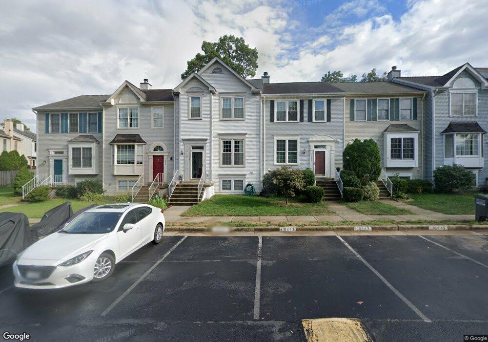
10841 Campaign Ct Manassas, VA 20109
Estimated Value: $434,570 - $481,000
3
Beds
3
Baths
1,388
Sq Ft
$334/Sq Ft
Est. Value
About This Home
This home is located at 10841 Campaign Ct, Manassas, VA 20109 and is currently estimated at $464,143, approximately $334 per square foot. 10841 Campaign Ct is a home located in Prince William County with nearby schools including George P. Mullen Elementary School, Unity Braxton Middle School, and Unity Reed High School.
Ownership History
Date
Name
Owned For
Owner Type
Purchase Details
Closed on
Aug 3, 2012
Sold by
Biwott Samuel and Biwott Moira
Bought by
Biwott Samuel
Current Estimated Value
Home Financials for this Owner
Home Financials are based on the most recent Mortgage that was taken out on this home.
Original Mortgage
$184,000
Interest Rate
3.38%
Mortgage Type
New Conventional
Purchase Details
Closed on
Nov 15, 2002
Sold by
Derflinger Jennifer E
Bought by
Biwott Moira
Home Financials for this Owner
Home Financials are based on the most recent Mortgage that was taken out on this home.
Original Mortgage
$192,850
Interest Rate
6.03%
Create a Home Valuation Report for This Property
The Home Valuation Report is an in-depth analysis detailing your home's value as well as a comparison with similar homes in the area
Home Values in the Area
Average Home Value in this Area
Purchase History
| Date | Buyer | Sale Price | Title Company |
|---|---|---|---|
| Biwott Samuel | -- | Cardinal Financial Co Lp | |
| Biwott Moira | $200,000 | -- |
Source: Public Records
Mortgage History
| Date | Status | Borrower | Loan Amount |
|---|---|---|---|
| Previous Owner | Biwott Samuel | $184,000 | |
| Previous Owner | Biwott Moira | $192,850 |
Source: Public Records
Tax History Compared to Growth
Tax History
| Year | Tax Paid | Tax Assessment Tax Assessment Total Assessment is a certain percentage of the fair market value that is determined by local assessors to be the total taxable value of land and additions on the property. | Land | Improvement |
|---|---|---|---|---|
| 2025 | $4,134 | $438,200 | $128,000 | $310,200 |
| 2024 | $4,134 | $415,700 | $120,800 | $294,900 |
| 2023 | $4,100 | $394,000 | $114,000 | $280,000 |
| 2022 | $4,009 | $353,300 | $102,800 | $250,500 |
| 2021 | $3,993 | $325,700 | $88,300 | $237,400 |
| 2020 | $4,720 | $304,500 | $88,300 | $216,200 |
| 2019 | $4,511 | $291,000 | $76,700 | $214,300 |
| 2018 | $3,367 | $278,800 | $74,600 | $204,200 |
| 2017 | $3,263 | $262,700 | $72,500 | $190,200 |
| 2016 | $3,116 | $253,000 | $71,600 | $181,400 |
| 2015 | $2,960 | $256,200 | $71,600 | $184,600 |
| 2014 | $2,960 | $234,900 | $62,200 | $172,700 |
Source: Public Records
Map
Nearby Homes
- 7945 Blue Gray Cir
- 7967 Calvary Ct
- 7858 Blue Gray Cir
- 7937 Rebel Walk Dr
- 11184 Stagestone Way
- 11002 Koman Cir Unit 103
- 7905 Rebel Walk Dr
- 7849 Sabre Ct
- 7860 Rebel Walk Dr
- 7879 Apache Ridge Ct
- 11010 Koman Cir
- 11112 Stagestone Way
- 8083 Lacy Dr Unit 101
- 11005 Kinship Ct Unit 303
- 10874 Stone Hill Ln
- 10875 Stone Hill Ln
- 8068 Stonewall Brigade Ct Unit 204
- 11353 Kessler Place
- 11007 Hiram Ct
- 10805 Violet Ct
- 10843 Campaign Ct
- 10839 Campaign Ct
- 10845 Campaign Ct
- 10837 Campaign Ct
- 10847 Campaign Ct
- 10849 Campaign Ct
- 10913 Campaign Ct
- 7775 Black Horse Ct
- 7773 Black Horse Ct
- 7777 Black Horse Ct
- 7771 Black Horse Ct
- 7769 Black Horse Ct
- 10831 Campaign Ct
- 10853 Campaign Ct
- 7779 Black Horse Ct
- 10829 Campaign Ct
- 7767 Black Horse Ct
- 10827 Campaign Ct
- 10855 Campaign Ct
- 10844 Campaign Ct