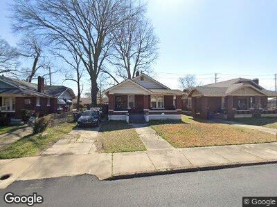
1085 Forrest Ave Memphis, TN 38105
Crosstown NeighborhoodEstimated Value: $108,689 - $196,000
3
Beds
1
Bath
1,445
Sq Ft
$104/Sq Ft
Est. Value
About This Home
This home is located at 1085 Forrest Ave, Memphis, TN 38105 and is currently estimated at $150,922, approximately $104 per square foot. 1085 Forrest Ave is a home located in Shelby County with nearby schools including Bruce Elementary School, Manassas High School, and Memphis Scholars Caldwell-Guthrie.
Ownership History
Date
Name
Owned For
Owner Type
Purchase Details
Closed on
Oct 21, 2022
Sold by
Holbrook Delphia J
Bought by
Toney Darren
Current Estimated Value
Purchase Details
Closed on
Dec 18, 1996
Sold by
Hud
Bought by
Holbrook Delphia J
Home Financials for this Owner
Home Financials are based on the most recent Mortgage that was taken out on this home.
Original Mortgage
$51,650
Interest Rate
7.51%
Mortgage Type
FHA
Purchase Details
Closed on
Jun 26, 1996
Sold by
Tennessee Housing Development Agency
Bought by
Hud
Purchase Details
Closed on
Jun 19, 1996
Sold by
Tatum I Dyke
Bought by
Tennessee Housing Development Agency
Create a Home Valuation Report for This Property
The Home Valuation Report is an in-depth analysis detailing your home's value as well as a comparison with similar homes in the area
Home Values in the Area
Average Home Value in this Area
Purchase History
| Date | Buyer | Sale Price | Title Company |
|---|---|---|---|
| Toney Darren | -- | -- | |
| Hud | -- | -- | |
| Tennessee Housing Development Agency | $48,664 | -- |
Source: Public Records
Mortgage History
| Date | Status | Borrower | Loan Amount |
|---|---|---|---|
| Previous Owner | Holbrook Delphia J | $51,650 |
Source: Public Records
Tax History Compared to Growth
Tax History
| Year | Tax Paid | Tax Assessment Tax Assessment Total Assessment is a certain percentage of the fair market value that is determined by local assessors to be the total taxable value of land and additions on the property. | Land | Improvement |
|---|---|---|---|---|
| 2024 | $412 | $12,150 | $1,125 | $11,025 |
| 2023 | $740 | $12,150 | $1,125 | $11,025 |
| 2022 | $740 | $12,150 | $1,125 | $11,025 |
| 2021 | $749 | $12,150 | $1,125 | $11,025 |
| 2020 | $589 | $8,125 | $1,125 | $7,000 |
| 2019 | $260 | $8,125 | $1,125 | $7,000 |
| 2018 | $260 | $8,125 | $1,125 | $7,000 |
| 2017 | $266 | $8,125 | $1,125 | $7,000 |
| 2016 | $355 | $8,125 | $0 | $0 |
| 2014 | $355 | $8,125 | $0 | $0 |
Source: Public Records
Map
Nearby Homes
- 1063 Forrest Ave
- 1074 Forrest Ave
- 1060 Forrest Ave
- 1062 N Parkway
- 1100 N Parkway
- 994 Forrest Ave
- 1032 N Parkway
- 1159 Forrest Ave
- 998 J W Williams Ln
- 1052 Faxon Ave
- 230 Decatur St
- 945 Faxon Ave
- 424 Ayers St
- 1188 Faxon Ave
- 1245 Forrest Ave
- 1044 Delmar Ave
- 305 Ayers St
- 1224 Faxon Ave
- 888 N Parkway
- 292 Decatur St
- 1085 Forrest Ave
- 1089 Forrest Ave
- 1077 Forrest Ave
- 1073 Forrest Ave
- 1095 Forrest Ave
- 1067 Forrest Ave
- 1099 Forrest Ave
- 1084 Forrest Ave
- 1088 Forrest Ave
- 1094 Forrest Ave
- 1068 Forrest Ave
- 1057 Forrest Ave
- 1098 Forrest Ave
- 1064 Forrest Ave
- 1111 Forrest Ave
- 1071 Galloway Ave
- 1056 Forrest Ave
- 1047 Forrest Ave
- 1112 Forrest Ave
- 1052 Forrest Ave