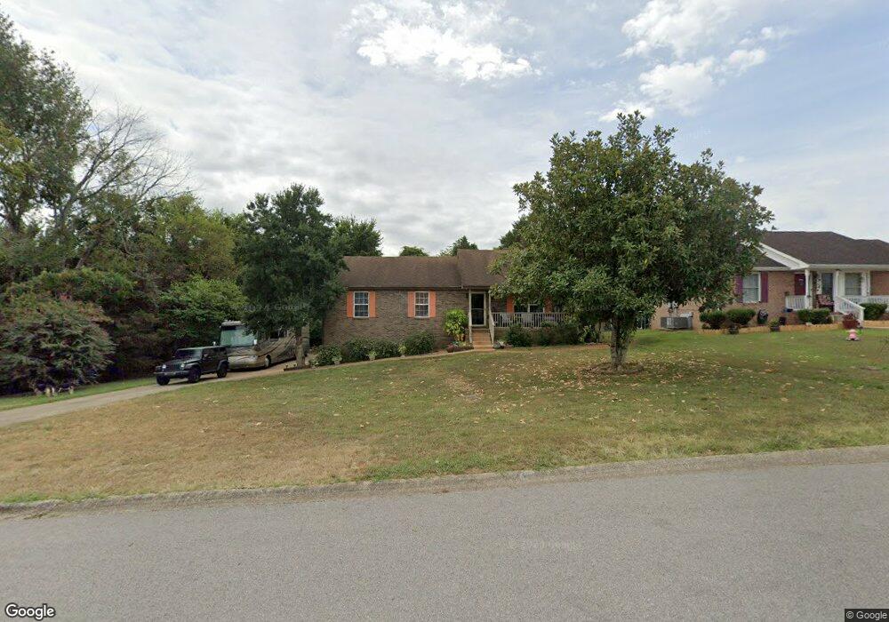
1086 Bobcat Dr Clarksville, TN 37042
Estimated Value: $274,000 - $313,514
--
Bed
2
Baths
2,008
Sq Ft
$146/Sq Ft
Est. Value
About This Home
This home is located at 1086 Bobcat Dr, Clarksville, TN 37042 and is currently estimated at $292,879, approximately $145 per square foot. 1086 Bobcat Dr is a home located in Montgomery County with nearby schools including West Creek Elementary School, Kenwood Middle School, and Kenwood High School.
Ownership History
Date
Name
Owned For
Owner Type
Purchase Details
Closed on
Apr 12, 2012
Sold by
Harbinson Jerome F
Bought by
Lane Leonard L
Current Estimated Value
Home Financials for this Owner
Home Financials are based on the most recent Mortgage that was taken out on this home.
Original Mortgage
$118,665
Outstanding Balance
$82,156
Interest Rate
3.96%
Mortgage Type
VA
Estimated Equity
$210,723
Purchase Details
Closed on
Apr 18, 2011
Sold by
Stovall Dick B
Bought by
Harbinson Jerome F and Harbinson Christine T
Purchase Details
Closed on
Feb 2, 2006
Sold by
Tierney Karyn Sub & Tr
Bought by
Secretary Of Housing And Urban
Purchase Details
Closed on
Sep 24, 1999
Sold by
Mark Young J
Bought by
Stovall Dick B
Purchase Details
Closed on
May 21, 1999
Sold by
Mark Young
Bought by
Mark Young J
Create a Home Valuation Report for This Property
The Home Valuation Report is an in-depth analysis detailing your home's value as well as a comparison with similar homes in the area
Home Values in the Area
Average Home Value in this Area
Purchase History
| Date | Buyer | Sale Price | Title Company |
|---|---|---|---|
| Lane Leonard L | $146,500 | -- | |
| Harbinson Jerome F | $135,000 | -- | |
| Secretary Of Housing And Urban | -- | -- | |
| Stovall Dick B | $97,900 | -- | |
| Mark Young J | -- | -- |
Source: Public Records
Mortgage History
| Date | Status | Borrower | Loan Amount |
|---|---|---|---|
| Open | Lane Leonard L | $118,665 |
Source: Public Records
Tax History Compared to Growth
Tax History
| Year | Tax Paid | Tax Assessment Tax Assessment Total Assessment is a certain percentage of the fair market value that is determined by local assessors to be the total taxable value of land and additions on the property. | Land | Improvement |
|---|---|---|---|---|
| 2024 | $2,327 | $78,100 | $0 | $0 |
| 2023 | $2,327 | $43,800 | $0 | $0 |
| 2022 | $1,849 | $43,800 | $0 | $0 |
| 2021 | $1,849 | $43,800 | $0 | $0 |
| 2020 | $1,781 | $44,300 | $0 | $0 |
| 2019 | $1,781 | $44,300 | $0 | $0 |
| 2018 | $1,643 | $37,050 | $0 | $0 |
| 2017 | $473 | $38,125 | $0 | $0 |
| 2016 | $1,170 | $38,125 | $0 | $0 |
| 2015 | $1,607 | $38,125 | $0 | $0 |
| 2014 | $1,585 | $38,125 | $0 | $0 |
| 2013 | $1,536 | $35,075 | $0 | $0 |
Source: Public Records
Map
Nearby Homes
- 1073 Bobcat Dr
- 1354 Whitt Ln
- 1397 Shady Hill Ct
- 1030 Mile High Dr
- 1412 McClardy Rd
- 1478 McClardy Rd
- 1009 Fillmore Ct
- 657 Peachers Mill Rd
- 1496 Buchanon Dr
- 1308 Sonja Dr
- 1419 Janet Way Dr
- 209 Griffey Estates
- 865 Burley Barn Rd
- 867 Burley Barn Rd
- 361 Burley Barn Rd
- 1046 Dwight Eisenhower Way
- 1145 Ishee Dr
- 164 Griffey Estates
- 842 Burley Barn Rd
- 1084 Harrison Way